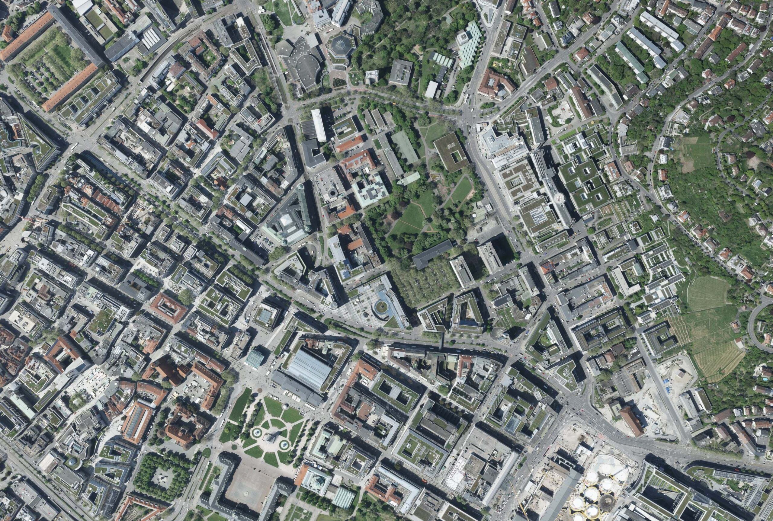
The City of Stuttgart in Germany, as part of its Smart City Stuttgart Concept, has strategic goals to support their offices of Urban Planning, Housing and Buildings. One of these goals is to improve the databases for urban planning within the administration. One initiative that supports this goal is to have a realistic 3D city model created every two years. The City of Stuttgart publishes a public tender for image acquisition, processing, and creation of a Digital Surface Model (DSM), a True Ortho, a Point Cloud, and a 3D Mesh. From a practical standpoint, for a flying company, this entails intricate flight planning, image acquisition, photogrammetric processing, and generating final outputs to aid the City of Stuttgart and its stakeholders in supporting urban initiatives like planning projects. In 2023, GeoFly GmbH, an aerial mapping company for the European market, won this tender.
What’s That in the Sky?
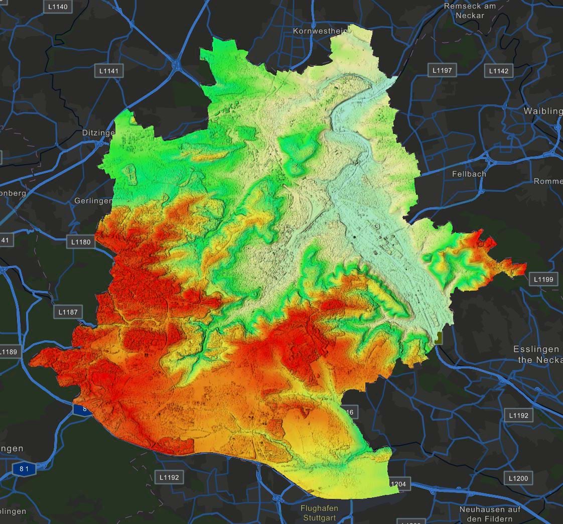
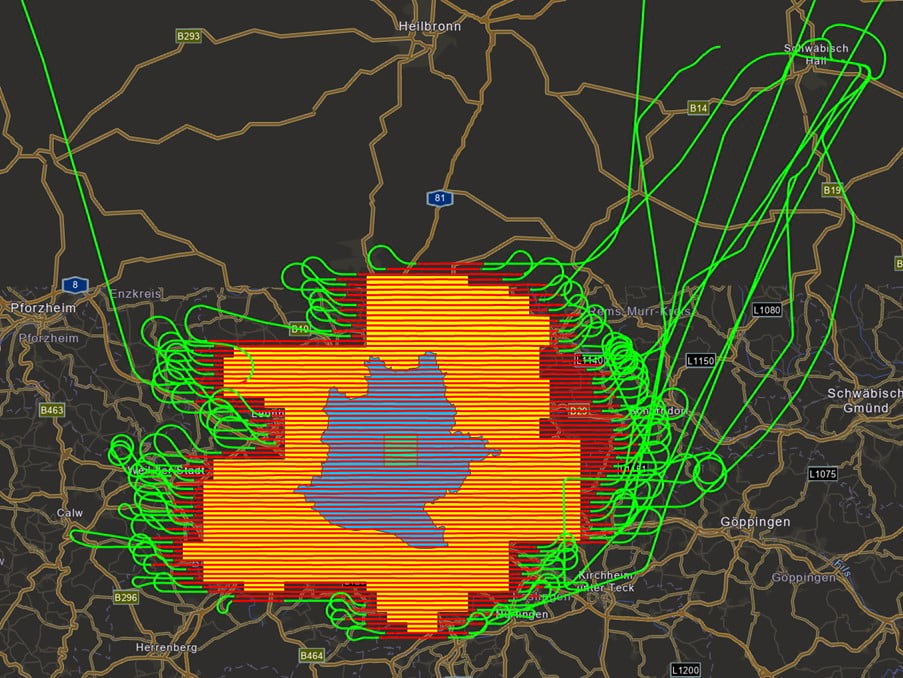
The process of flight planning and aerial image acquisition is different for every city, and several aspects must be considered: Ground Sampling Distance (GSD) and image overlap are essential components of the planning and are specified in a tender. For Cities with basin-like topography such as Stuttgart, the calculation of the consistent flight height needs to consider the longest distance to ground to guarantee that the maximum GSD is not exceeded, while maintaining the required overlap for all images.
In most cases, aerial mapping flights can be recognized by their parallel flight lines, which might cause suspicion to the avid online flight tracker, especially as it is common for people today to track flights on apps like Flightradar 24.
It’s Flying Time!
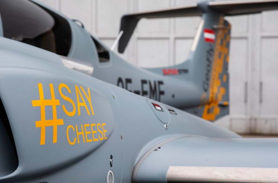
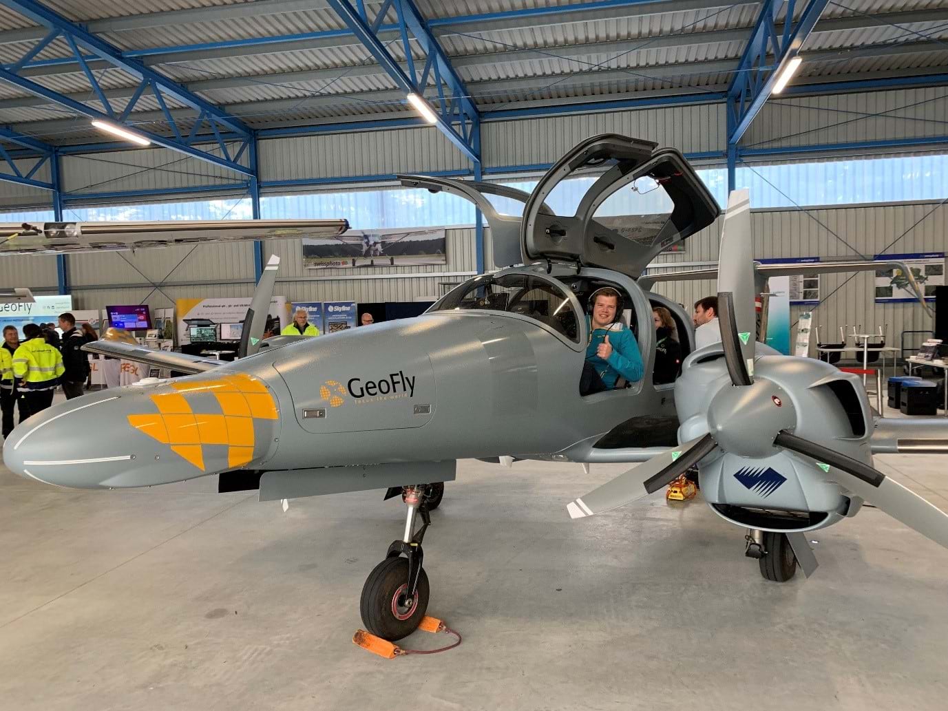
GeoFly used a Vexcel Osprey 4.1 sensor, which was mounted to one of their Diamondcraft DA62 MPP airplanes. The sensor uses advanced technology to compensate for fast motion during acquisition. Outstanding flight performance and efficiency specifically characterize these aircraft. Compared to similar aircraft models, they have particularly low fuel consumption. In addition, the DA62 uses jet fuel instead of the traditional leaded AVGAS. Both factors contribute positively to the carbon footprint while still offering economic benefits.
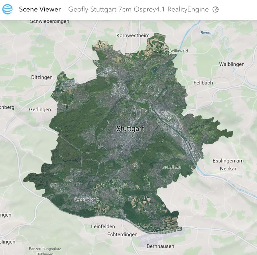
These environmental and economical savings become especially valuable considering GeoFly’s 1300 hours of flying every year, which adds up to 1.8 million km (about 1.2 million mi) flown with an image coverage of 3.5 million km² (about 1.35 million mi²) over the last five years. This means that GeoFly circumnavigated the earth almost 45 times and covered an area of 10x the size of Germany, 1/3 of the size of the USA, or 490 million football fields over five years. For the City of Stuttgart project, 69760 images were acquired, amounting to a whopping 40 Terabytes of data and roughly 12.5 Terapixels. The nadir images (perpendicular to Earth surface) of the larger project area alone cover 1152 km² (about 715.82 mi²), amounting to 2330 km (about 1447.79 mi) flown and 12.5 hours of flying on four different flying days.
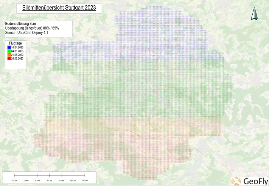
The number of flying days is required to ensure the best weather and illumination conditions for all images. Images were acquired at 7 cm GSD. For the center of the city, an additional dataset with 4 cm GSD was acquired. Both datasets were flown with an 80% forward overlap and 65% sidelap.
Back in the Office
Once the data capture was finished, it was time to do the photogrammetric processing. Esri’s ArcGIS Reality Studio was used to perform the image alignment and the processing of DSM, True Ortho, Point Cloud, and 3D Mesh of the complete dataset. The alignment of the large area included four capture sessions with one individual capture session for every flying day. Treating the flying days as individual capture sessions allows consideration of individual boresight and lever arm misalignments as well as individual camera calibration sets. This alignment process included the measurement of 23 Ground Control and Check Points, which can be a time-consuming process. ArcGIS Reality Studio can perform fast control point measurements. Geometric re-projection and image content are used to semi-automatically find the respective features in each relevant image.
“The function for automatic control point measurement is fantastic, I have never experienced it in this quality and implementation before.”
To ensure the requirements of the tender are satisfied, ArcGIS Reality Studio offers a variety of easy-to-use QA tools and features such as measuring manual tie points, check points and ground control points. The next challenge after completing the alignment process was to generate the photogrammetric products quickly. While the DSM and True Ortho photo were processed on GeoFly’s office cluster, the Reality Engine was used to process the 3D Mesh in the cloud.
"I am excited! The software looks really good, and the handling is great!”
“The quality of the mesh texture exceeds our expectations, even challenging areas such as facades are displayed cleanly.”
Data in Action to Support the City’s Strategic Initiatives and Goals
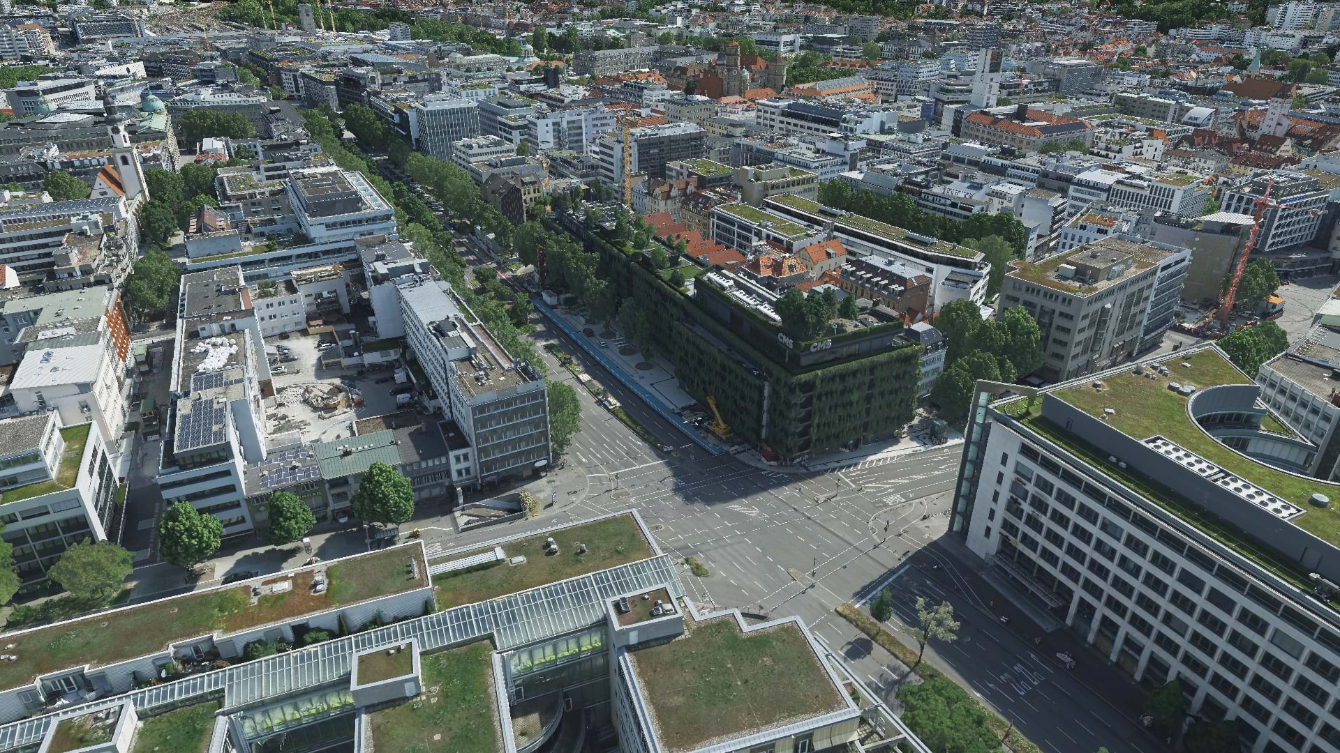
Martin Grünheid and Benjamin Vogel from the City Survey Office of Stuttgart published the results in their Geoinformation system. With an internally shared web scene, other city offices can now use this data for multiple purposes, such as measuring or visualizing shadow gradient, or applications like solar potential analysis. For some of the city planning projects, the City Survey Office shares publicly available web scenes that incorporate a 3D mesh and building proposals from various architects. This inclusive approach allows city inhabitants to actively participate in the decision-making process for the city’s development. The high-resolution 3D Mesh of the city center is part of a funding project for mobility and environment, where it is used as a catalyst for other projects such as real-time sensor data integration into a digital twin. There is also a future proposal to combine the 3D Mesh with georeferenced historical images. In this scenario, the 3D Mesh serves as a photorealistic, easy-to-navigate layer and allows the user to virtually walk through the city, visualizing historical images for specific locations.
The DSM and True Ortho are used in the InVeKoS systems (Integriertes Verwaltungs-und Kontrollsystem=Integrated management and control system), which are used to determine the land use of farming areas to assure that subsidies from the European Union are used in an appropriate manner. Products created from ArcGIS Reality Studio are well-suited for many more applications, including change detection, building footprint extraction, flood analysis, green space analysis, thermal analysis, and much more.
"We are very satisfied with the quality of the mesh; the building edges are reconstructed very sharply."
Who is GeoFly GmbH?
GeoFly’s main expertise is the acquisition of aerial imagery with nadir, oblique, and thermal camera systems for city- and country-wide reality mapping, which can even be further supported by airborne lidar. GeoFly uses advanced cameras, liDAR equipment and airplanes. Besides two Ultracam Eagle Mark3 and a Ultracam Osprey 4.1, the thermal sensor IR8800 is used for the data acquisition. GeoFly uses 5 airplanes overall, three of those are Diamondcraft DA62 MPP’s.

GeoFly has 10 years of experience in delivering DSMs, True Orthos, 3D Point Clouds, and 3D Meshes to fulfill the high-quality standards from tenders as well as private clients. GeoFly was historically requested to produce just DSM and True Ortho outputs, but with increasing efficiency of oblique camera systems, the demand for 3D Meshes has become significantly higher in the last four years. There is also a growing demand for thermal imagery. Thermal imagery can be combined with and used in 3D Meshes to determine sources of heat loss in buildings and support climate-friendly city planning. In other cases, these thermal images are used to quickly determine leaks in district heating pipes and make sure that localities are safe, as well as to locate, control, and eliminate aerobic (site fires) and anaerobic (gas production) processes of waste disposal sites.
Blog Header: 3D Mesh – New Castle in Stuttgart. Source: GeoFly GmbH – Vexcel Osprey 4.1 – processed with ArcGIS Reality by Esri. Copyright © GeoFly GmbH/Esri

Article Discussion: