The March 2017 ArcGIS Online release contains demographic updates for several countries as well as some key datasets in the U.S. Read more about these updates below or jump ahead to learn how these updates affect you.
Demographic Updates
Thirty-two (32) countries in Europe and two (2) countries in Central and South America have been updated with more recent demographic data from MB Research (MBR).
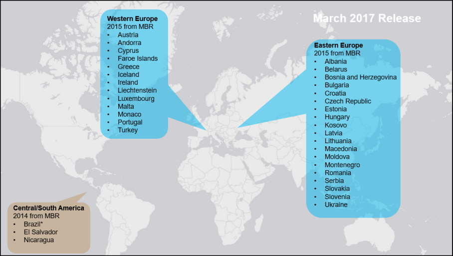
- All European countries have one or more new attributes, in many cases Population Density. And the following have new levels of geography available: Andorra, Albania, Bosnia and Herzegovina, Bulgaria, Estonia, Greece, Iceland, Kosovo, Latvia, Lithuania, the Former Yugoslav Republic of Macedonia, Portugal, Romania, Serbia, and Slovenia.
- Some countries no longer have certain attributes (Croatia, the Former Yugoslav Republic of Macedonia, and Slovakia) and some no longer have certain levels of geography (Albania and Latvia).
- *The REST endpoints for Brazil were updated, but there was no vintage update.
Updated Traffic Counts in the U.S.
Updated Traffic Counts from Kalibrate (Q4 2016) on the Traffic Count Profile, Traffic Count Map, and Traffic Count Map – Close Up reports.
More Topics from ACS 2010-2014 in the U.S.
Access new content from ACS 2010-2014 including population ethnicity, ancestry, and poverty status.
 These variables are available for mapping at the State, Congressional District, County, and Census Tract levels of geography in the Business Analyst and Community Analyst web apps. View a detailed list of these variables.
Note: These variables are not available for reports.
How will these updates affect me?
For the Ready-to-Use Living Atlas Maps User within ArcGIS Online
Demographic layers and maps for 34 countries are updated.
For the Business Analyst and Community Analyst User
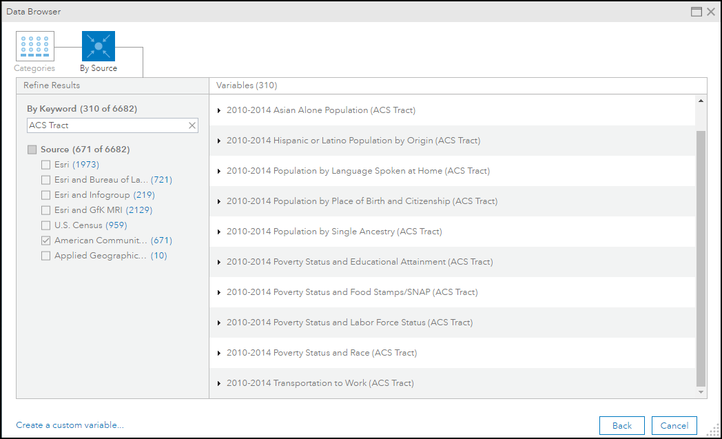
Business Analyst and Community Analyst users can access the updated data through reports and maps. The complete attribute list for each country is accessible through the data browser contained in the application.
For the Data Enrichment user in ArcGIS Online or ArcGIS Maps for Office
The March 2017 update provides access to the datasets shown above. For a detailed explanation of new or deleted attributes in datasets, see the Release Notes for each individual country available on the Esri Demographics documentation pages.
For the Developer using REST endpoints for Standard Global Demographics & Lifestyle Map Services
The REST endpoints for Standard Global Demographics & Lifestyle Map Services were updated in March 2017. These changes will impact any application consuming these services. Some of the changes to the underlying REST endpoints included in this release are:
1. Changes to the layer IDs.
2. Changes to layer names.
3. Changes to attribute field names, IDs, and aliases including additions and deletions.
Because of updates to the underlying data, users of the Demographics & Lifestyle Map Services may need to update these items in the query parameters of REST requests to the service from their apps. To view the updated map service REST endpoints, you will need to access the REST API with a developer or organizational account, using a token request.
For the Developer using the REST endpoints of the GeoEnrichment Service
The underlying datasets of the REST endpoints of the GeoEnrichment Service were updated in March 2017. Some of the changes to the REST endpoints included in this release are:
1. Changes to the layer IDs of the administrative/statistical boundaries.
2. Changes to the layer names of the administrative/statistical boundaries.
3. Changes to attributes/analysis variables including additions and deletions.
Because of updates to the underlying data, users of the GeoEnrichment Service may need to update these items in the query parameters of REST requests to the service from their apps. To view the updated REST endpoints, you will need to access the GeoEnrichment Service with a developer or organizational account, using a token request.


Article Discussion: