It’s a new decade; out with the old and in with the new! As part of the ArcGIS 10.8 release in February, the Real-Time & Big Data GIS team is excited to announce some new feature enhancements to ArcGIS GeoEvent Server. Updates include many usability enhancements to the service designer in GeoEvent Manager, a new embedded utility called the GeoEvent Sampler that offers a quick way to review and visualize processed event data, and expanded documentation for the available processors.
New service designer functionality
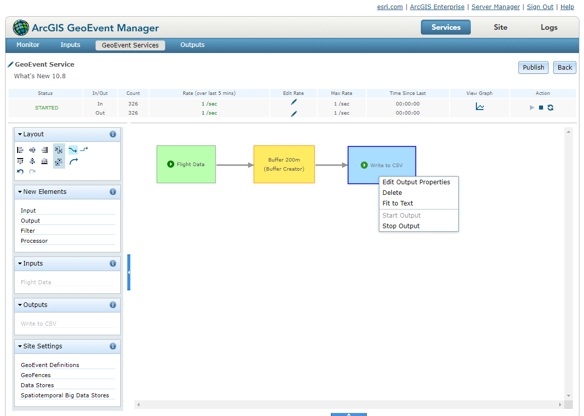
Gone are the days of managing different browser tabs to create all the necessary components of a GeoEvent Service. The 10.8 release of GeoEvent Server features new usability and functionality in the service designer. Available is the ability to create, add, copy, edit, start, and stop input and output connectors directly in the service designer. In addition, new status icons display the state of each connector, making it easy to quickly determine if they are started, stopped, or in an error state. Along with the new input and output connector capabilities, you can now easily access and edit several key GeoEvent Server settings from directly in the service designer. These settings include GeoEvent Definitions, GeoFences, Data Stores, and Spatiotemporal Big Data Stores.
Need to make a small edit to a GeoEvent Definition? Or need to modify the refresh interval for a Poll an ArcGIS Server for Features input connector that has already been configured? Now, rather than loading separate browser tabs or leaving the service designer altogether, simply access the appropriate settings from directly inside the service designer to make these changes on-the-fly (or one could say, in real-time… I’ll see myself out).
New GeoEvent Sampler utility
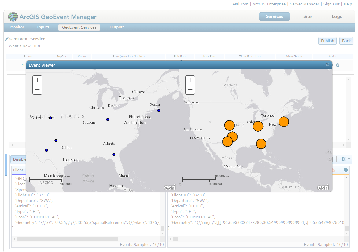
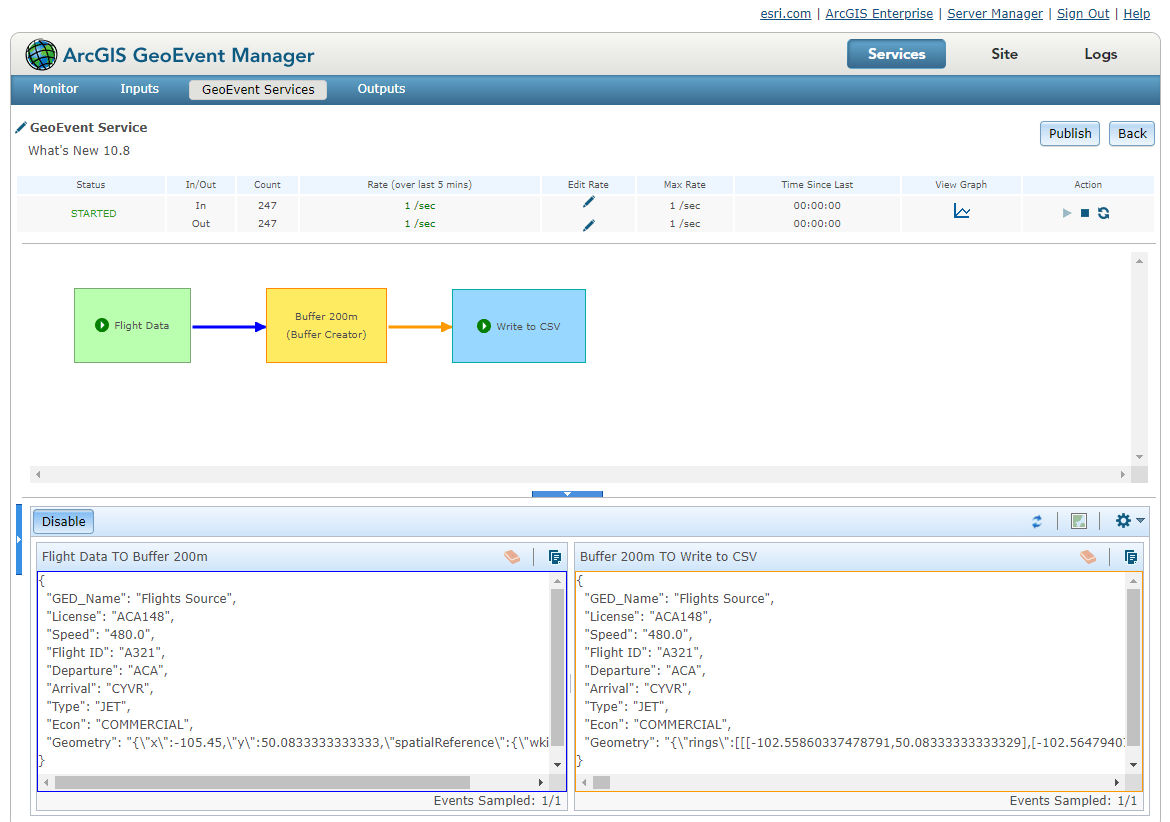
The 10.8 release includes the latest utility for GeoEvent Server called the GeoEvent Sampler. The first of its kind, the GeoEvent Sampler is an embedded utility in GeoEvent Manager’s service designer. It provides the means to quickly capture, review, and compare processed event data, or GeoEvents, in real-time as delimited text or prettified JSON. Sampled GeoEvents with a valid geometry can even be visualized in a web map using a lightweight viewer capability of GeoEvent Sampler; the Event Viewer.
Use the GeoEvent Sampler to better understand what’s happening to the event data flowing through a GeoEvent Service without the need to configure a variety of output connectors. The sampled data can be used to quickly and easily gain insight into how data is being handled by different elements of a GeoEvent Service. For example, want to make sure that your Field Calculator (Regular Expression) processor has the correct regular expression? Sample the GeoEvents sent from the processor, make any necessary edits to the processor configuration, and sample again to verify you’re seeing the correct output from the processor.
For documentation on how to get started with sampling GeoEvents, see GeoEvent Sampler. For more information on what GeoEvent Sampler is and how it can be used in different ways in your GeoEvent Service(s), check out the New Service Designer Capabilities in ArcGIS GeoEvent Server 10.8 blog.
Expanded processor documentation
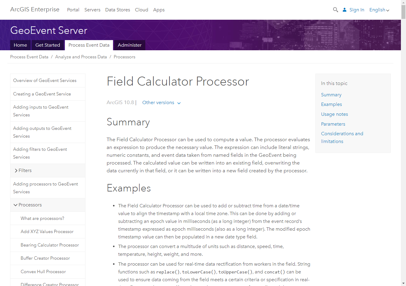
All the available processors in GeoEvent Server now have expanded documentation that include a summary, example use cases, usage notes, parameter descriptions, as well as any considerations and limitations to consider when using. Access the expanded documentation and learn more about the processors in GeoEvent Server by visiting the 10.8 version of What are processors?.
General enhancements
Other updates to GeoEvent Server include general stability enhancements and changes to the initial state of input and output connectors when first created. By default, inputs and outputs are now in a stopped state when they are initially created. This ensures ingestion, processing, and dissemination of event data does not happen until you, and your GeoEvent Service, are ready.
As always, see the ArcGIS 10.8 Issues Addressed List for a complete list of the issues addressed in ArcGIS GeoEvent Server 10.8. If you have any feedback on the new enhancements, submit them in the Real-Time GIS category in ArcGIS Ideas place on GeoNet.

Commenting is not enabled for this article.