Ever struggled to keep track of all the work being done in your field operations?
You’re not alone.
Planning and coordination are essential functions to all project management but become even more crucial in field operations as teams are not co-located but, rather, are geographically dispersed between field and office locations. This planning and coordination includes defining, prioritizing, and communicating the individual work that needs to be done in the field, and by whom, across all the individual field projects at an organization.
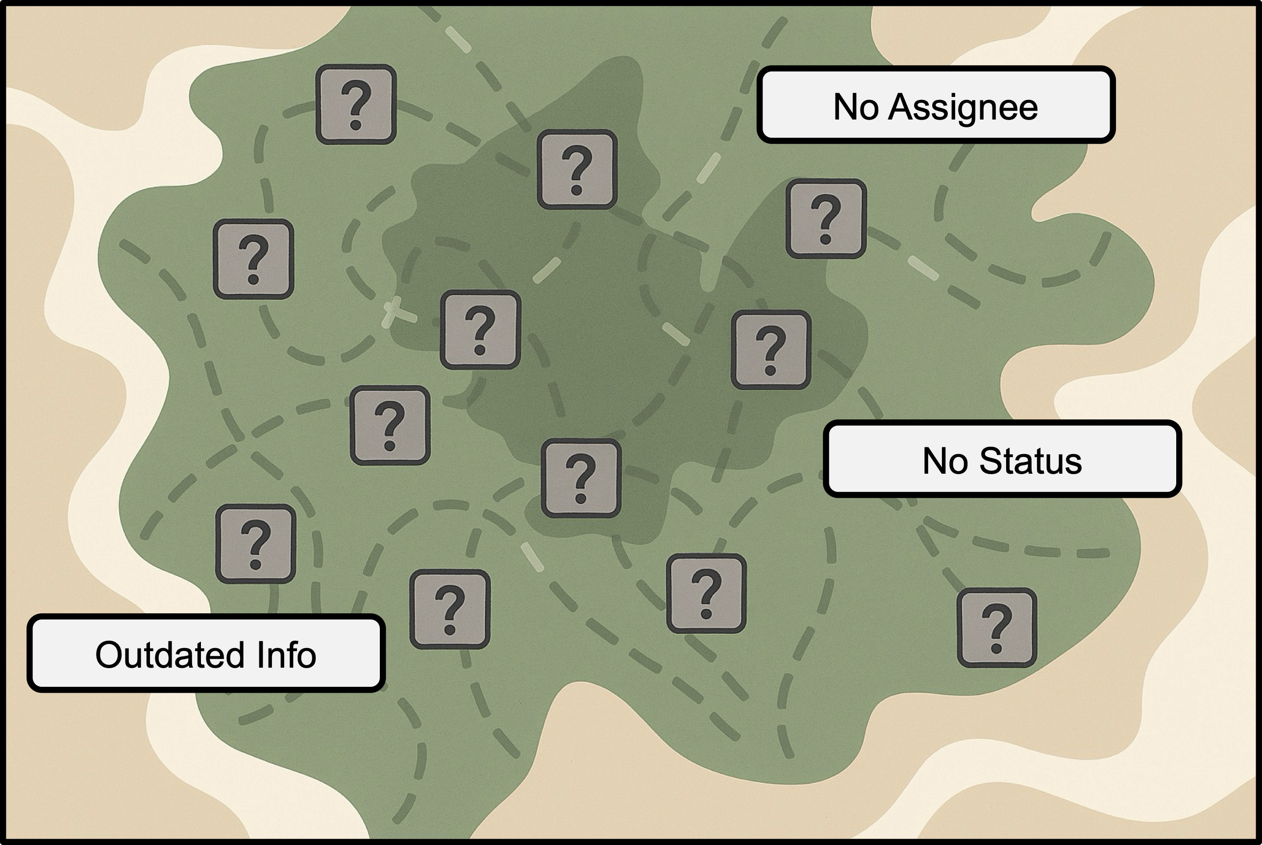
Many field operations teams often face challenges with fragmented communication, missed prioritization or requirements, and limited visibility into work progress. Managing multiple, disparate tools makes it difficult for field and office staff to collaborate effectively and adapt quickly to changing conditions.
Introducing the Tasks capability
ArcGIS Field Maps now includes the Tasks capability which provides field operations with a better way to manage the planning and coordination of fieldwork.
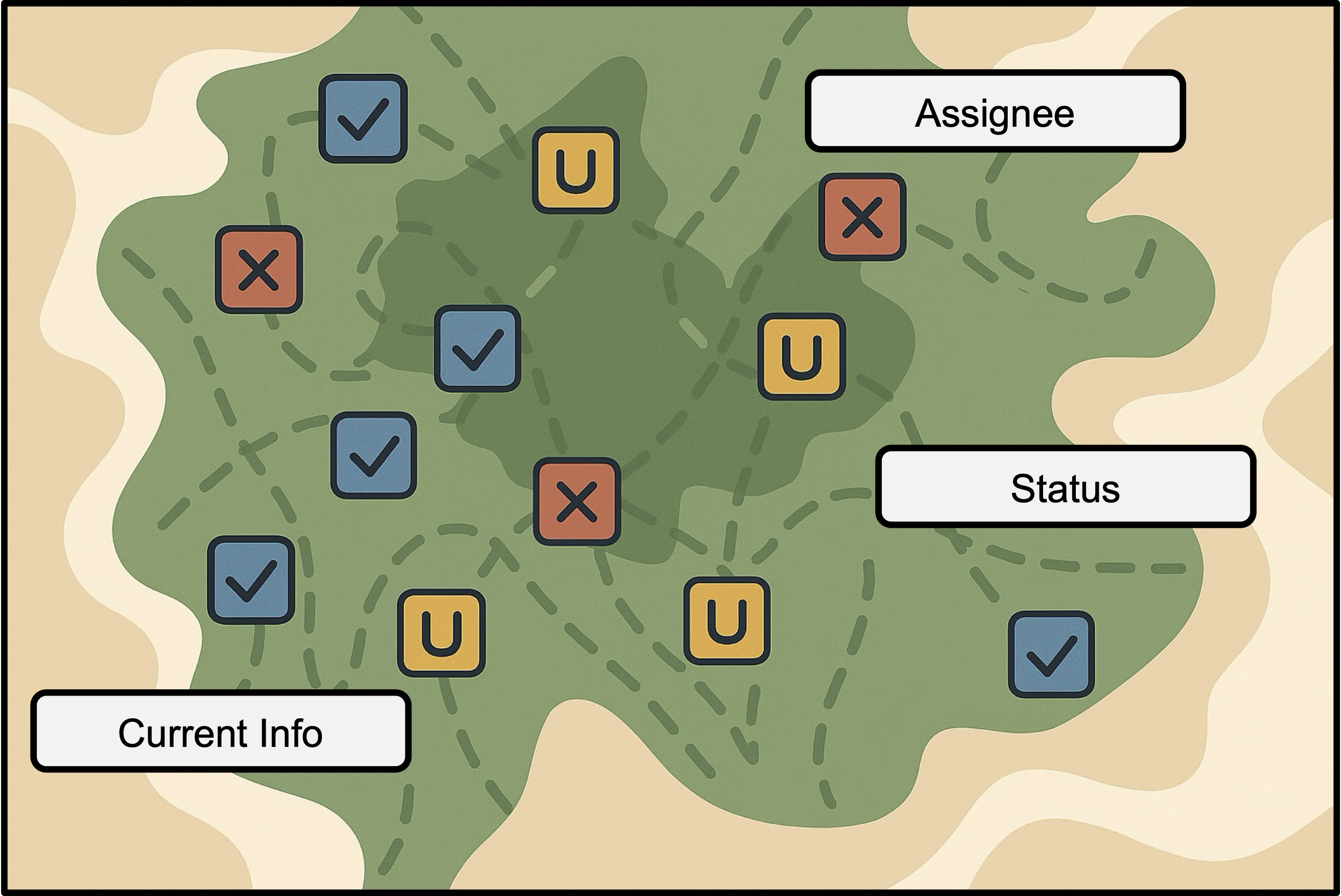
For organizations, this means better collaboration, accountability, and data-driven insights that support decision-making.
For field staff, it means having clear, prioritized to-do lists built right into the same app they already use to collect data and perform inspections – eliminating the need to switch tools and helping them stay focused and efficient in the field. With Field Maps as their all-in-one app, everything they need is in one place.
With tasks, organizations can:
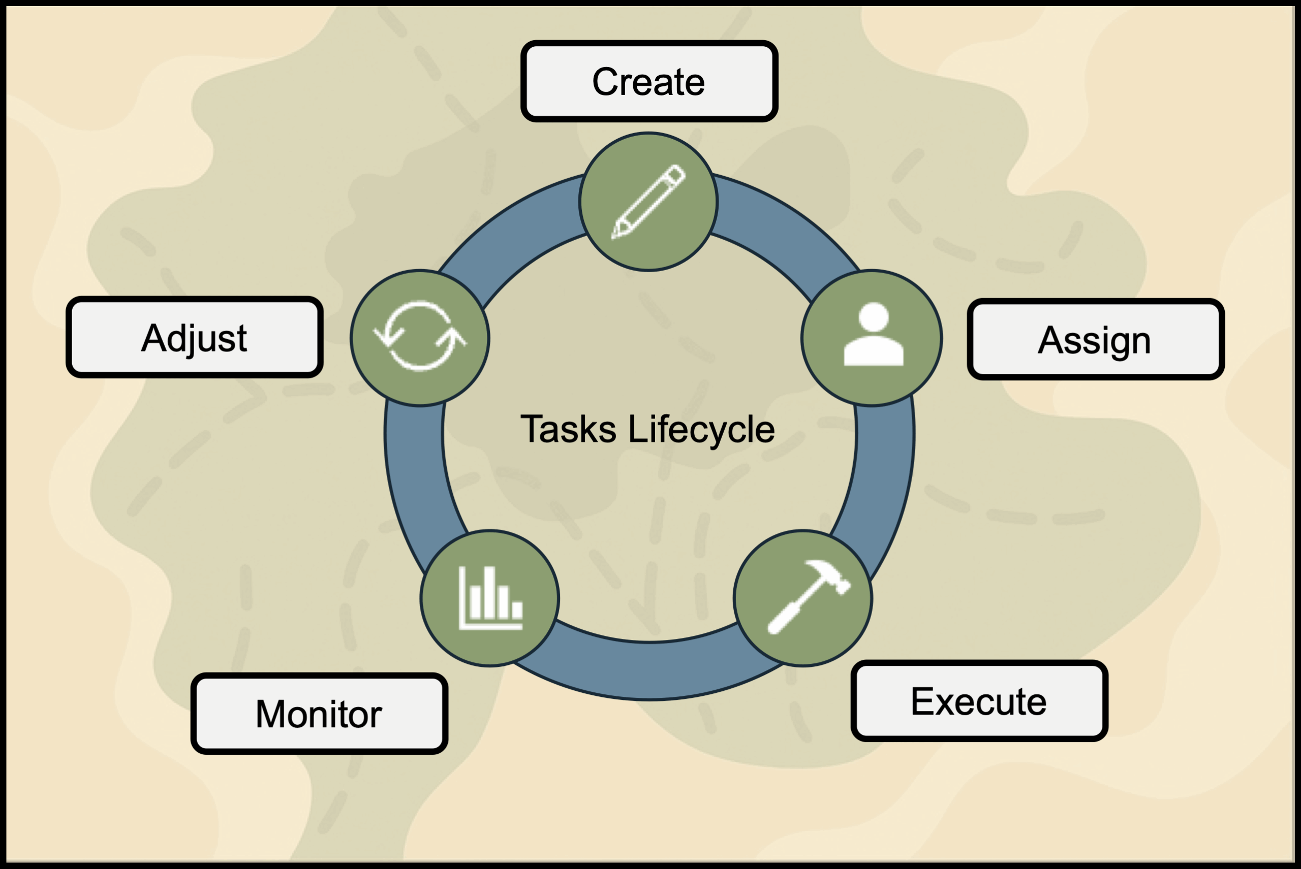
- Create, assign, and prioritize fieldwork from the office or the field
- Configure tasks workflows to specific project requirements
- Share information (e.g., instructions, safety guidelines) for fieldwork to mobile workers
- Enable mobile workers to view tasks spatially on the map and in to-do lists
- Enable mobile workers to pick up unassigned work
- Provide mobile workers the ability to complete tasks, guided with context-specific actions and information
- Ensure mobile workers can work on tasks in disconnected environments, automatically syncing when connected
- Integrate with other apps and broader work management systems
- Monitor fieldwork progress in near real-time
How do tasks work?
Tasks are features in a feature layer – just like assets – with associated geometry (points, lines, or polygons) and location but with configurations and settings that light up a to-do list experience in the Field Maps mobile app. Mobile workers use tasks to understand the work that needs to be done and report on their progress from the field.
Tasks workflows are configured in Field Maps Designer. You can quickly and easily get started by creating a new task-enabled layer that will provide default settings and fields that can be used out-of-the-box with minimal configuration or adapted to meet additional workflow needs. You can also enable tasks on an existing layer.
Tasks can be managed – created, edited, or deleted – anywhere feature layers can be edited, such as ArcGIS Map Viewer, Web Editor, or through custom task dispatching experiences built with our app builders like ArcGIS Instant Apps and ArcGIS Experience Builder. You can also automate task creation using tools like Microsoft Power Automate.
Tasks structure
To better understand how tasks work, let’s take a look at the tasks model, settings, and components that define how they behave and appear in Field Maps.
The task layer information model
A task-enabled feature layer must have the following fields to show up as a to-do list in the Field Maps mobile app:
- Task type – What kinds of jobs will be done in this project? You must configure at least one task type. (e.g., inspection, repair)
- Task status – What states will your tasks move through during their lifecycle? (e.g., assigned, in progress, completed)
- Task assignee – Who will be working on this project? You must add at least one assignee to work on the tasks.
- Global ID – Unique identifier for each task, ensuring reliable tracking and integration.
When you create a new task-enabled layer in Field Maps Designer, we also give you additional commonly used fields by default that you can use as-is, remove, or configure. You can also add your own fields to configure the tasks layer to meet your individual project requirements.
Visit the Understand the tasks information model topic for more details.

Tasks components
The tasks functionality has several components that can be configured in Field Maps Designer to create workflows tailored for each of your projects.
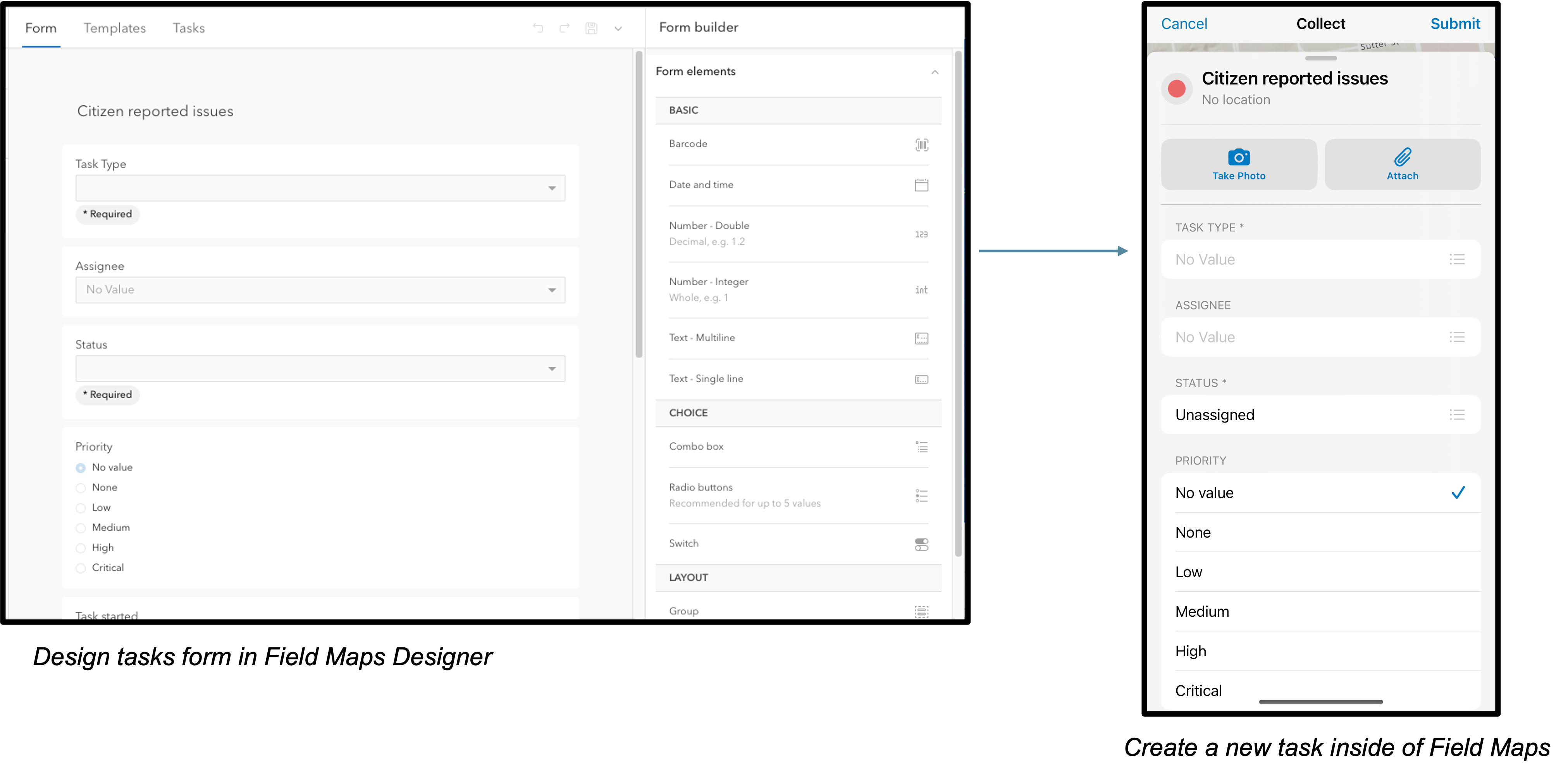
- Forms – Used to define the information captured when a task is created.
- Layouts and actions – Used to define stages tasks can move through as well as the tools and actions available to the mobile workers in each phase of the task lifecycle.
- Tasks filters – Used to define the criteria that defines which tasks are displayed in to-do lists.
- Pop-ups – Used to define the information that is provided to the mobile worker when they open a task.
Tasks forms are fully customizable, allowing you to tailor the layout, fields, and logic to match your team’s workflows, from simple checklists to complex data collection scenarios. This is the form that task creators fill out when defining a new task, making it essential for capturing the right context, instructions, and requirements to guide field execution effectively.
Tasks layouts and actions are highly configurable elements that shape how a task appears and behaves in the field. Task layouts act as containers for the tools and actions available to a task in any given stage. Tasks actions are the interactive buttons and menu items you can configure for your mobile workers to have access to for each task, like launching navigation to a work site, editing an asset’s attributes, performing an inspection, attaching an image, chatting about the task with their coworkers in Microsoft Teams, etc. By customizing layouts and actions, task creators ensure that field users have the right tools at their fingertips, tailored to the task’s context and lifecycle.
Task pop-ups are used to surface contextual information when a user taps on a task icon on the map. They can be customized to display relevant asset attributes, instructions, external links and more, ensuring your mobile workforce has immediate access to the information they need to complete their work.

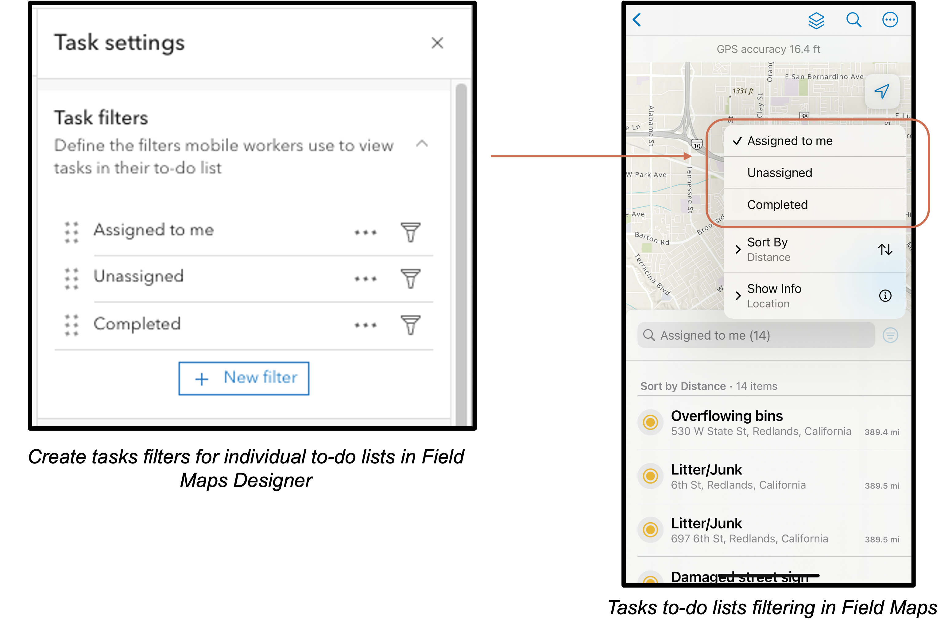
Task filters define the dynamic to-do lists that mobile workers see in the Field Maps mobile app. By default, filters are provided for tasks that are “Assigned to me”, “Unassigned”, and “Completed”. You can use these, customize them, or create your own.
Each task filter is powered by an expression that evaluates task attributes to determine which tasks appear in the list. For example, the default “Assigned to me” task filter looks at the current logged in user to pull any tasks that are assigned to that user and not in a completed state to compile the to-do list.
Visit the Configure tasks topic for more details on how you can adapt tasks to your workflows.
We want your feedback on tasks!
Once you’ve tried out the new tasks functionality, we’d love to get your feedback on it! Sharing your needs helps us shape what’s next.
Take the survey!
Commenting is no longer enabled for this article