What is ArcGIS Field Maps?
ArcGIS Field Maps is the go-to app for viewing maps, collecting data, performing inspections, sharing location, and providing situational awareness in the field. Field Maps includes two apps: the Field Maps mobile app and the Field Maps Designer web app. Both apps include all the features needed to prepare maps for the field and deploy field workflows. In this article, learn about the features and capabilities included in ArcGIS Field Maps.
The Field Maps Mobile App
With the Field Maps mobile app, mobile workers can collect data, mark up and view maps, work offline, filter indoor assets, share their location, and complete other necessary field tasks. Learn more about these features below:
Collect data
Field Maps allows you to collect data using the Add  button. When collecting data, you can select assets from a feature template and add data by filling out smart forms. See Create a map enabled for editing to learn more about preparing maps for data collection.

Map Viewing
The Field Maps mobile app allows you to tap on map features to view information in a popup. You can search for and locate features on your map using the search function. You can also open a map and tap Layers  to see all the layers in the map. These layers can be toggled on or off to show or hide them.

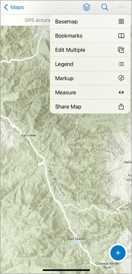
Use the Overflow  menu to change your basemap, access bookmarks, view your map legend, and even measure distances between points on your map. Tap Share Map to share the map with others. See Quick reference to learn more about working with maps in Field Maps.
Share Location
Location sharing allows you to record where mobile workers are and where they have been. Mobile workers turn location sharing on and off in the Field Maps mobile app using the My Tracks card in the Maps list. While location sharing is on, their location is recorded whether they are using the app or it’s running in the background, and tracks are collected if the device is online or offline. If indoor positioning systems (IPS) are configured for the map, Field Maps will use IPS to record indoor locations while the map is open. See Share Location to learn how to enable location sharing in Field Maps.

Work Indoors
Field Maps also supports working indoors. If your map is compatible with ArcGIS Indoors, viewing a web map or mobile map package (MMPK) that contains Facilities and Levels layers will show a floor picking tool when a building centered on your screen. All the floor levels of that building will then be accessible and filterable as layers. See Create a map for indoor use to learn more.
Use Markup
Markup allows you to capture sketches and add markers to your map. You can change the color of your sketches or add arrows to your markup. Notes and labels can also be added to communicate additional information.

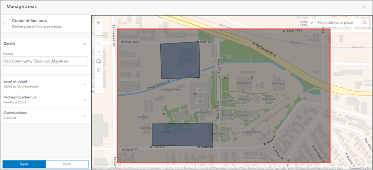
Work Offline
Field Maps works where you work – even offline. If you realize you’ll be working in an area with an unreliable internet connection, you can create a map area or use a mobile map package (MMPK) that allows you to view assets and collect data while working offline. See Prepare maps for download and Download maps to learn more about working offline in ArcGIS Field Maps.

Field Maps Designer
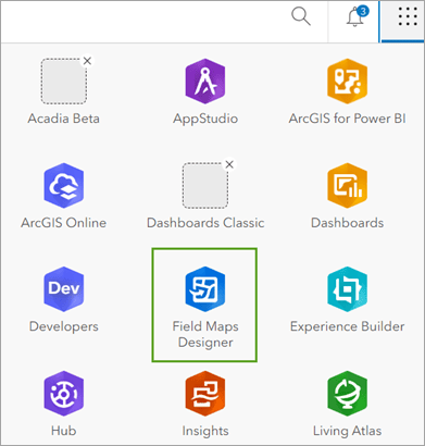
Field Maps Designer allows you to configure the mobile app experience for mobile workers. With Field Maps Designer, you can quickly create maps, build data collection forms, set up offline map areas, and customize the overall experience in the Field Maps mobile app. You can access Field Maps Designer from the app launcher located at the top of your organization’s home page in ArcGIS Online.
Learn more about the features available in Field Maps Designer below:
Create a map
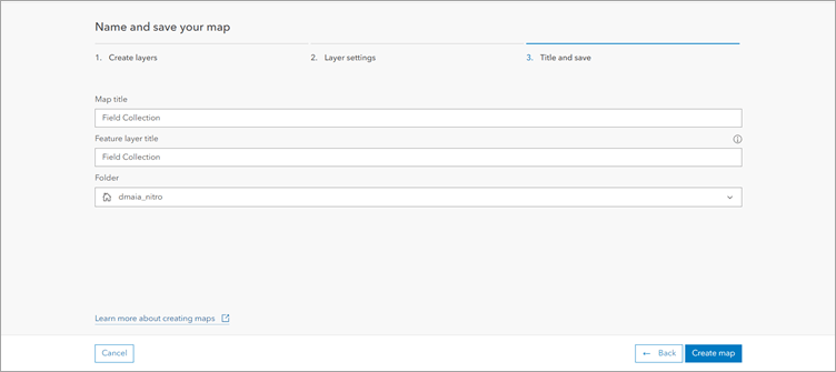
Field Maps Designer is a browser-based experience that allows you to create a data collection map for mobile workers to use in the mobile app. See Create a map for data collection to learn more about preparing maps for data collection in Field Maps.
Build forms
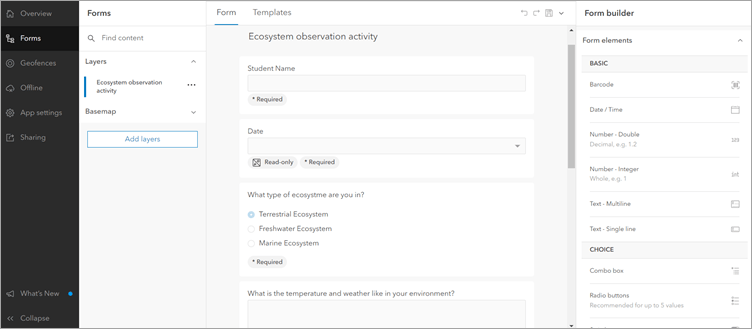
You can configure forms in the Field Maps Designer web app. This allows you to ensure mobile can successfully collect data in the field. To configure forms, you can add form elements like text, radio buttons, and switches to the form. See Configure the form to learn more about creating forms in Field Maps Designer.
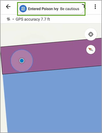
Create and manage geofences
Geofences allow you to define areas that, when exited or entered, trigger location alerts or location sharing. You can add geofences to your map with Field Maps designer.
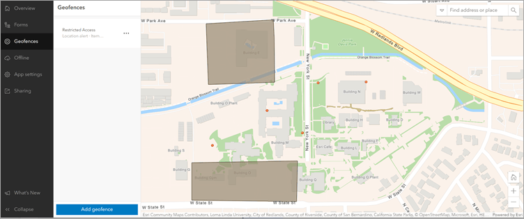
After geofences are configured in Field Maps Designer, a location alert or location sharing will be triggered in the mobile app when mobile workers enter or exit the configured geofence. Geofences work offline or online and in the foreground or background of a mobile device. They also work indoors if indoor positioning systems (IPS) have been set up.
See Configure the map to learn more about creating geofences in Field Maps.
Create offline map areas
With Field Maps Designer you can ensure mobile workers are able to use their web maps offline by enabling maps for offline use and creating offline map areas. See Configure the map to learn more about creating and configuring offline map areas in Field Maps.
Field Maps on Windows Devices
ArcGIS Field Maps is supported on Windows 11 devices. Field Maps can be installed and used on any Windows machine running Windows 11 using Windows Subsystem for Android. To learn how to install Field Maps on a Windows 11 device, see Install ArcGIS Field Maps on Windows 11.
Migrate to Field Maps from Collector, Explorer, and Tracker
ArcGIS Field Maps combines the capabilities of ArcGIS Collector, ArcGIS Explorer, and ArcGIS Tracker into a single app that’s easy to use and simple to deploy. See the ArcGIS Field Maps Migration Guide and Migrate to ArcGIS Field Maps blog post to learn more about what to consider when making the transition from Collector, Explorer, and Tracker to Field Maps.
Resources
Now that you know more about ArcGIS Field Maps and its capabilities, check out the following resources to learn even more:
- ArcGIS Field Maps Resources Page
- ArcGIS Field Maps Documentation Site
- ArcGIS Field Maps Esri Video Channel
Additionally, check out the Get to know Field Maps video below!


Article Discussion: