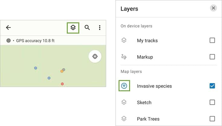
When you’re working with a lot of features, maps can get messy. This can be especially true when viewing maps on a mobile device. Just look at this invasive species map in ArcGIS Field Maps:

Each point on the map represents a different invasive species. Due to how they’ve grown in this area, many plants are within a few inches of each other, making for a crowded map. Even though I’ve used different colors to symbolize the layer by species type, it’s still difficult to identify individual species. Layer filters can help solve this issue.
Apply a layer filter
With a layer filter, I can limit the features displayed on the map based on specific attributes. By tapping the Layers button, I can view the layers in the map. If a layer has a filter configured, a Filter button appears next to the layer name.
By tapping the Filter button, I can select the field and value I’d like to filter the layer by. In this example, I’m going to filter the Invasive Species layer by the species type field so only English Ivy features are displayed on the map.

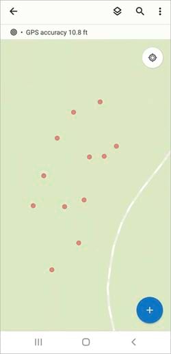
After I apply the filter, the map is simplified and only displays the features relevant to my current work.
Configure a layer filter
Layer filters are configured in the Field Maps Designer web app. After you open your map in Field Maps Designer, click on the App settings tab and expand the Layer filters section.
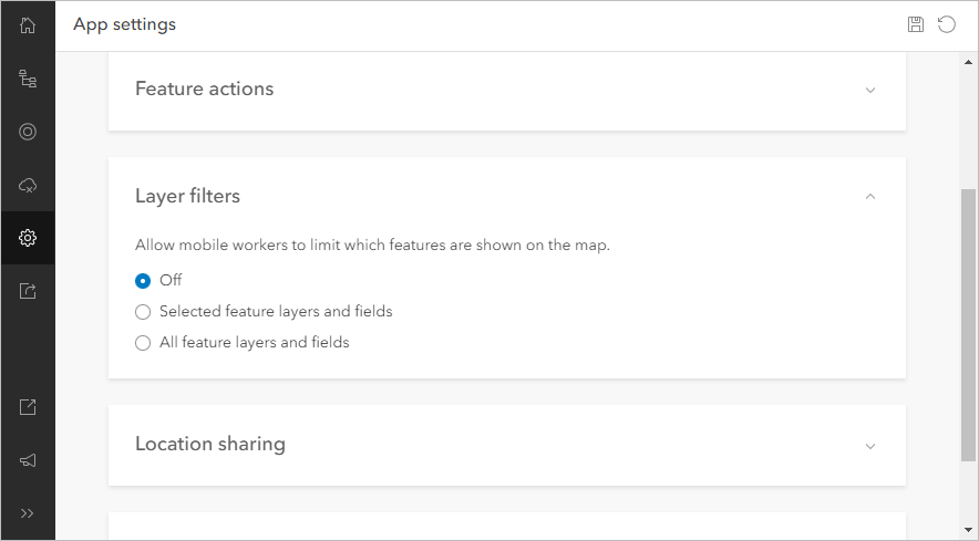
Here, you can control the filtering experience in Field Maps. You can enable filtering on all layers and fields within the map, or you can be selective—whatever makes the most sense for the work being done in the field.
For this map, I’ll allow only the Invasive species layer to be filtered by Species type and Size. Note: Layer filters can only be added to text (string) fields and fields with coded value domains (text and numeric).
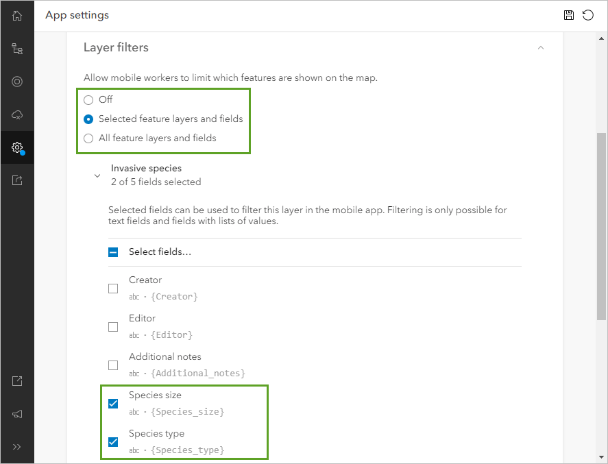
After I save the map, mobile workers can access the configured layer filters on any device the map is deployed to. Note: If the map is already open on a device, reload the map in Field Maps to apply the new layer filter.
Here’s a short video demonstrating the layer filter in action (there is no sound in the video):
This has been an overview on using layer filters to limit the features displayed on your map in ArcGIS Field Maps. For more information on layer filters, see the Add layer filters help section.


Commenting is not enabled for this article.