In the ArcGIS GeoAnalytics Engine 2.2 release (November 2026), we have a variety of new features and enhancements to improve your big spatial data workflows. This release includes new raster functionality, several new features and enhancements to the general ST and Track functions, and updates to our environment, setup, and data format support.
Let’s take a look at the new features and updates in GeoAnalytics Engine 2.2:
Raster
We have introduced several new functions and tools to enable your work with raster data. Notable additions include a new RT_Convolution function and capabilities to convert raster to polygon data.
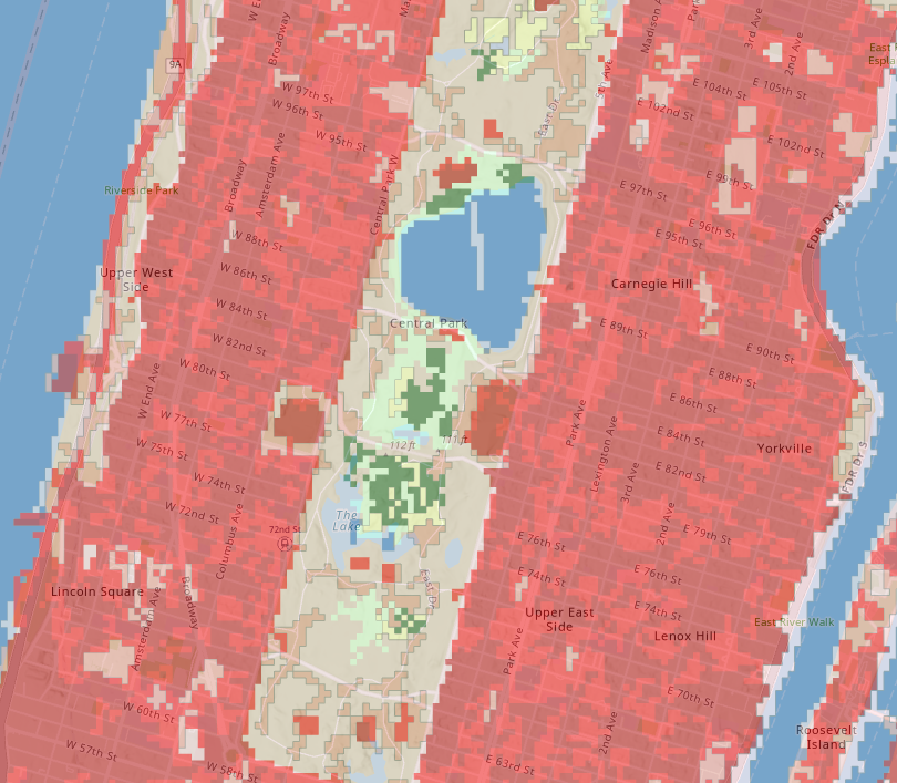
With the raster to polygon tool, you can convert a raster dataset into a polygon dataset with adjacent pixels of equal value grouped together. For instance, you could create land cover polygons from a classified land cover raster.
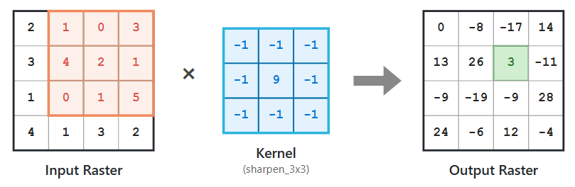
The convolution raster function performs filtering on the pixel values in a raster image, which can be used to sharpen or blur an image, detect edges within an image, or other kernel-based enhancements.
Data format support
There is now support for directly reading and writing the new parquet feature layer, currently available in beta in ArcGIS Online. The parquet feature layer type provides fast visualization and client-side querying capabilities. It is spatially optimized for read-only reference data and large datasets, providing faster filtering and drawing time to improve the end-user experience. And now you can read and write them directly from GeoAnalytics Engine.
We have also added support for the native Spark geometry type in Spark 4.2 using several new functions, including ST_GeomFromSparkGeom and ST_AsSparkGeom, as well as support for Cloud Raster Format (CRF). These enhancements improve your ability to work with the cloud-native formats critical to driving your vector and raster analysis at scale.
Enhanced functionality
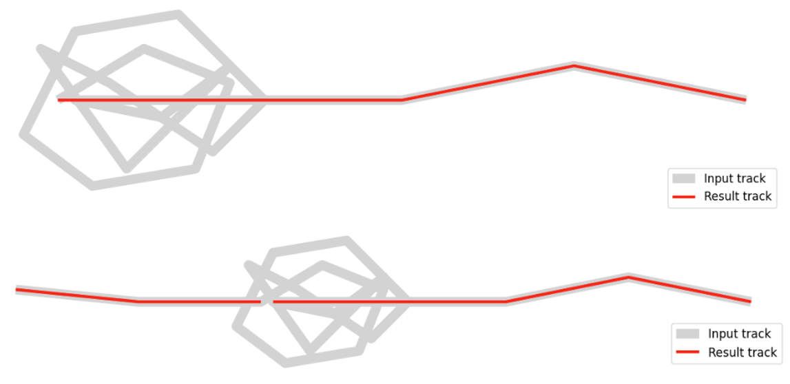
We also continue to add new functionality to meet customer needs, including a new trim parameter for improving dwell compactness, for instance with the Split By Dwells function, and several new functions to aid in finding locations at or between arbitrary points on linestrings (ST_LocateAlong, ST_LocateBetween, ST_LocatePointAlong, and ST_LocateLineBetween). Additionally, we now support geodetic distance in HDBSCAN with the Find Point Clusters tool.
As part of our functionality improvements, we have also updated the underlying technology that powers our geocoding and network analysis capabilities.
Note: If you are working with ArcGIS StreetMap Premium licensed for GeoAnalytics Engine, you will need to obtain an updated ArcGIS Maps SDKs for Native Apps license string to work with the data in GeoAnalytics Engine 2.2. Please reach out to your account team to obtain this new Maps SDKs for Native Apps license string for v300.x. Your existing runtime license string (v100.x/200.x) will continue to work to authenticate your StreetMap Premium data in GeoAnalytics Engine 2.1 and earlier.
The updated license string is only a requirement if you are working with StreetMap Premium for GeoAnalytics Engine; this does not apply if you provide your own non-StreetMap Premium-based network or locator dataset.
Updated environment support
We have done significant work to support the latest Spark and common analytics platform runtimes. Notably, we now support Spark 4.2 and 4.3, including ST functions to convert to and from the native geometry type introduced in Spark 4.2. We have also improved our support for Databricks environments so that you can now read and write feature services, as well as run analysis tools in Standard Access Mode and Shared Compute, allowing you to use GeoAnalytics Engine in a wider range of configurations. For more details, see our documentation on installing GeoAnalytics Engine in Databricks.
Conclusion
We update ArcGIS GeoAnalytics Engine a few times a year to make spatial analytics a seamless part of your data science workflows. We always look forward to hearing from you about the features you need for your big data spatial analytics!
For more information on the latest enhancements, check out the product release notes. For resources on getting started, tips and tricks with various tools, and much more, be sure to check out the GeoAnalytics Engine Community Site.


Article Discussion: