Here are 10 ways an ArcGIS administrator can make it easier for Insights analysts to get up and running quickly. A little prep work and thought can speed adoption time for these analysts, who might not have a ton of GIS experience. As a GIS admin, these suggestions could help you make more efficient use of your time, improve Insights’ first impression, and make it easier for new analysts to just get it.
1. Break free from silos
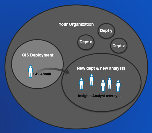
Identify who’s who and break free from silos. As a GIS admin of your ArcGIS Online or ArcGIS Enterprise organization, you hold the keys to GIS software and data access. But the people in other divisions and departments may not know that. Help these other departmental managers understand that you are willing and able to work with them. You can enable them, rather than being seen as gatekeepers. One goal could be to provide an analyst within their division with “self-service location analytics” (aka Insights), rather than your GIS team supporting one-off map or data export requests.
Next, within that new department, who are the analysts that will be using Insights? You can create an account for these folks, and assign them the Insights Analyst user type, which is designed and priced to provide access to just Insights, and that’s it.
2. Shortcut to Insights
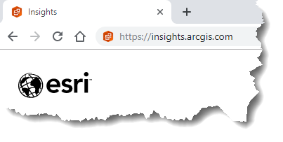
Point new analysts to insights.arcgis.com, instead of going through the portal. When you point new users to ArcGIS Online or ArcGIS Enterprise, it might be a little overwhelming with all the apps and different options. Give your new analysts just one simplified user experience and app, no need to overwhelm a new user with a ton of apps.
3. Make GIS data accessible
Catalog your organization’s data. Invite these new users to groups, and share data appropriately with those groups, so that when they open Insights, data is immediately there. The GIS content is a hidden treasure chest of data that they have never been able to access before. Previously they’d have to ask you in the GIS group to export them a shapefile – not any more. Remember marking data as authoritative also helps – Insights shows this on the data item cards.

4. Make business data accessible
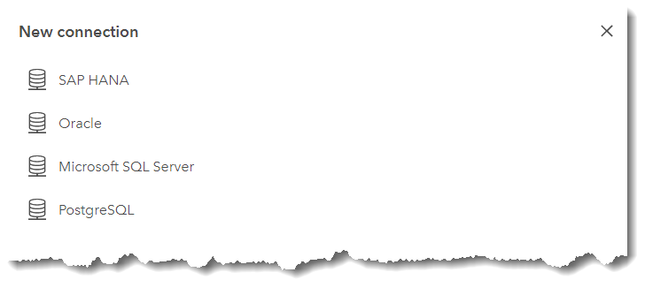
Create a databse connection and share it as an item to the other analysts. The other analysts can then simply add that connection, rather than trying to type in tedious connection information. This video shows how to create and share connections. Also, work with your database administrator to make sure that the connection properties provide access to the right business tables and data. Insights honors database views that the DBA can create. Also, indexes are important for performance.
5. Create & share models
Create an Insights model and share it for other analysts to use and learn from. This example should show the value of spatial and do something above and beyond what they were doing in their traditional software analysis package. Some example tools include: geo-enable tabular business data, geo-enrich, spatial filter, spatial aggregation, calculate density, find nearest, create buffer/drive time, and link analysis. Additionally, identify technical subject matter experts within that new division that can continue to create new models and share with the rest of their division.
6. Translate business problems into spatial questions
Define and document analysis use cases that are inherently spatial. Explain how location analytics can provide information, answers, and understanding that couldn’t be achieved before without spatial analysis. Or, perhaps it’s more accuracy or granularity that is being achieved. Simply provide a bullet-point list of problems and analysis, specific to the division and their data. Often, it’s not understood how to think spatially, or realize the possibilities that exist with this new spatial component.
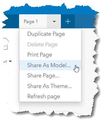
7. Create & share a theme
Create a theme, and share it. The theme should have the organization’s branding and authoritative look. The new analysts can then simply apply the theme to their pages and workbooks. This also creates consistency among shared reports, so that they are immediately recognizable and familiar.
8. Create & share polished examples
Get visibility within your organization, and make sure that senior management sees the shared pages and workbooks. These information products can be beautiful and compelling when done correctly.
9. Export resulting datasets, for reuse
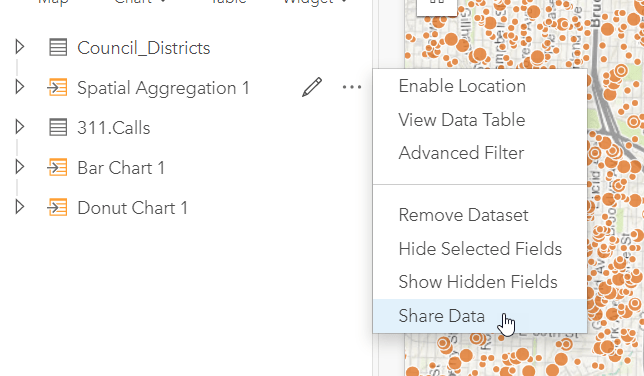
Emphasize that resulting datasets from analysis can be exported and used in other business systems. Once you share a result dataset as a feature layer, just export it as a .csv or .shp from the Insights home page. Identify some broader workflows where Insights could be an analysis link in the information chain. Data into Insights –> analysis results out –> off to a larger system or process.
Insights is also interoperable with the ArcGIS platform, so data is easily be used in other ArcGIS apps.
10. Training Plan
Use training materials to develop a training plan. There are a lot of good resources – use them. Here are a few: YouTube video playlist, hands-on tutorials, intro presentation video, advanced presentation video, and instructor led training.
11. Enterprise logins
Okay, this is technically the 11th item in this list, more than 10 as promised. But I couldn’t resist. Enterprise logins make it incredibly easy for your users to sign in and gain access to ArcGIS. They allow members of your organization to sign in to ArcGIS using the same logins they use to access your other enterprise information systems. The advantage is that members do not need to create additional logins within the ArcGIS system; instead, they can use the login that is already set up within their enterprise system.
In Conclusion…
As a GIS owner, give your coworkers a fishing pole, instead of a fish. Teach them how to fish for themselves and catch a location analytics monster! This will allow you to move away from the data export and map requests, and on to more strategic GIS activities. Although a little more prep work upfront, in the long run, this strategic thinking can help you achieve organizational goals.

Commenting is not enabled for this article.