Updated December 8, 2017: The Esri Vector Basemaps were recently updated to a new version (v2). The best way to access them in ArcGIS Online is through the Esri owned Vector Basemaps group, which contains the latest set of web maps and tile layers. See What’s New in Esri Vector Basemaps (December 2017) for information related to this update.
We kicked off the month of August with a round of data updates in the Esri Vector Basemaps. We close out the month with another update of content spanning the globe. The entire western hemisphere, North and South America, was updated with our latest HERE commercial data refresh. Since we produce a single tile set that all our styles reference, this new data is displayed in all the Esri vector tile layers and web maps, including our creative sample styles.
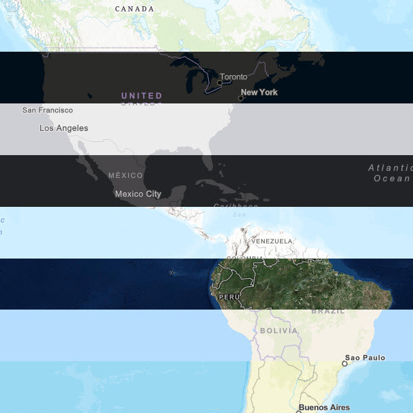
Esri Vector Basemaps from top to bottom: Topographic, Streets at Night, Light Gray Canvas, Dark Gray Canvas,
Terrain with Labels, Imagery Hybrid, Navigation, and Street Map.
Data Updates and Community Contributions
In addition to our commercial data update, we’ve added and updated a number of community areas with data contributed through our Community Maps Program. If you are a steward for your local, city, county, state, region or nation data sets, we encourage you to join and contribute data and maps through the Living Atlas of the World. Our most recent additions to the vector basemaps:
- Arizona State University
- Appleton, WI
- Dakota County, MN
- State of Delaware
- Grandview Heights, OH
- Lee’s Summit, MO
- Republic of Maldives
- New Braunfels, TX
- Nordrhein-Westfalen, Germany
- Queensland, Australia
- Reading, MA
- Sioux Falls, SD
- State of Tennessee
- Thuringen, Germany
- University of Idaho
- Williamson County, TX
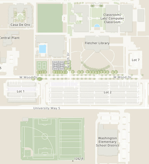
Arizona State University – West Campus, with detailed Special
Area of Interest features like sports fields, solar covered parking
lots, and Trees shown in the Topographic vector map style.
Featured Use Case of Esri Vector Basemaps
The Maryland Food System Map is an interactive web app from Johns Hopkins Center for a Livable Future. There are many layers of data that can be applied to the map to show how complex the food system in Maryland is, even at the local level. GIS Specialist Jamie Harding, who helped develop the app, believes it is a useful tool for people to learn more about Maryland’s food system, presenting the many elements – and their interconnections–in a way that people can easily process and understand. The website includes a detailed annotated image showing all the different functions of the map.
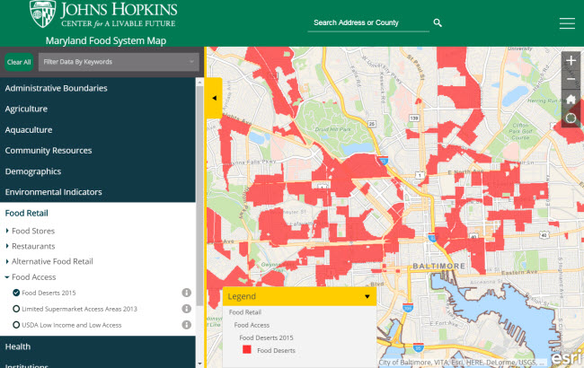
This image shows the Esri Navigation vector basemap in Baltimore
with Food Desert areas highlighted in red, showing where there
is limited local access to fresh fruit, vegetables and whole foods.
(App description and image from the Maryland Food System Map website)
Organization Administration
As previously reported, organization administrators can choose to use Esri vector basemaps as the default in the Map Viewer and Scene Viewer basemap galleries. Check Use Esri vector basemaps in supported ArcGIS apps in the Map tab under Edit Settings.
Those accessing the Esri Vector Basemap web maps will always be connected to the latest vector tile layers. If you created maps or apps during the beta period of the Esri Vector Basemaps (June 2015-December 2016) and haven’t updated the underlying tile layers, you are not using the most current style or tile set. The current URL is:
- https://basemaps.arcgis.com/v1/arcgis/rest/services/World_Basemap/VectorTileServer
The URL for beta layers has “b1″ or “b2″ instead of the production “v1″. This URL can be found on the lower right of any of vector tile layer item page (World Navigation Map for example). If you are using layers with the “b1″ or “b2″ URL (beta layers), it is recommended that you update to the current production layers. Older tile layers also carry “mature support” in their title.
To stay up-to-date on all the vector basemap news, bookmark this link.

We still cannot get any related record functions to work when using a ArcServer hosted service. Does it require 11.x maybe? Or is this still not supported yet? Where is it on the roadmap?
thanks a lot