Firefly…the map style that captures our attention and dutifully honors the First Law of Geography. Those of us that know it best think about it often. I swear…the maps I’ve seen. Sometimes it gives me pause, though, Firefly being free, belonging to every cartographer who wants to take a chance. I have to remind myself that some map styles aren’t meant to be caged. Their radiance is just too bright. And the part of me that knows it was a sin to keep it to myself does rejoice.
So here it is. Do interesting things with your data.
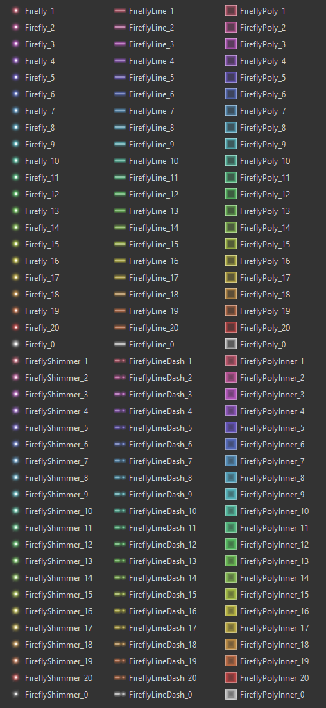
The Firefly style consists of the following point, line, and polygon symbols, packaged up for your adventures in ArcGIS Pro…
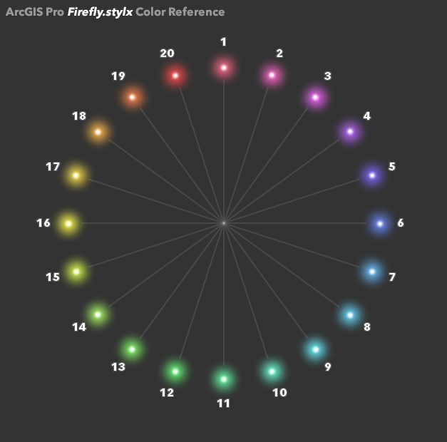
There are 20 pre-defined colors available for each symbol (but there is no reason you can’t tweak them for whatever visualization scheme you cook up). Here is a reference of their numbering…
To add these to your Pro project, first download the Firefly.stylx file and save it to your machine. From your project’s Catalog panel, right-click the Styles category and choose to add a style.
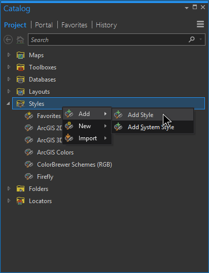
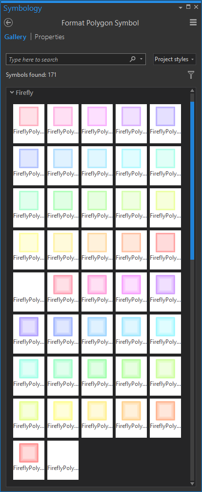
Point it to your Firefly.stylx file and you are good to go. Thereafter, the firefly styles will be available in the project via the Symbology panel’s Gallery.
So many possibilities. But where to start?
Points
Here’s a look at the standard Firefly point symbol, in this case showing, obviously, Taco Bell locations scaled by revenue…
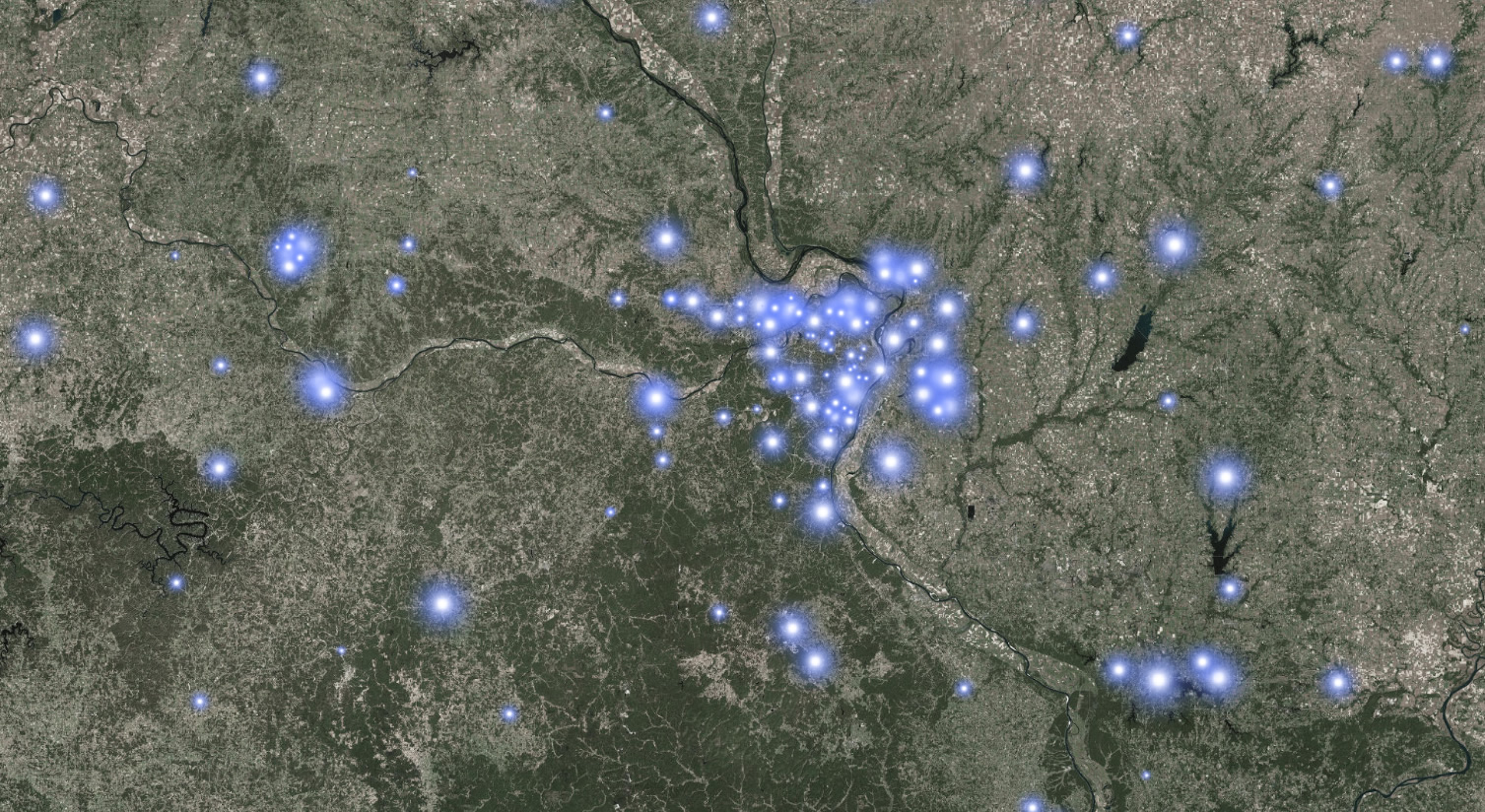
But sometimes you want to turn your Firefly point features up to eleven. I’ve got you covered. There is an alternative version with a twinkly lens flare shimmer sort of thing going on. Like in this map of luminescent earthquakes…
![]()
Lines
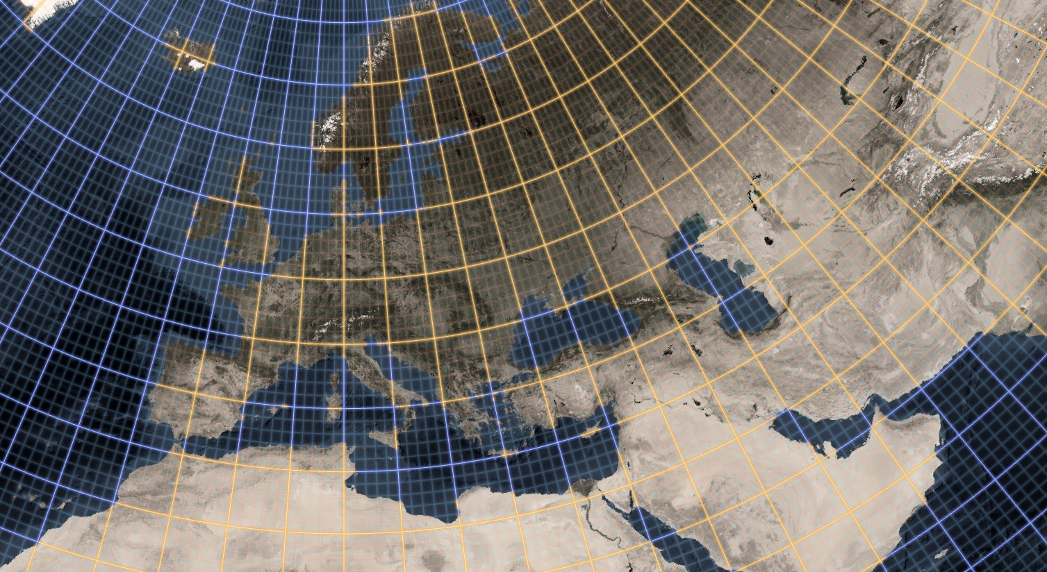
Firefly has two line styles. But, again, you can totally play with the Symbol settings to teach it whatever tricks you need. Here is the standard, solid, line illustrated in this map of glowtastic graticules…
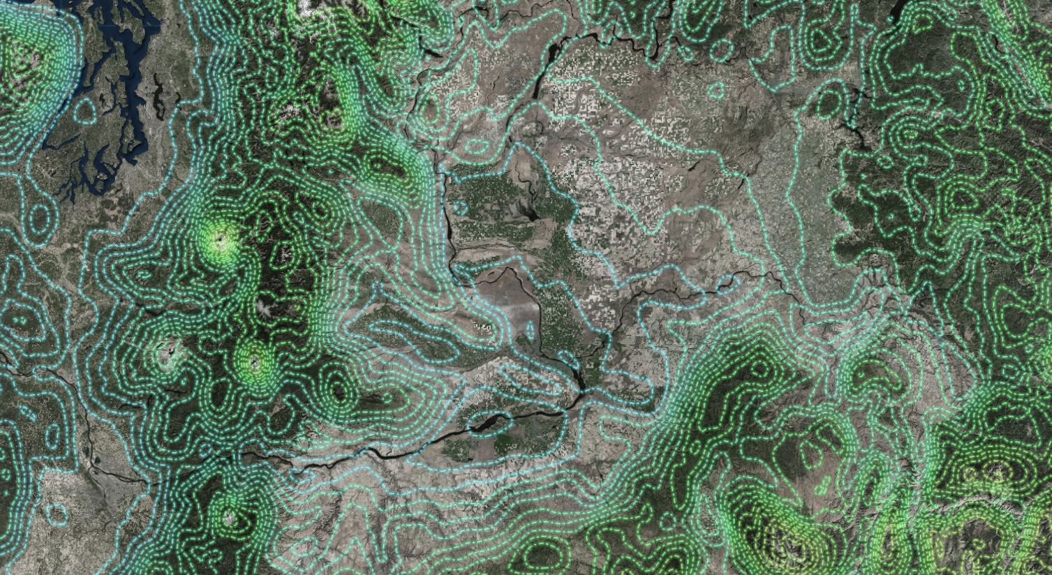
But sometimes you just need a dashed line. So here is an example of the dashed Firefly line style applied to contour lines in the Pacific Northwest…
Polygons
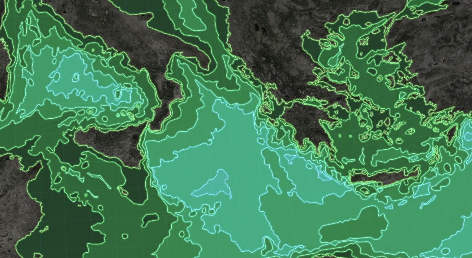
Here is a look at the Firefly polygon style. It is a glowing boundary with a faint fill, applied to these Mediterranean bathymetric zones, submitted for your approval…
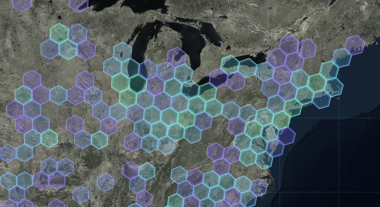
But when you have adjacent polygons, which is often the case with human geography data, the glowing edges of the Firefly polygons can bleed into, or overlap, each other and sort of make a mess. So here is an alternate version of the polygon fill with only an inner glow, as evidenced by these hexbins of aggregated Chipotle locations…
Basemaps
Ah, basemaps. When it comes to Firefly cartography, the basemap is a big player. A firefly basemap ought to be dark and nearly devoid of color. Conveniently, we have a Firefly global image service that you can use as a basemap. If that’s too busy, then I recommend Dark Gray Canvas vector tiles as an alternate.
Thematics
Just because there is a spectral set of colors available, please don’t use all of them in a thematic map. The rainbow color scheme has lots of problems for perception in scientific visualizations. I recommend using up to 6 consecutive firefly colors if you are putting together a classed thematic map. Any more than that and you start to span into another dominant hue and perception diminishes.
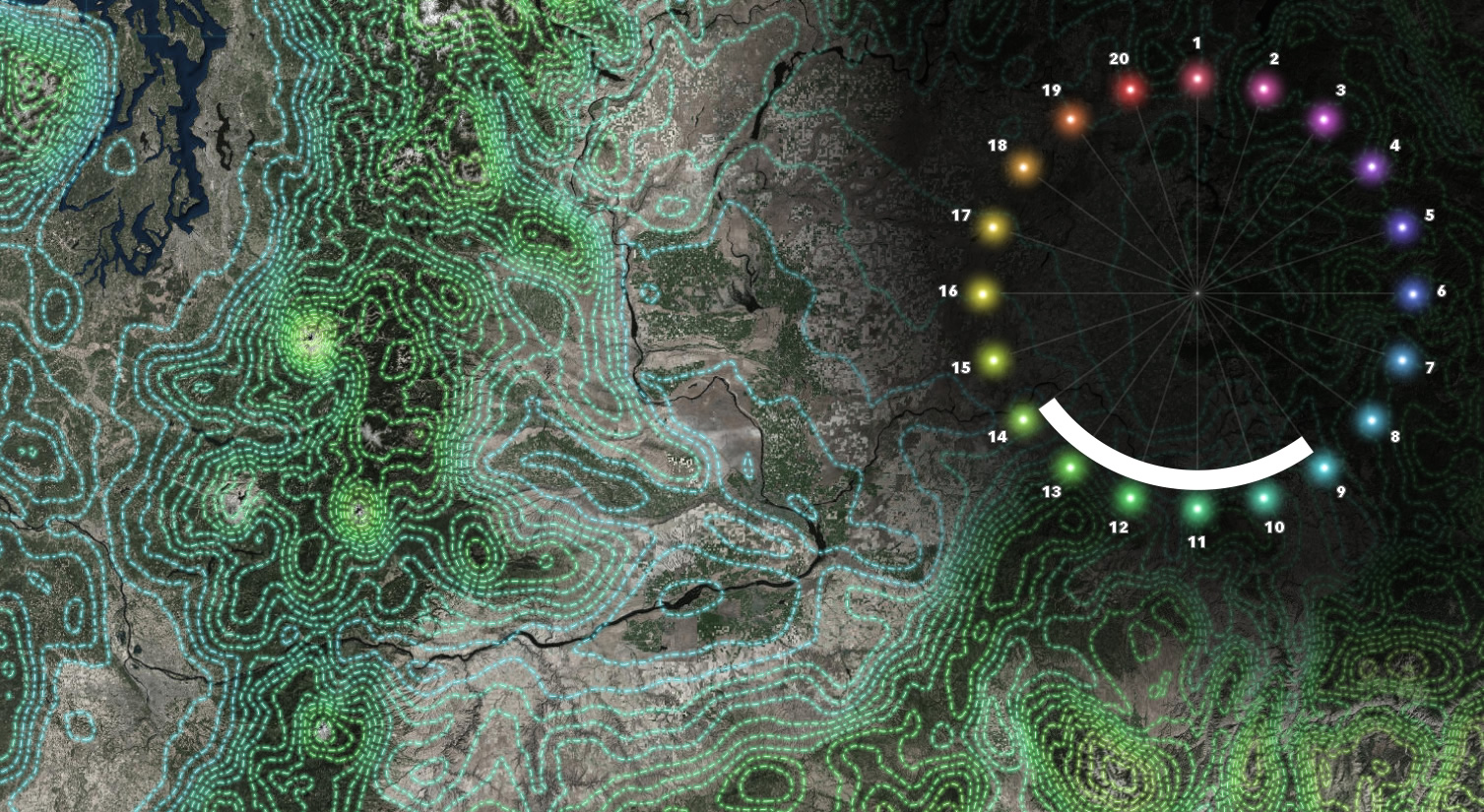
If you need contrasting colors, the colors opposite each other on this wheel tend to be differentiated well. Of course be careful to avoid colors that are particularly problematic for those with color-deficient vision.
No Color
Don’t want a color but still want a glowy Firefly map? No worries; there is a non-colorized version of each symbol, just look at this map of top college football prospects, scaled by player size…
![]()
Happy Firefly Mapping! John

Commenting is not enabled for this article.