ArcGIS Maps for Power BI provides you with the ability to build beautiful maps using your data within Microsoft Power BI. It works with all three versions of Power BI – Free, Pro and Premium. Getting started is easy. It is embedded within Power BI, which means you don’t have to go to an app store to use it. Just click on the Esri icon and start visualizing your data on maps. We are constantly adding features to the product so that it meets your needs.
Connect to ArcGIS Enterprise
In October 2019, we made ArcGIS Enterprise support available in a preview mode and received a great response. In this release, we are finalizing Enterprise support. This means that all ArcGIS Enterprise 10.7.1 and above users can connect to their organization’s Enterprise account and use their secure GIS data in dashboards and reports within Power BI. To get started, you would need an ArcGIS login with an ArcGIS Maps for Power BI add-on license, and then just login to the visual and start mapping!

Add multiple reference layers to a map
All ArcGIS users can now add multiple reference layers to a single map visualization within Power BI. A reference layer is information represented on a map. It adds context to your operational business data. For example, let’s say you have mapped your store locations in Power BI. You can now overlay it against reference layers such as income, age, competitor locations or other demographics to gain valuable insights. You can add data and layers that are published and shared online by the global ArcGIS community, the Living Atlas and data from your ArcGIS Online or ArcGIS Enterprise organization.
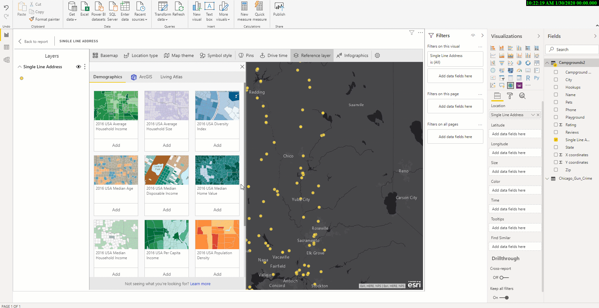
Table of Contents
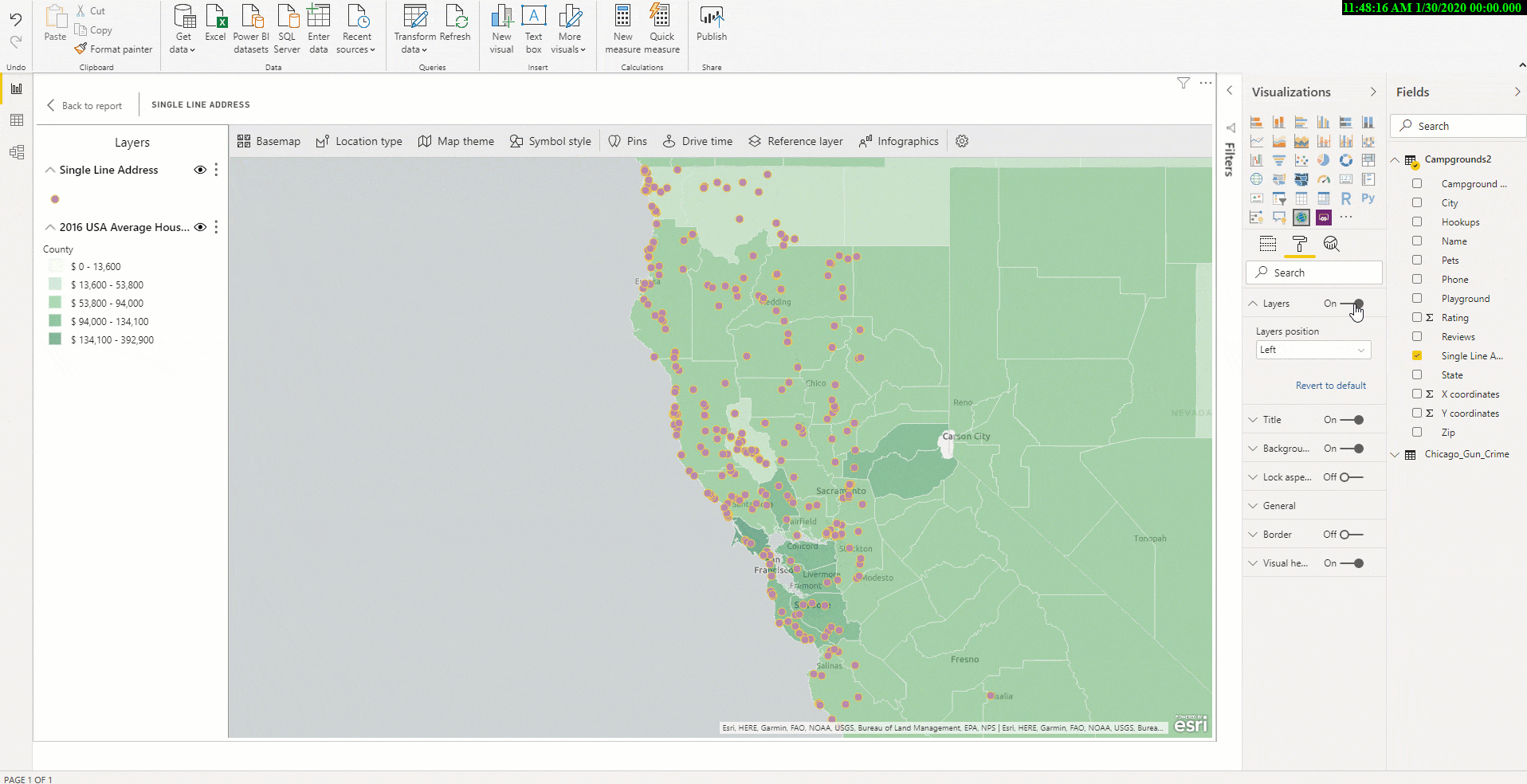
We have also added a new table of contents that will help all ArcGIS Maps for Power BI users (Standard and ArcGIS) better visualize their data on a map. Now when you drag data to a location field well and see it on a map, you can also see a table of contents that lists all the layers on the map and shows the features represented by the layers. This allows your report viewers to quickly understand what data they are seeing.
New Login Screen
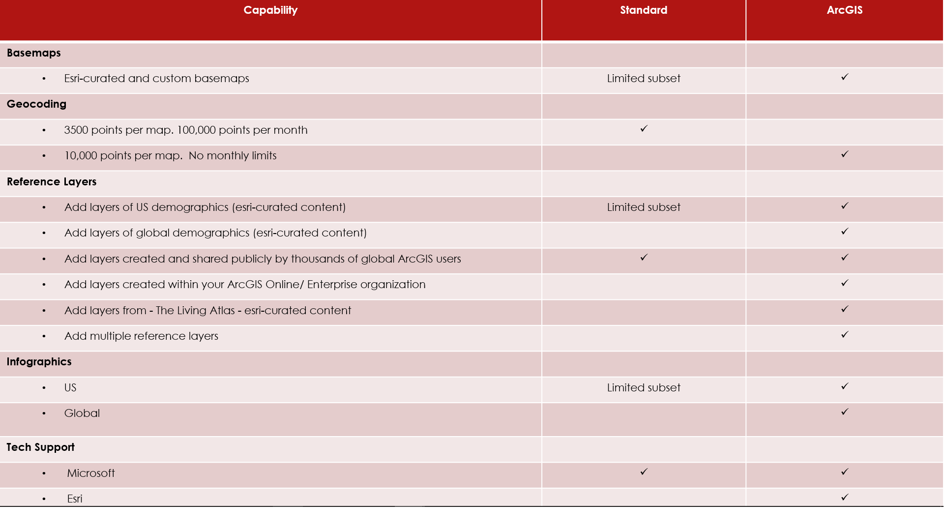
With this release of Power BI, you will notice an updated login screen. The Standard connection option is free for all Power BI users and provides basic mapping and location analysis capabilities. You can geocode, detect patterns in your data with different map styles and find similar or nearby locations. You can also access US demographics and infographics information to gain better context and make smarter decisions.
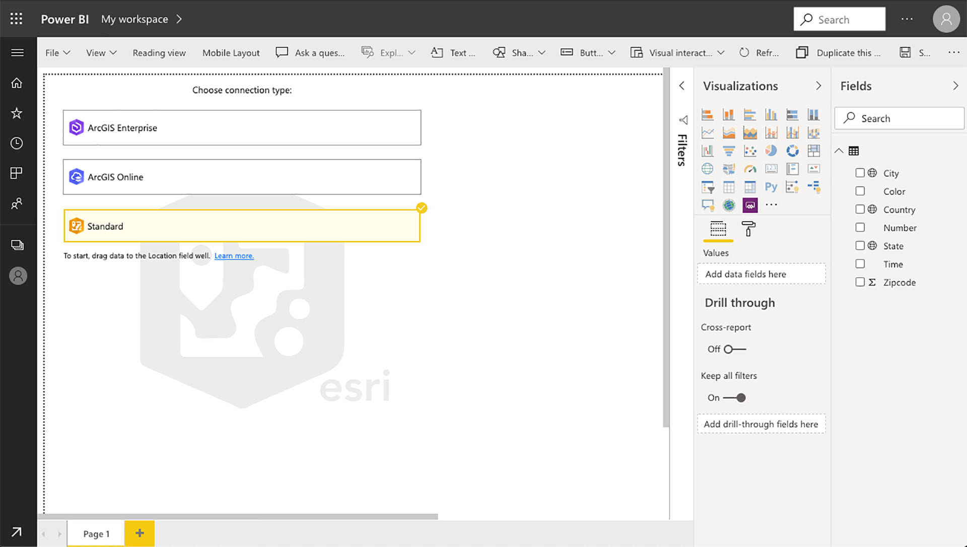
The ArcGIS Online and ArcGIS Enterprise connection options are for ArcGIS users who have the add-on license and provides all the capabilities of Standard as well as additional capabilities such as more basemaps, geocoding, access to global demographic data and The Living Atlas – Esri curated content, and the ability to add multiple reference layers on a map for more insightful analysis.
Learn more about ArcGIS Maps for Power BI on our product page. Get tips on using the different mapping and analysis tools within ArcGIS Maps for Power BI with these videos.

1. Would a standard user be able to see a dashboard that contains multiple layers? I appreciate that standard user can not add multiple layers.
2. Has the geocoding reference data now been updated to the latest versions as some of the admin boundaries are being plotted based on out of date information?
Sanjay, I had shared my response earlier, but I am not sure sure if you got a notification.
1. Multiple layers are only supported with the ArcGIS login. This is true for both Power BI report designers, as well as Power BI report viewers.
2. ArcGIS Maps for Power BI (and other Esri client apps) consume the ArcGIS Online World Geocoding Service for locating point features, and the ArcGIS Online GeoEnrichment Service for locating boundary features. Each of those are updated regularly, however different parts of the world are updated more/less frequently.
https://www.esri.com/en-us/arcgis/products/geocoding
I’ll second the question regarding whether a standard user would be able to see the multiple layers
Stephen, please see my response below.
1. Multiple layers are only supported with the ArcGIS login. This is true for both Power BI report designers, as well as Power BI report viewers.
2. ArcGIS Maps for Power BI (and other Esri client apps) consume the ArcGIS Online World Geocoding Service for locating point features, and the ArcGIS Online GeoEnrichment Service for locating boundary features. Each of those are updated regularly, however different parts of the world are updated more/less frequently.
https://www.esri.com/en-us/arcgis/products/geocoding
Priyanka, how can I have more than one Data Layer in my map. In Microstrategy this is super simple to achieve, but in Power BI the feature doesn’t even seem to exist. If not possible today, is there a roadmap plan to allow for this in the near future? I don’t understand why the ArcGIS visualization in Microstrategy is much better than in Power BI. I would’ve expected them to be equal. @Priyanka Rawat
Cesar, ArcGIS Maps for power BI does support more than one reference layer with the ArcGIS Login. For more than one geo-enabled business layer, this is a current limitation of Power BI.
It is great that the link to Esri Enterprise has been released. However, what we really need is the ability to connect to data in a layer that is in Enterprise. Being able to show a background layer is fine but we need to be able to connect data to the layer and create a choropleth map. We can do this in the Map box visual but really want to do this in our enterprise Esri system. Please allow this crucial feature.
David, this is a feature that we are looking to add to our visual in an upcoming release. We are researching the best path forward with minimal movement of data.
Priyanka,
Do you have any information on when we will be able to see ArcGis maps on PowerBI Embedded? Any company that is serious about PowerBI have a Premium or Embedded enviromment.