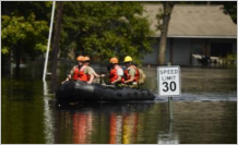
 Hurricane Harvey overwhelmed authorities trying to find shelter for the 300,000 victims seeking dry ground during that storm’s record rainfall in August and September 2017.
A new Learn ArcGIS lesson, Find Potential Hurricane Shelters, could help authorities avoid the human toll of future storms like Harvey by identifying shelters before hurricanes can make landfall.
In this 40-minute lesson, you’ll use ArcGIS Business Analyst Web App to compare locations of potential shelters in the greater Houston area with FEMA’s 100-year-flood-plain map. You’ll remove the shelters within the flood zones and then run a suitability analysis ranking each potential shelter on its ability to serve vulnerable populations, such as those over 65 years.
About the author

Article Discussion: