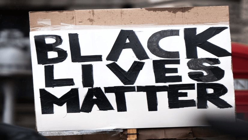
During the week of July 13th, 2020, Esri held it’s first-ever virtual User Conference (UC), and it all took place during a national call for racial equity and justice. Going virtual enabled over 85,000 people to attend the UC and exchange ideas around addressing some of the world’s toughest challenges. This conference brought together a diverse community of geospatial professionals worldwide in the wake of extrajudicial killings of unarmed Black people and a pandemic that exposed long-standing racial inequities. Attendees and speakers addressed these issues through a variety of dedicated events and activities. At these events, Esri users convened to recognize the role that race and place play in peoples’ opportunities to thrive and emphasize geospatial technology’s potential to expose and dismantle unjust systems and build a more equitable and inclusive society.
Prior to the conference, we shared an ArcGIS Blog post announcing the content related to Diversity, Equity, Inclusion & Racial Justice at the Esri User Conference 2020. This blog post is a summary of those events and a call to action to our geospatial community to stay engaged and bring your talents to bear to address these issues.
“I want to thank Esri, and its sponsors, who made User Conference 2020 available virtually this year. I am sure that I am just one of many who was able to finally attend for the first time. One of many who previously dreamed of, planned to, or just wanted to, attend UC “one day”, but for some reason or another was unable to.
Read below for a recap of these events & activities, including:
- The Homecoming (Presented by NorthStar & Blacks in GIS)
- Special Interest Group (SIG) Meetings
- User Presentations focused on Equity & Social Justice
- Equity & Social Justice Map Group in the Map Gallery
*Note: readers must have been registered for the UC to visit the UC conference platform links referenced in this article.
Homecoming at the UC (Presented by NorthStar & Blacks in GIS)
This week-long virtual gathering of GIS professionals of African descent began Sunday, July 12, and concluded on Thursday, July 16 at an Esri UC special interest group (SIG) meeting (see below in the SIG section for more on this special event). Throughout the week, guests enjoyed the following events and activities:
- Panelist discussions on topics such as equity in the COVID-19 response
- Esri UC 2020 Plenary watch parties
- Video introductions of various GIS professionals and their work
- Virtual social hours complete with a DJ, trivia and other games
- An educational activity that empowered users, young and wise, to use GIS to address racial equity
You can view the recordings of the sessions on the NorthStar YouTube channel. The Homecoming @ the Esri UC 2020 could not have been hosted without the sponsorship of the following:
- NorthStar
- Blacks in GIS
- SpatialGIS
- The C3 Initiative
- GeoTechVision
- HERE Technologies Unity and Power
To learn more about this event and its featured panelists, see this page: https://gisnorthstar.org/blacks-in-gis-homecoming

Special Interest Group (SIG) Meetings

I especially want to let you know I appreciated the Equity and Social Justice SIGs. This is no coincidence. You have been brought together “For Such a Time as This”
Racial Equity & Social Justice [recording here]
In this Special Interest Group meeting, over 1,100 people gathered to hear how 3 organizations from the government & nonprofit sectors approach racial equity and social justice work and the role that GIS plays in advancing each of their missions. Attendees heard from Deirdre Johnson Burel and Amanda Otter (Otter:Create) representing the W.K. Kellogg Foundation, Julian Ware & Jacque Larrainzar representing the City of Oakland, and Rae Johnson, Zachary Swingen, and Dr. Ben Weston representing Milwaukee County.
Deirdre and Amanda shared how racial equity is not just something the W.K. Kellogg Foundation funds— but rather how it is part of their DNA. They shared their focus on systems transformation and racial healing to achieve racial equity, their holistic approach to racial equity, and the importance of community engagement and making long-term, generational commitments to the communities they work within. Julian & Jacque shared the City of Oakland‘s long history of activism and their commitment to “reshaping the narrative” by making sure community voices are represented in day to day city operations & planning. They defined terms such as institutional and structural racism, and described how GIS is inherent in their analysis and equitable decision making processes across all departments of city government. Finally, Rae, Zac, and Ben outlined Milwaukee County‘s journey toward achieving racial equity, from declaring racism a public health crisis in 2019, to rolling out racial equity training to every county employee, to putting their commitment to the test during the COVID-19 pandemic once it became clear that the county’s Black and Latinx residents were disproportionately affected. They stressed the role of geography in their ability to understand who was affected, where they lived, communicate information to the public, and most importantly, to deploy resources to better support community members.

GIS for Equity & Social Justice [recording here]
In this Special Interest Group meeting, over 850 people gathered to hear GIS users from the government, nonprofit, and education sectors who are leading equity and social justice efforts speak about their work, their values, and their calls to action for the GIS community. In their pláticas, Sophia Garcia, Nicole Franklin, and Verónica Vélez centered community engagement and listening.
Verónica quoted Du Bois in sharing her maps of geographic color lines in LA and went on to say “what policies, what historical conditions lead to this? This is not the fault of individuals living within them…” Sophia, on her work with the community at the Dolores Huerta Foundation, said “if you’re in the GIS profession you hold privilege. What does that mean when you work with communities?” And followed up, “it’s time to listen and to meaningfully engage with our communities.” Nicole described the “ability to thrive indicator” as “the difference between the top 20% and the bottom 20%” and said the “gap in relative equality is bad for the community overall.” Nicole’s call to action: “make it so that race and place don’t matter in determining people’s ability to thrive.”

THANK YOU to these activists for inspiring us and calling us to what we need to do. I’m really moved and want to make a difference. Thank you all for reminding us of our positions of power and privilege--and for giving us the language and places for action.
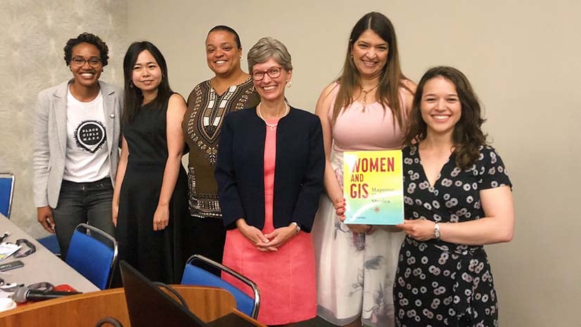
Women and GIS [recording here]
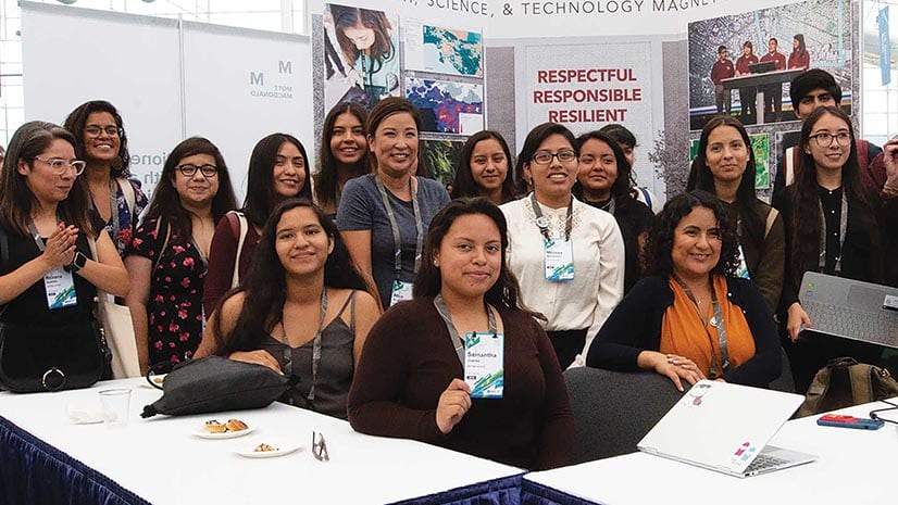
On July 16th, over 1,250 women and their allies from across the globe came together to learn about a few of the many organizations and initiatives that exist to support and advocate for women in the geospatial industry. The organizations featured included: Black Girls MAPP, Women in GIS, Women in Geospatial+, African Women in GIS, and Women in GIS Kenya. Attendees also heard from Esri Press about their book series highlighting women’s contributions to GIS. This session was facilitated by Esri’s Women’s Enablement & Career Advancement Network (WeCan), whose mission is to enable women of all backgrounds at Esri to achieve their goals and build strong careers. A full summary of the organizations and resources shared is available on the Women and GIS SIG Story Map.

The SIG was packed with information and wonderful stories of empowering women in geospatial technologies across the globe. I look forward to more engagement in this community!
Homecoming (Blacks in GIS)
Over 400 attendees attended this Special Interest Group (SIG) meeting – the capstone to the week-long Homecoming event, dedicated to bringing together professionals of African descent in GIS. The meeting opened with a special video from Jack who expressed his delight in and appreciation for the Homecoming events that took place during the Esri UC and emphasized the importance of leveraging GIS to advance the work of racial equity. Jack’s thoughts were immediately followed by a thoughtful panel discussion on racial equity and its impact on education and the COVID-19 response.
The panel showcased diverse works and expertise from among the following Black GIS professionals:
- Dr. Dawn Wright, Ph.D., Chief Scientist, Esri
- Donta White, Sr. Traffic Quality Specialist, HERE
- Christine Wacta, D.P.L., Ph.D., Architecture/Urban Design
- Christine Wacta, D.P.L., Ph.D., Architecture/Urban Design
- Clinton Johnson, Esri Racial Equity Team Lead
- Tiffany Cousins, GIS and Research Analyst, New York State Governor’s Office of Storm Recovery
- Jamal Watkins, Vice President of Civic Engagement, NAACP
- Dr. Celeste Chavis, Associate Professor, Morgan State University
- Valrie Grant, Msc, GISP, Executive Chairman, GeoTechVision
- Karimata Bah, Program Associate, Child Well-being
Panelists were moderated by Kendrick Faison, CEO at SpatialGIS and sponsor of the Homecoming (Blacks in GIS) SIG, and Sheree Baugh, Marketing Specialist at Esri.

User Presentations
This year, the UC had nearly 30 user presentations from across industries and around the world sharing stories of how they have leveraged GIS to advance equity and social and racial justice. The presenters included Esri users from local governments, research institutions, universities, state government, tribal government, nonprofits, health departments, global organizations, banks, news media organizations, and community advocacy organizations. The presentations covered topics ranging from promoting GIS for equity and social justice best practices, equitable access to green infrastructure, how to create an equity index to guide local government decision making, affordable housing, racial justice in K-12 education, mapping historic redlining and displacement, environmental justice, banking deserts, alleviating student homelessness, mapping tribal resources, health equity and social determinants of health, systemic racism, access to reproductive services, gender equity in COVID-19, accessibility in the outdoors, global efforts to eliminate poverty, and more. These presentations represent just some of the many ways GIS is being used around the globe to advance equity and social justice across all domains of society. The full list of presentations is listed in the previous blog post on Diversity, Equity, Inclusion & Racial Justice at the UC, and can be accessed in the On-Demand Presentations section of the user conference platform for registered attendees of the conference.
Equity & Social Justice Group in the Map Gallery
This year, the Map Gallery had a special category to tag maps that focused on equity and social justice. Users could filter by this category to find nearly 50 maps, Story Maps, Apps, and Dashboards devoted to this topic. Submitted from around the globe, these maps showcased how GIS being used to map and influence everything from racial inequities during COVID-19, equitable disaster response, the planned destruction of Black communities, equitable access to parks, equitable transportation planning, community displacement risk, racial disparities in maternal mortality, the life of workers rights icon Dolores Huerta, police force representation of the Black communities they serve, racial residential segregation, fair redistricting, and more. This was the first time Esri had a special category for this content, and many users expressed how inspiring it was to see the scope and breadth of GIS users doing social justice work around the world.
See you next year! Until then, stay engaged.
While this year was certainly different than Esri’s past conferences, the virtual format enabled people to come together and engage with each other in new ways to address the most important issues affecting our society. The engagement at the activities and events dedicated to diversity, equity, inclusion & racial justice demonstrated the strong solidarity and recognition across the global geospatial community of the need to bring the full power of geospatial technology to bear in the fight against racial inequity and injustice in all its forms.
Whether in person or online, next year we look forward to seeing what Esri’s brilliant and dedicated user community achieves toward advancing equity and racial justice. Between now and then, we encourage our users to stay connected to the following groups and resources:
- GIS for Equity & Social Justice group on GeoNet
- Social Justice Track at URISA GIS-Pro Virtual Conference
- Social Justice Track at Applied Geography Conference
- Esri GIS for Racial Equity overview
- Racial Equity GIS Resource Hub
- Stay connected to community groups & initiatives such as NorthStar, Blacks in GIS, Black Girls MAPP, WeCan, Spatial Commons, Women in GIS, Women in Geospatial+, African Women in GIS, Women in GIS Kenya, and EDGE (Ethnically Diverse Geospatial Engagement)


Article Discussion: