By Aileen Buckley, Mapping Center Lead

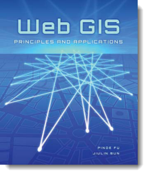
Esri Press has just released a new book called Web GIS: Principles and Applications written by Pinde Fu and Juilin Sun. This is a resource for GIS technicians and managers who want to learn state-of-the-art concepts, architectures, techniques, and applications of Web GIS. Written for an audience with a basic and/or working knowledge of GIS, it is also appropriate for college students and Web developers who may not have extensive experience with GIS.
Description
The Web has revealed the immense value and broad applicability of GIS, set the bar for today’s user expectations, and introduced flexible architectures for use with modern IT infrastructure. From basic architecture to new frontiers, Web GIS: Principles and Applications presents a thorough overview of the origins and developments of this emerging platform. New Web technologies addressed include ArcGIS Server, REST services, JavaScript API/Flex API, and ArcGIS Mobile. This book offers a balance of principles, concepts, and techniques to provide you with an understanding of how Web GIS can revolutionize the way your GIS functions.
Table of Contents
- Chapter 1 – GIS of the Internet era
- Chapter 2 – Technical basics
- Chapter 3 – Geospatial Web services basics
- Chapter 4 – Geospatial mashup
- Chapter 5 – Mobile GIS
- Chapter 6 – Geoportals
- Chapter 7 – Web service applications
- Chapter 8 – Web GIS applications in e-commerce
- Chapter 9 – Web GIS applications in e-government
- Chapter 10 – Web GIS trends and frontiers
About the authors
Pinde Fu is a senior GIS application developer and project lead at Esri. He earned his PhD in GIS from the University of Kansas in Lawrence. Fu is a member of the Association of Chinese Professionals in Geographic Information Systems. In 2008, he was named honorary director of the ArcGIS Education and Application Research Center at Henan University in China.
Jiulin Sun is academician of the Chinese Academy of Engineering. He has authored and coauthored four books on GIS. In addition, Sun is chairman of the Scientific Advisory Committee of the State Key Lab of Resources and Environmental Information Systems in China, as well as the Scientific Database and Information Engineering Science Committee of the Chinese Academy of Sciences.
Ordering Options
- Online: www.esri.com/esripress
- Phone: 1-800-447-9778
- Email: service@esri.com
- FAX: 909-793-4801

Article Discussion: