In case you missed it, December saw the release of two new law enforcement solutions to help your agency share information with the public and enable community members to create their own crime analysis reports.
As with all our ArcGIS solutions, these are free to download and will help you enhance public awareness about crime and criminal activity in people’s neighborhoods, district, or community.
Public Crime Map
The first application creates a public crime map that can be used by citizens to view recent crime activity in and around a given location.
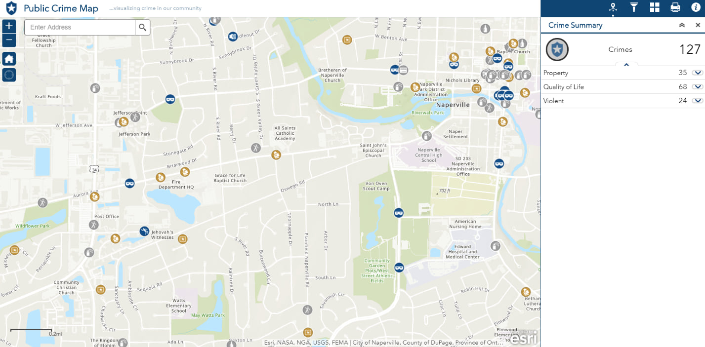
This solution is a configuration of Web AppBuilder for ArcGIS and can be used to search for crime by type, date, or time of incident. This application can help people understand crime patterns in the community, and it provides a proactive way to engage the public in your agency’s overall crime reduction strategies.
You can create a public crime map with either ArcMap or ArcGIS Pro and an ArcGIS Online subscription. To deploy the Public Crime Map app using the ArcGIS Solutions Deployment tool, you will need ArcGIS Pro 1.3 or later. This tool will help you install, deploy, configure, and load the data through an easy-to-use, automated series of tasks that require little configuration. If you don’t have ArcGIS Pro, you can still deploy the tool from ArcMap manually by configuring and publishing your data to your ArcGIS Online organizational account.
The Public Crime Map app can be deployed in your ArcGIS Online organizational account without even downloading the solution. When you deploy it, you will find the following:
| Item | Name | Description |
| Application | Public Crime Map | An application used by the general public to view recent crime activity in and around a given location |
| Map | Public Crime Map | A map used in the Public Crime Map application to view recent crime activity in and around a given location |
| Feature layers | Crimes | A feature layer that stores actions or omissions that constitute an offense that may be prosecuted by a government agency and is punishable by law |
| Crimes_public | A public feature layer view of actions or omissions that constitute an offense that may be prosecuted by a government agency and is punishable by law |
View the Public Crime Map application.
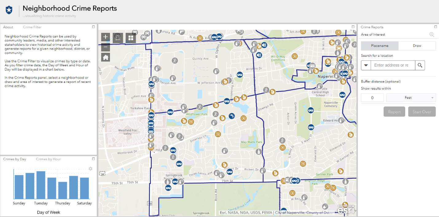
Neighborhood Crime Reports
This configuration of Web AppBuilder can be used by citizens to view historical crime activity and generate reports for a given neighborhood, district, or community, helping law enforcement agencies engage neighborhood groups, satisfy media requests, and help other stakeholders monitor and understand crime problems affecting the community over time.
ArcMap or ArcGIS Pro can be used to configure the Neighborhood Crime Reports feature layer, which can then be shared via your ArcGIS Online organizational account. As with the Public Crime Map application, to use the ArcGIS Solutions Deployment tool with Neighborhood Crime Reports, you will need ArcGIS Pro 1.3 or later.
When you deploy Neighborhood Crime Reports in your ArcGIS Online organizational account, you will get the following:
| Item | Name | Description |
| Application | Neighborhood Crime Reports | An application used by community leaders to view historical crime activity and generate reports for a given neighborhood, district, or community |
| Map | Neighborhood Crime Reports | A map used in the Neighborhood Crime Reports application to view historical crime activity and generate reports for a given neighborhood, district, or community |
| Feature layers | Crimes | A feature layer used to store actions or omissions that constitute an offense that may be prosecuted by a government agency and is punishable by law |
| Crimes_public | A public feature layer view of actions or omissions that constitute an offense that may be prosecuted by a government agency and is punishable by law | |
| PublicSafetyDistricts | A feature layer used to store the administrative and response districts maintained by emergency medical services, fire, and law enforcement agencies | |
| PublicSafetyDistricts_public | A public feature layer view of administrative and response districts maintained by emergency medical services, fire, and law enforcement agencies |
View Neighborhood Crime Reports.
To learn more about these solutions, join us for the next edition of the Esri Law Enforcement Webinar Series
Would you like to be contacted by an Esri Public Safety Representative? Contact us: publicsafetyinfo@esri.com

Commenting is not enabled for this article.