Enterprise Fleet Management Overview
Site Scan Manager’s enterprise fleet management system enables drone program managers to interact with detailed flight and asset data captured automatically from the Site Scan Flight app. Fleet management has histograms to view flight frequency, maps to view flight locations, and tables of attribute information to reach a deeper understanding of the organization’s drone activities and assets.
What’s new in this release?
There are three exciting changes to fleet management that are included in all Site Scan subscriptions:
- Expanded access to fleet management data via a new Fleet Permission
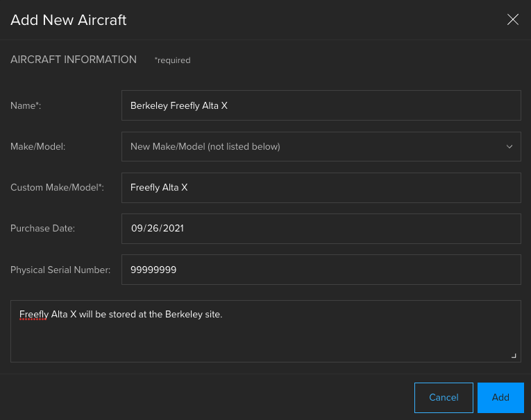
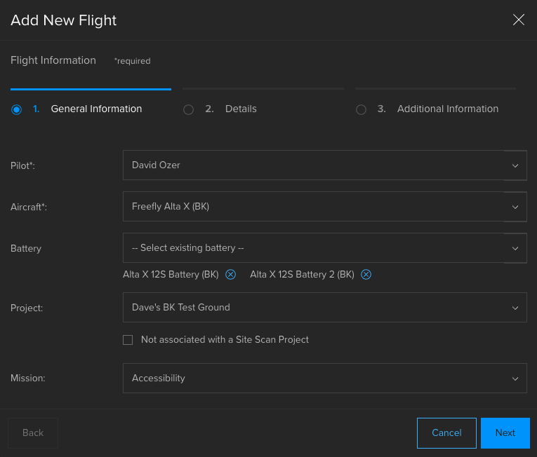
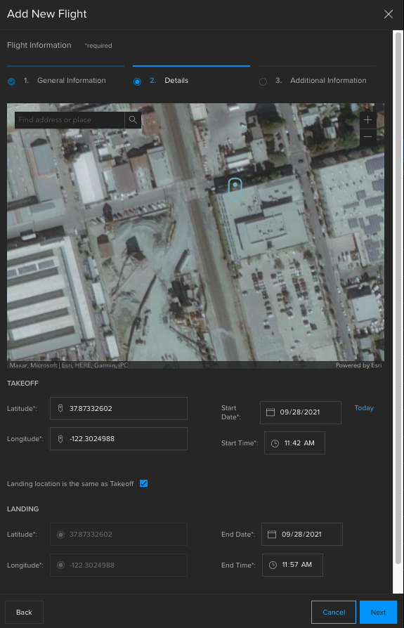
- Adding external flights, aircraft, and batteries
- Pilot Profile enhancements
Fleet Permission
Site Scan now offers a user permission called the Fleet Permission, which determines fleet management access. Organization administrators can set users’ Fleet Permission level on the Team Members page. The Fleet Permission has three levels:
- Fleet Manager (all Org Admins and available to Full-Access users): This is the highest Fleet Permission level. In addition to an organization-wide dashboard, they can view and edit their own activities as well as activities of others. Fleet Managers are the only ones who can manually add new aircraft and batteries.
- Fleet User (available to Full-Access and Read-Only users): This is the secondary Fleet Permission level. These users have a fleet management experience that is specific to their own activities. They can edit their own pilot profile, add new flights for themselves, and view all aircraft and battery assets in the organization. However, they cannot view profiles of other pilots or activity details that are not their own.
- None (available to Full-Access and Read-Only users): Users who are assigned a Fleet Permission level of None cannot access fleet management.
How to assign Fleet Permissions
Site Scan automatically assigns all Organization Admins a Fleet Manager permission which cannot be changed. By default, Full-Access users with an Operator license receive a Fleet User permission, and Full-Access users without an Operator license and all Read-Only users receive a Fleet Permission of None. Organization Admins may edit users’ Fleet Permission at any time in the Team Members page.
With these new permissions, pilots who are non-Admins can access to their own pilot information and flight history, expanding the value of fleet management across your organization.
Adding external flights, aircraft, and batteries

The Site Scan Flight app transfers all flights flown and aircraft and batteries used to fleet management. This automatic process is extremely valuable to confidently track flights and drone assets. However, it does not necessarily capture all drone activity in every organization.
Some organizations have pilots who fly drones outside of the Flight app for various reasons. The Site Scan Flight app does not support certain drone models, for example, the DJI Mavic Mini, Wingtra WingtraOne or Freefly Alta X. Furthermore, drone pilots in your organization may not fly drones for mapping; rather, they may fly for marketing or other purposes. Flight data might be collected in disparate systems, such as excel spreadsheets, or not collected at all. As a result, drone program managers may have challenges making sure that pilots are following safety protocols. If aircraft have registration information stored in Site Scan, where is this stored for aircraft that are not flown with the Flight app? Ultimately, without a single source of truth, this data is inefficient to review and possibly unreliable.
Now, you can add all drone assets and their flights to Site Scan’s fleet management. Drone pilots who use other flight applications can add their flights as a Fleet User. They do not need a Site Scan Operator license, and they can even be a Read-Only member. Therefore, you don’t need more licensing for these pilots to contribute flight data. Finally, Fleet Managers and Fleet Users can view all aircraft data, including uploaded documents like registrations, even for aircraft that the Flight app does not support.
The ability to add flights, aircraft, and batteries offers greater flexibility in fleet management. Any organization can tune it to their needs and use it as a single repository, regardless of where and how drone flights are conducted.


Pilot Profile enhancements
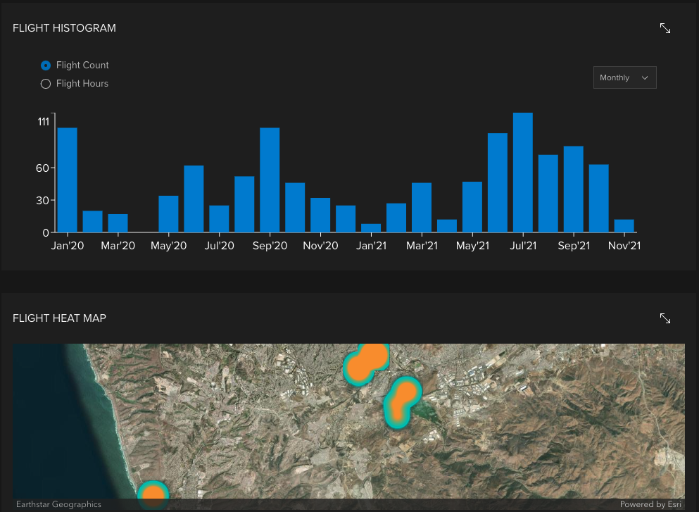
The Pilot Profile contains important summary information about pilots such as flight hours logged and pilot documents. A flight frequency histogram and flight heat map are now available on the Pilot Profile, which provide information about how often and where a pilot has flown.
Furthermore, you can filter this activity over different time periods and intervals. To modify the time period, use the drop down in the upper right corner of the profile. You can specify different time intervals on the histogram depending on the time period you choose. The histogram, heat map, and flights/flight hours statistics will change based on the time period you select.

Stay tuned for additional enhancements to fleet management over the coming months!

Article Discussion: