Autumn has arrived and so has the latest version of Urban. Get yourself comfortable, sip on a pumpkin spice latte and learn about new capabilities like 3D mesh basemaps, BIM data integration, parcel exploration, integration with community user names, and sped-up large-scale planning that are now available with the latest version of Urban. We are also excited to announce the beta release of the Urban API.
Support for 3D meshes
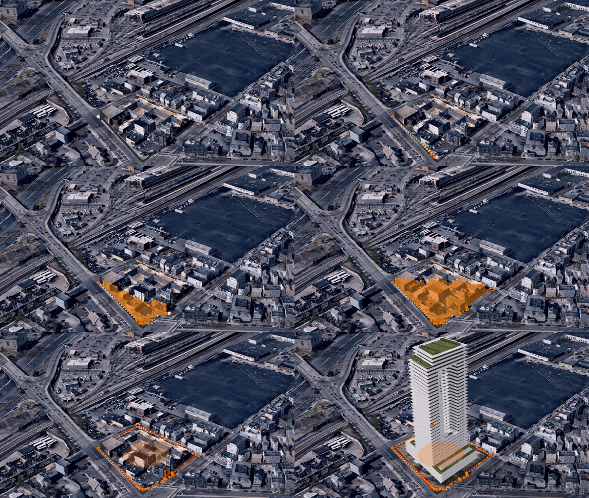
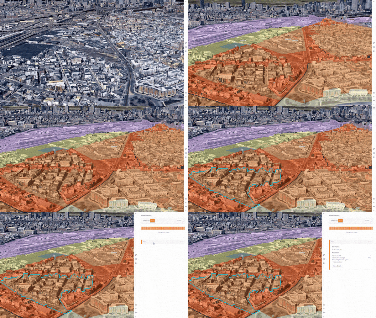
Bring real-world context to your digital twin in ArcGIS Urban by configuring your 3D mesh as the existing buildings layer for satellite visualization. Accessing this new realism has never been easier and now within Urban, you can demolish existing buildings from the 3D mesh just like you demolish schematic buildings. Urban can also utilize the existing parcel or study area to make these modifications to the mesh, allowing new buildings to be applied across different scenarios. You can easily switch between the two basemaps options both the satellite and the schematic basemap, depending on the situation.
Enhance your projects with BIM
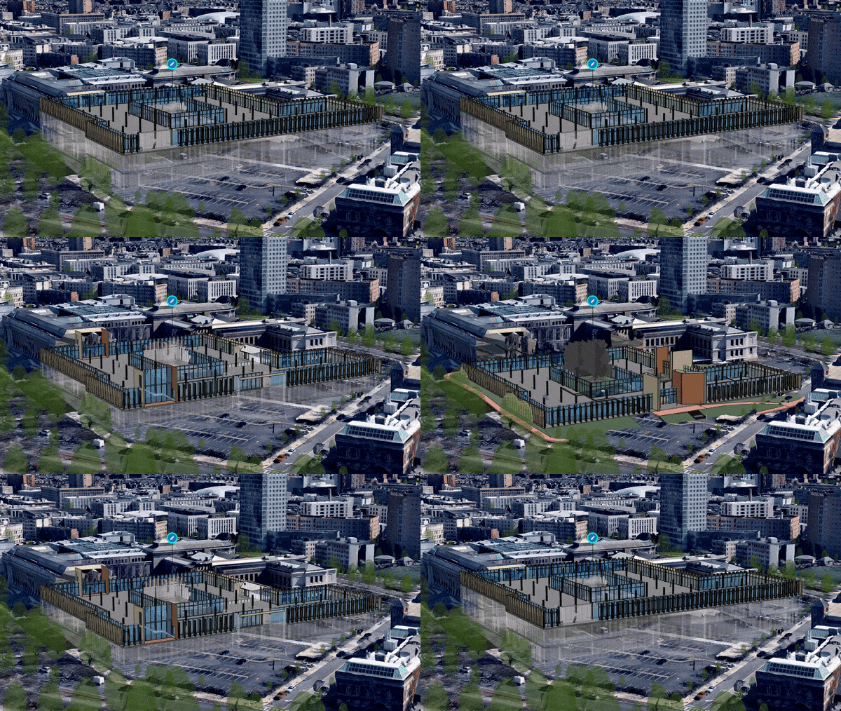
Esri launched the Building Scene Layer as a result of the ongoing partnership with Autodesk and the continued digital transformation of the architecture and construction industries towards the use of Building Information Modeling (BIM). You can publish BIM data and consume this building model directly in ArcGIS Urban as a Project scenario. In Urban, you can explore the different construction phases of your building, filter your BIM data by disciplines and categories, and have a detailed look at the building one floor at a time. You can represent a partial building, an individual building, or even multiple buildings across an entire campus.
Extending ArcGIS Urban with the Urban API
The Urban API has officially been promoted from its private beta state and is now released as a public beta. It provides an interface for developers between Urban’s capabilities and third-party applications (such as permitting systems). You can use the new Urban API for example as part of an ArcGIS Pro toolbox written in Python to create and update Plans, Projects, and Indicators as well as to conduct further analysis on the generated plausible buildings, and much more. Check out the ArcGIS Urban API documentation for further details.
Search parcels city-wide and explore zoning potential
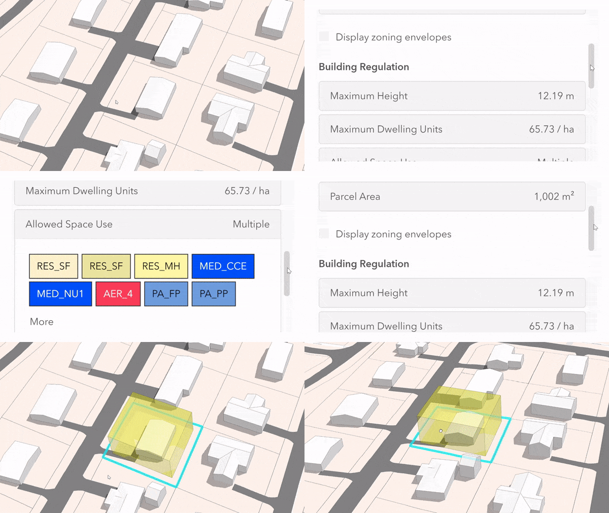
Parcel level zoning information is key to understand what can be built. With the new parcel exploration capability, you can click on any parcel and see the zoned development capacity, setbacks, lot attributes, and more. This information is directly retrievable from the overview of ArcGIS Urban and can be made available to the general public. You can search by address to locate and select parcels of interest or by the active project. From there you can directly create a new Plan or Project with a study area corresponding to the selected parcels. This means you can visualize, test, and report on changes to existing zoning in a matter of minutes.
Engage the public through Hub Premium
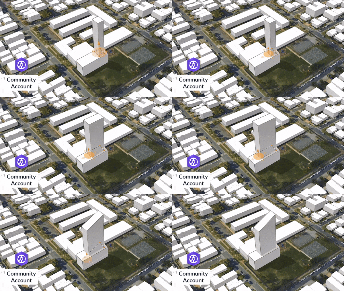
This release has added something special. Support for ArcGIS Hub Premium and the community user name capability which enables anyone outside of your organization, such as citizens, developers, and architects, to create a new Project and start building different development scenarios. Check out this video to learn how community user names are useful for the project design process. For existing ArcGIS Hub Premium customers who have already enabled community users, you can get started right away by making your Urban Model public and sharing it with your citizens. The community sign-up process for new community users is smoothly integrated into ArcGIS Urban. Both Hub and Urban are extensions to ArcGIS Online, so if you don’t yet have community user names, it’s easy to get started. Do you want to learn more about Hub Premium? Continue reading here.
Large-scale planning
As Plans get larger and more complex, we realize the need to make sure your time is used as efficiently as possible when working with Urban. That’s why we sped up certain operations under the hood to make Urban faster and reduce loading times when you are generating large study areas, making complex duplicate scenarios and generally making awesomely detailed Plans. You will feel these improvements when authoring Plans and when initially importing layers into your Urban Model through the data manager.
Learn more
This is just a selection of the new features shipped with the 2020 Q4 release of ArcGIS Urban. On top of these features, you can now validate your Zoning Plan scenario against any Land Use Plan scenario that spatially intersects with your Zoning Plan, and we made the UI for submitting Public Feedback more intuitive. Check out our release notes to make sure that you don’t miss any new features, improvements, and bugfixes.
Want to see these new features live in ArcGIS Urban? Please feel free to schedule a demo with our team or play around with it yourself in a trial version.
And last but not least, we are also excited to announce a special offering together with our partner Nearmap for Urban customers who are interested in acquiring their own 3D mesh basemap. This can provide you access to 6-inch (15cm) high-resolution 3D mesh, annual updates (and sub-annual for many larger metro regions), seamless delivery through Scene Layer Packages (SLPKs) in the I3S format, and the opportunity to make your 3D mesh basemap publicly visible for sharing your projects within Urban. Here you can learn more about the offer.

Article Discussion: