Code example for this blog is written in C# using ArcGIS Maps SDK for .NET but all the concepts apply to Java, Kotlin, Qt, and Swift.
The ArcGIS Utility Network is used by various kinds of utilities in a diverse set of mobile workflows and these capabilities are supported by the ArcGIS Maps SDKs for Native Apps (formerly known as ArcGIS Runtime SDKs). The functionality available through these APIs continue to improve with each release, and we’re excited to announce with the 200.1 release of the Native Maps SDKs that we now support all industries and domains as well as a broader set of workflows.
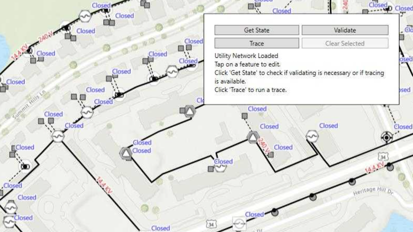
Our active pursuit toward supporting utility networks in a partially or fully disconnected environments should be evident in this blog series. Functionalities that were once only accessible in service-based utility networks become progressively available offline. In part 1, we introduced offline tracing in stand-alone mobile geodatabases which can be sideloaded onto the device. Then in part 2, we shared how the installation of ArcGIS 11.1 Server patches make offline tracing available for utility networks in read-only mobile geodatabases. An internet connection is only required while downloading the sync-enabled mobile geodatabase. These geodatabase-based utility networks can be traced even when internet connectivity becomes unavailable.
In this part of the series, we will go over the following offline tracing additions:
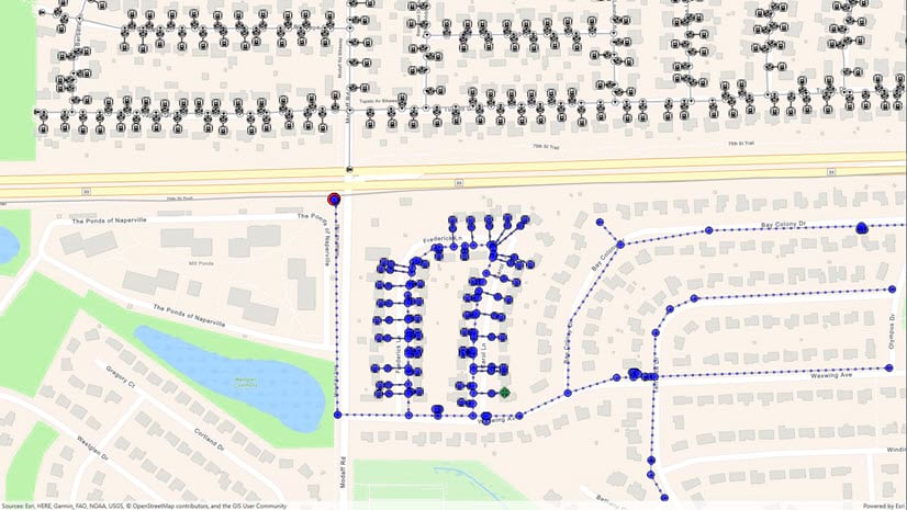
Aggregated geometry trace results allow you to efficiently visualize large result sets because they don’t require processing and displaying individual elements for each network feature. Geometry results can also provide more accurate information by returning only the relevant portions of an edge feature. For example, an upstream trace from a distribution transformer using geometry results would only return the portion of the medium-voltage line that is truly upstream from the transformer. See the geometry results section in the developer’s guide for code examples that display trace results as graphics.
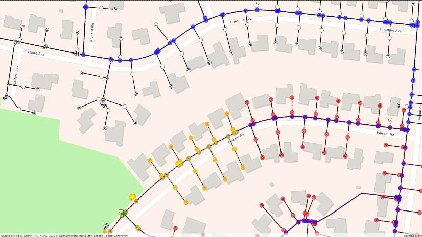
Isolation traces allow you to identify and respond to the impact of an equipment failure in a network area. For gas and water utilities, this may be finding the minimum set of operable features required to isolate a leak. For electric utilities, this may be identifying the residential customers impacted by an electrical fault. Download the perform valve isolation trace sample to see how trace locations, trace filters, and the isolation trace type are used to accomplish these workflows.
Hierarchical tiers are used by gas and water utilities because they allow a single feature to belong to multiple subnetworks. As an example, a water main will belong to a water distribution system, a local pressure zone, an isolation zone, and potentially even a cathodic protection system. This is an important addition in this release as it means we now support all topology types for network analysis.. This means you can now create apps with the ability to assess the safe repair of damage resulting from a gas leak, water outage, or sewerage overflow. Read the trace configuration section to learn how to get a tier from a domain network and how they are used in subnetwork traces. Support for partitioned domain networks was added earlier this year and covered in the previous blog post.
The following table summarizes the supported functionalities for recent releases of the Native SDKs. Note that in 200.0, this support was limited to stand-alone mobile geodatabases. And in 200.1, this support includes sync-enabled mobile geodatabases generated with topology tables. Read part 2 of the series to learn how you can download and replace a mobile geodatabase with a traceable utility network.

As you can see, in this release of the ArcGIS Maps SDKs for Native Apps, we are closer to supporting the same tracing and analysis capabilities between ArcGIS Pro and mobile applications for the ArcGIS Utility Network. With every release, we continue to grow the list of supported features, allowing the applications you develop to support even more interesting workflows.
If you have any questions or want to let us know what cool apps you are developing, post in the ArcGIS Maps SDKs for Native Apps Esri Community. We hope that you will continue to watch for announcements in our developers section of the ArcGIS Blog and remain engaged in the Esri Community, for your feedback and contributions are truly valuable in helping us build the SDKs with you.


Commenting is not enabled for this article.