Overview
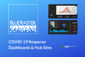
Blue Raster is ready to assist your organization with the rapid setup of Operations Dashboards and ArcGIS Hub pages for Coronavirus response efforts. Trained by Esri & FEMA on disaster response efforts, our team is experienced in quickly developing innovative and clear dashboards and sites that present crucial data in an easy-to-understand and consumable format, which allows for decision makers to view and assess current situations and guide informed decision making.
Operations Dashboards
- Rapid setup of dashboards tracking Coronavirus data
- Detailed and easy to consume data on Social Distancing efforts
- We can quickly configure and deploy dashboards for an organization's internal and external use. As a result, State and Local agencies can also use these dashboards as a collaboration tool to aid in decision making.
ArcGIS Hub
- Rapid deployment of key metrics and community information
- Communicate recovery initiatives for essential and non-essential businesses
- Keeping citizens informed and aware of response efforts and latest updates
We can also help you achieve rapid, cost-effective cloud solutions for server and application hosting.
If you are a federal, state or local government agency, we are on the GSA Schedule as well as many state contracts, like Maryland CATS+ and Pennsylvania Disaster Emergency Suppliers.
Interested in learning more? Contact us to learn more about our services.

Business needs
Contact provider for more information
Industries
- National Government
- Health and Human Services
- Public Safety
- State and Local Government
- Education
Works with
Contact provider for more information
Platform
Contact provider for more information
System Requirements
Contact us for details.
Version
2020
Listed Date
Apr 17, 2020
Contact Information
Blue Rasterhttps://www.blueraster.com/Email703-875-0911
