Skip to Content
Blue and red map of the city of Houston with white data points

Operational Intelligence

Advanced geospatial solutions to support defense, intelligence operations, and national security operations from headquarters to the tactical edge

Find the right solution
Color-coded map depicting diverse zones with yellow, dark orange, and green hues

Operationalize data and analytics for decision-making and actionable intelligence

Accelerate decision-making by fusing many different sources of information and turning them into actionable intelligence that is accessible to your enterprise. Grounded in geospatial intelligence, ArcGIS is the premier system for operational understanding, command and control, and decision support to ensure the delivery of timely and accurate information to increase mission success. Thousands of analysts across intelligence, defense, and public safety use ArcGIS to provide a comprehensive system for data fusion, analysis, and tactical response. 

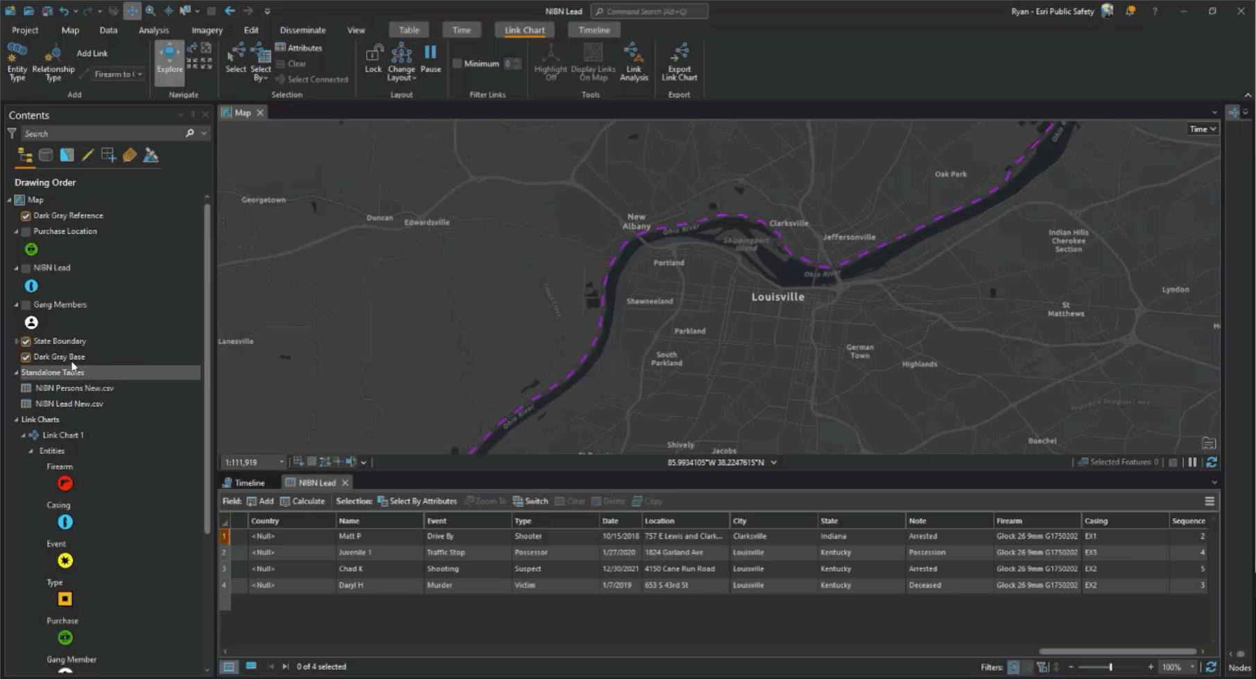
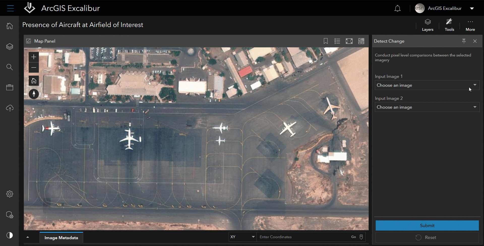
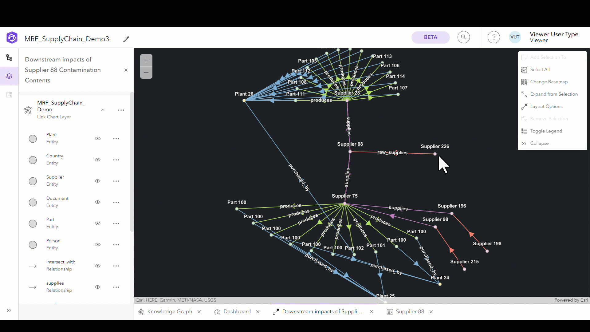
A comprehensive system for data fusion

Collect, integrate, and manage data from various sources to create a cohesive and comprehensive understanding of the operational environment.

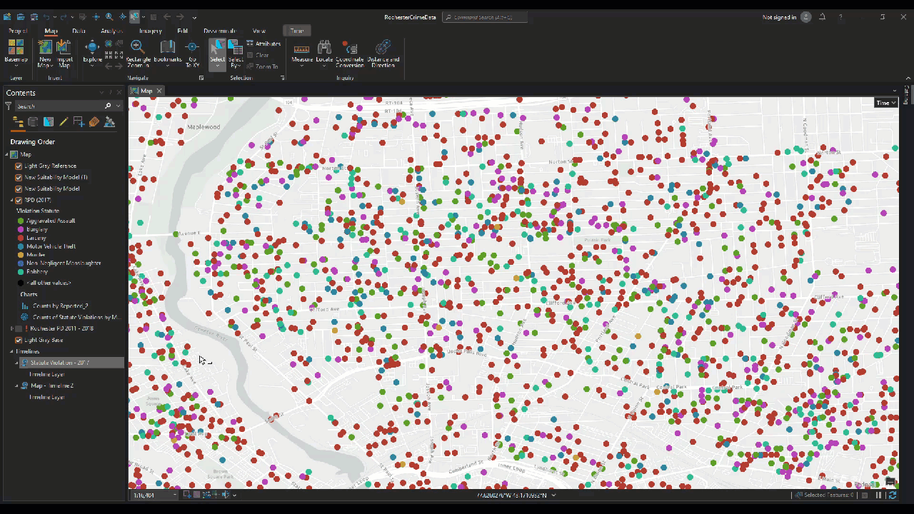
In-depth analysis and pattern recognition

Apply advanced analytical techniques to identify patterns and trends from the gathered data, enhancing situational awareness and decision-making.

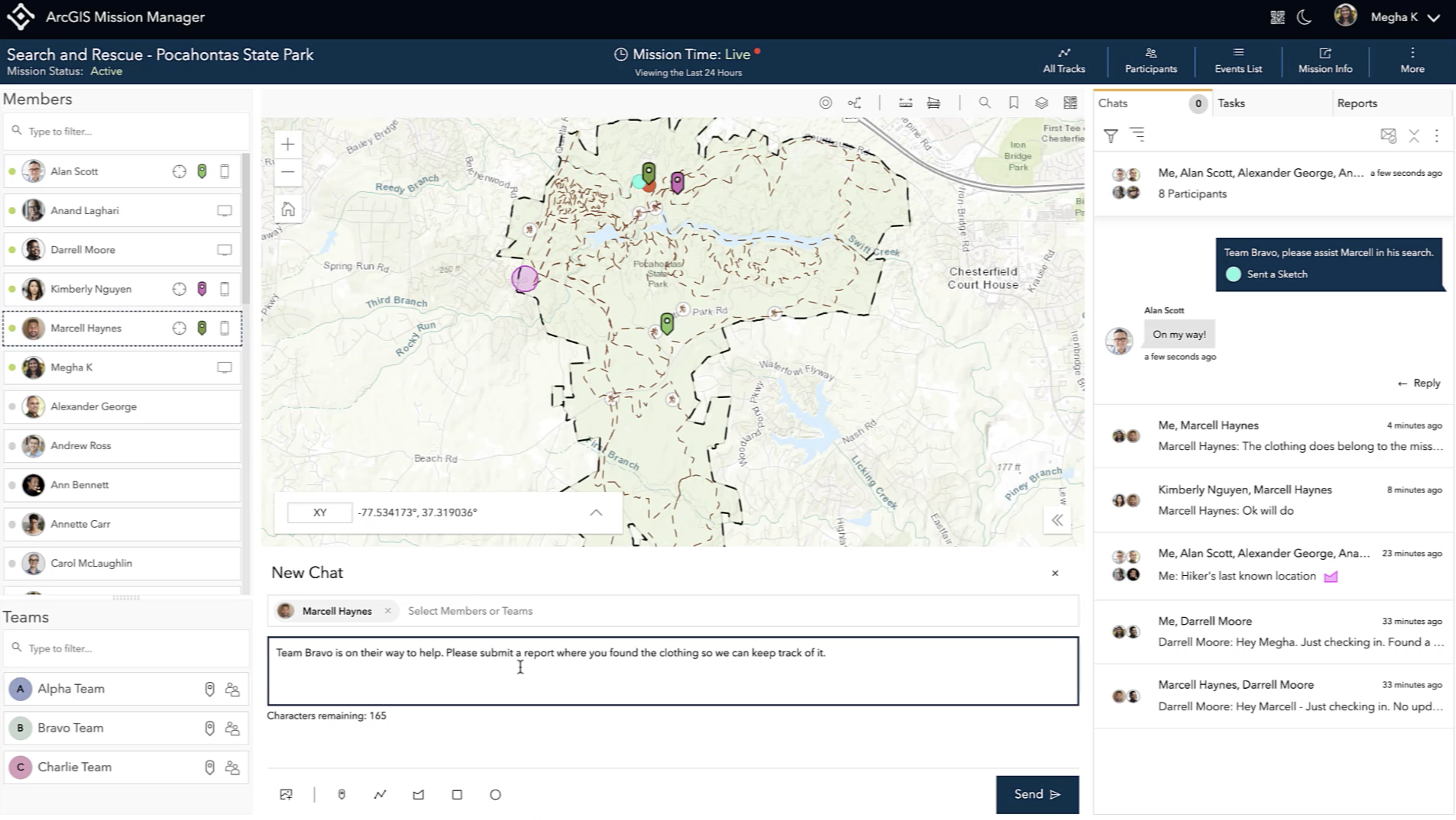
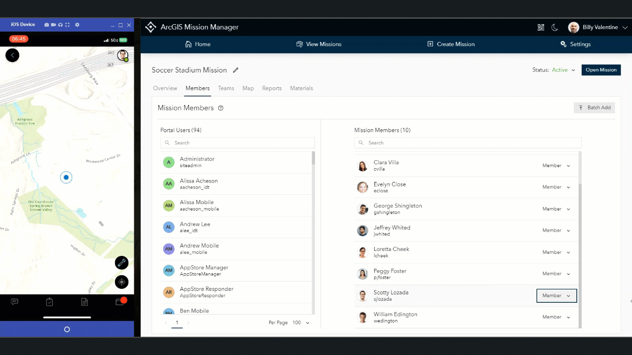
Tactical response and coordination

Implement well-informed operations while ensuring seamless coordination, communication, and resource optimization.

Close-up of military personnel in uniform working on a laptop computer
Animated GIF showing intelligence data within a map, featuring a moving target within a red box on a digital image of land

Gain an operational intelligence advantage through a geospatial lens

ArcGIS turns data into intelligence. It gives you the readiness to deploy personnel and assets in dynamic situations.

How can ArcGIS support your mission?

ArcGIS is an interoperable system built to support your data integration and technology modernization strategy. ArcGIS software can be used on a desktop, the web, or mobile devices with a flexible and agile configuration. Here are examples of how it supports each operational intelligence (OPINTEL) capability.

Synthesize all sources of information

Fuse and explore location and time-based data for actionable intelligence. Perform spatial, temporal, and relational data analysis to answer questions and forecast events for investigations and support security operations.

Gray map with white text and data points with additional text and multicolored icons on the left depicting intelligence data

Streamline tactical operations

Provide real-time situational awareness of an operating environment. Coordinate team movements with two-way updates via chats, tracks, tasks, and reporting. Perform after-action review to discover patterns and improve future operations with key mission data that is securely stored in ArcGIS.

A beige and light green map with icons to the left and a blank chat box below opened in ArcGIS Mission Manager

Transform video and imagery into intelligence

Extract information and track changes in imagery and video from drones, security cameras, sensors, and handheld devices to support inspections, investigations, strategic planning, and tactical response.

GIF showing movement of airplanes on an airport tarmac opened in ArcGIS Excalibur for enhanced air traffic monitoring

Realistic visualizations to enhance analysis

Plan, analyze, and build intelligent environments. Deliver the most photorealistic 3D experiences possible for real-time and simulated experiences. Extend capabilities to interoperate in a flexible and configurable system with ArcGIS Maps SDKs.

An immersive GIF showcasing 3D reality capture of a large commercial building and the surrounding green grass and roads

Powerful data integration

Get full data management control with ArcGIS Enterprise and ArcGIS Knowledge. Get fast and secure access to the data that powers your organization and scale as needed to bring in new information for additional insight.

A woman at a command center viewing multiple computer screens and moving the black mouse

Blog

Investigating a multistate criminal network

ArcGIS AllSource helps to uncover previously hidden connections between violent crimes in different states and jurisdictions.

Read the blog

Operational Intelligence Capabilities

Intelligence fusion and synthesis

Gather data from multiple sources such as tactical reports/crime data, intelligence reporting, sensor data (imagery, lidar, thermal, etc.), open-source intelligence, social media, and partner data. Integrate and fuse data with powerful data integration tools for strategic planning.

Multicolored dots representing data from multiple sources, with corresponding analysis below representing an analyzed map

Analysis and pattern recognition

Examine relationships, connections, and dependencies within a complex network to reveal underlying structures and patterns. Use machine learning algorithms and statistical techniques to forecast future trends, events, or outcomes based on historical data for tactical intelligence.

Lines connecting data points on a black digital map and white popup boxes with text representing a map GIF in ArcGIS

Coordination and tactical response

Facilitate instant information sharing and communication among team members, ensuring unified execution and rapid response. Strategically assign resources and personnel based on identified priorities to ensure maximum effectiveness and efficiency. Conduct targeted operations such as raids, arrests, or cyber defense measures based on the insights gleaned from data analysis and pattern recognition.

List of multicolored icons and black text in ArcGIS Mission Manager with an inset beige map representing communication views

ArcGIS delivers support across all industries

For years, mission-oriented organizations in private and public sectors have relied on ArcGIS to plan and execute their operations with a geographic approach. Learn about how each industry puts operational intelligence into action.

Previous
Next

Let us help you find the right solution

Schedule a conversation with one of our experienced sales consultants to discuss how our advanced geospatial solutions can support your mission.

Contact us

Outside the United States