
GIS fuels airport toward success
Discover how Reno-Tahoe International Airport leveraged GIS for the FAA Airport GIS program.
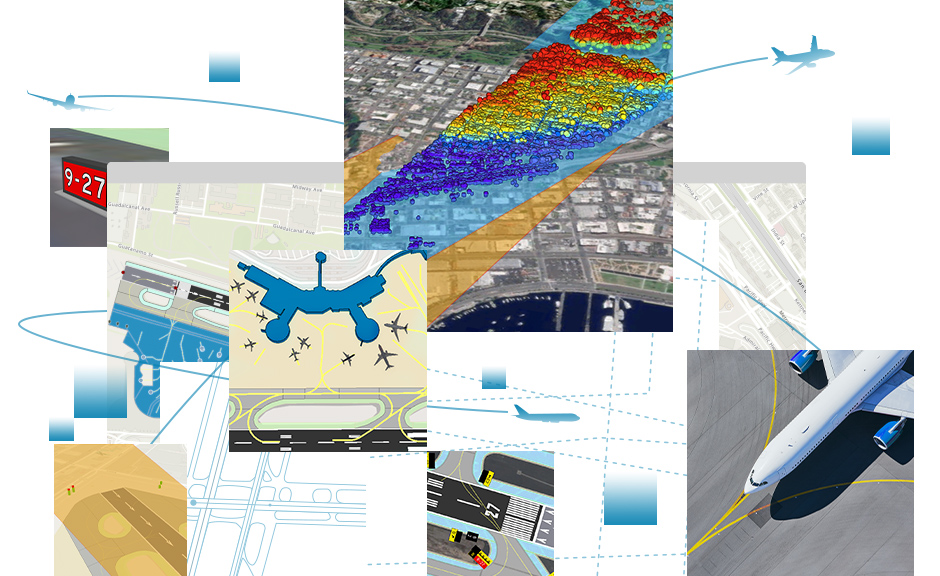
The foundation for your smart airport vision
An extension to ArcGIS Pro and ArcGIS Enterprise

Guarantee operational safety for the public, employees, and contractors by leveraging GIS for your airport operations and ensuring the airport airspace is free of potentially hazardous obstacles. Rely on accurate analysis to make critical decisions for airfield airspace management activities such as monitoring restricted zones.
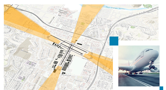

Use out-of-the-box tools to comply with US, international, and other regional/state regulations, including CFR Part 77; Federal Aviation Administration (FAA) 2C, 13A, and 18B; International Civil Aviation Organization (ICAO) Annex 4, 14, and 15; and ICAO EUR-DOC 15. Take advantage of preconfigured data checks developed from FAA 18B, Aerodrome Mapping Database (AMDB), and Electronic Terrain and Obstacle Data (eTOD) specifications.

Grow your organization strategically and sustainably with GIS, an enterprise information system that provides the foundation for the Smart Airports initiative and brings location intelligence to your operations. Communicate decisions, reduce conflicts, and improve customer experience with a common operating picture of your airfield.

Increase operational efficiency and drive better financial performance by extending the geodatabase to meet your current and future airport business requirements. Reduce production time from weeks to days by automating obstacle surface creation and obstacle analysis, data import/export, and data validation.

Deliver a framework for building and maintaining airport infrastructure datasets and integrating these assets with your GIS and other business systems for actionable insights and better decision-making. Integration with ArcGIS Enterprise and ArcGIS Online ensures access to correct information.
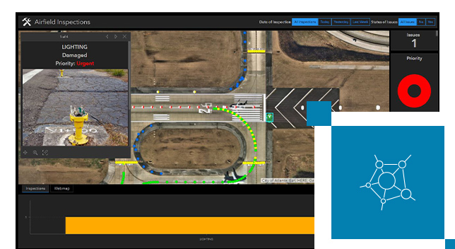
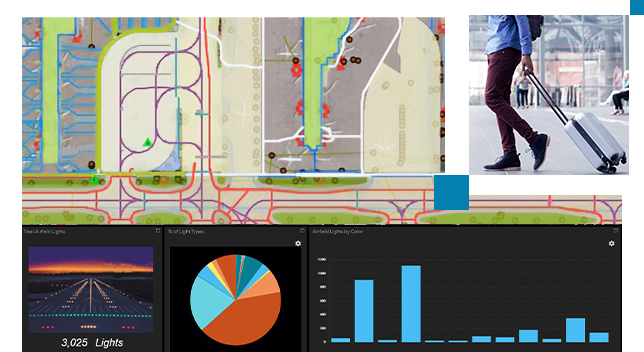
Use a consolidated database to map all critical and noncritical airfield infrastructure assets, including signs and markings. This fosters collaboration between airports and other agencies to analyze proposed construction projects that can impact airport airspace and protected airport surfaces.

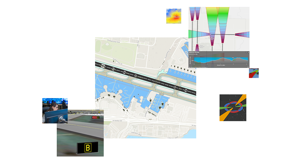
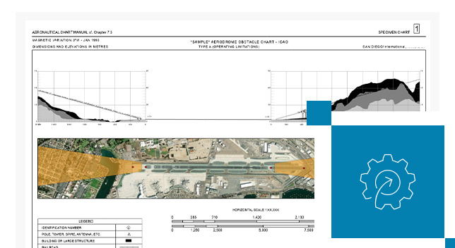
Map airfield infrastructure assets and create obstruction identification surfaces, obstacle charts, and signs/markings to specifications.
Support FAA and international standards such as RTCA, EUROCAE, and ICAO's Electronic Terrain and Obstacle Data requirements.
Efficiently manage obstacle collection and evaluation as well as airfield assets in a comprehensive database.
Visualize your airport assets such as signage and markings and your obstacle analysis results in two and three dimensions.
Improve decision-making and engage with stakeholders by leveraging ArcGIS to publish and share web services.
Establish a comprehensive system of record for airport information that forms the basis for business system integration, spatial analysis, and visualization in alignment with the airports' business objectives.
Combine Aviation Airports with other focused ArcGIS apps to streamline your airfield operations.
Power your location intelligence by organizing and sharing your work on any device from anywhere, at any time.
Create a consistent view of the airport by integrating different data types and formats.
Meet the charting and data management needs of the aviation community.
GIS fuels airport toward success

National aviation webinar series

Up-to-date aeronautical data ready in no time

FAA Advisory Circulars

ICAO announcements
Please share your information, and our sales team will contact you soon. We look forward to communicating with you.