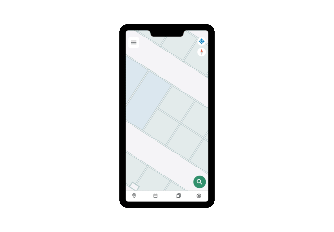
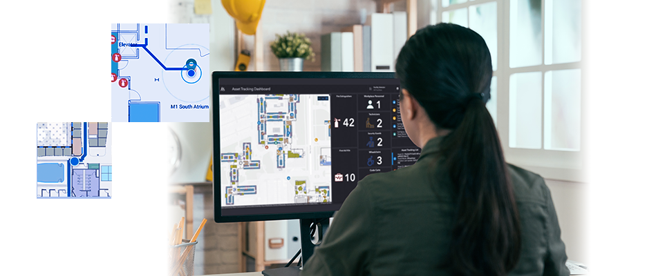
Skip to Content
,
ArcGIS IPS

ArcGIS IPS

Indoor positioning system and indoor tracking

Talk to an Esri representative

Bring the blue dot indoors

ArcGIS IPS is an indoor positioning system that allows you to locate yourself and others inside a building in real time. Similar to GPS, it puts a blue dot on indoor maps and uses location services to help you navigate to any point of interest or destination. Real-time indoor navigation, location sharing, and location tracking empower customers, visitors, and contractors. Indoor data collection provides a smooth workflow for mobile workers and analytics can help your organization increase efficiency and improve customer service.

Access a PDF of this web page

Indoor GIS

Check out Esri's indoor GIS with blue dot positioning and navigation.

ArcGIS IPS introduction video

What indoor positioning can do for you

Boost indoor location awareness

Use ArcGIS IPS to allow employees, contractors, and visitors to better orient themselves inside their facilities and navigate to people, assets, and places in real time. Empower mobile workers with tools to continue doing their job effectively as they switch from the field to an indoor environment.

The blue dot transitions seamlessly on the map as the user enters or exits the building or switches between floor levels.

Indoor blue dot shows live position on digital indoor map

Streamline indoor operations

Indoor operations such as maintenance work require excellent coordination and workforce management. Enable indoor location sharing and tracking for your employees and mobile workers to facilitate collaboration and monitor operations with complete transparency and visibility. Effectively coordinate and dispatch the right resources to do the right job at the right place inside the building.

An airport terminal walkway overlaid with a touchscreen phone design showing indoor mapping software

Get actionable insights

Get insights into activities inside your organization's facility by analyzing foot traffic patterns, dwell times, and frequencies and visualizing them on a dashboard. Make better-informed, data-driven decisions to optimize indoor operations and space utilization.

Indoor analytics visualized on a dashboard

Enhance your apps

ArcGIS IPS is available with ArcGIS Indoors, ArcGIS Maps SDKs, and ArcGIS Field Maps. Activate the indoor blue dot inside your ArcGIS Indoors or ArcGIS Field Maps mobile app, or add the indoor positioning system to your custom-built mobile app via ArcGIS Maps SDKs for native apps.

Indoor positioning integrated into a custom-built hospital app

Disclaimer


All images on the ArcGIS IPS product pages are examples designed to show indoor positioning integrated into a custom-built app. ArcGIS IPS provides the indoor blue dot that can be shown on an indoor map using ArcGIS Indoors, ArcGIS Field Maps, or an app created with ArcGIS Maps SDKs for native apps.

How it works

Enable ArcGIS IPS in your Esri-powered app

Use ArcGIS IPS within ArcGIS Indoors, ArcGIS Field Maps, or your custom-built app powered by ArcGIS Maps SDKs for native apps.

Unlock the full value of your indoor GIS

Activate the blue dot in your facility to enable live indoor positioning, navigation, location tracking, and indoor data collection.

Empower building occupants and visitors

Allow employees to optimize operations, workforce management, and safety inside the facility and create an exceptional experience for visitors.

Create sustainable workflows

Use location data to identify operational inefficiencies, better allocate resources and space, and manage indoor operations.

ArcGIS IPS in the Esri environment

You can unlock ArcGIS IPS in ArcGIS Indoors, an indoor mapping system for smart building management; use it in ArcGIS Field Maps, the all-in-one app to streamline critical field workflows; or access it via ArcGIS Maps SDKs for native apps to power your cutting-edge, custom-built indoor positioning app.

ArcGIS IPS comes with ArcGIS IPS Setup, a mobile app that allows you to collect radio signals from Bluetooth Low Energy (BLE) beacons or Wi-Fi signals inside your buildings to enable the indoor positioning system. It can make use of an existing or new beacon or Wi-Fi infrastructure and is vendor agnostic. ArcGIS IPS geoprocessing tools are also included to set up and author your indoor positioning environment in ArcGIS Pro.

Contact us to learn more
A light blue graphic of a large cloud icon being pointed to and away from by smaller icons that include Esri products, a mobile phone, coding, and maps

ArcGIS IPS integrators

ArcGIS IPS is available for users of ArcGIS Indoors, ArcGIS Field Maps, and ArcGIS Maps SDKs for native apps, which enable the indoor positioning capability in custom-built apps. ArcGIS IPS comes with the mobile ArcGIS IPS Setup app and ArcGIS geoprocessing tools for ArcGIS Pro.

ArcGIS Indoors

ArcGIS Indoors

Get started with ArcGIS Indoors, a complete indoor mapping system for smart building management.

Explore ArcGIS Indoors
ArcGIS Maps SDKs

ArcGIS Maps SDKs

Get started with ArcGIS Maps SDKs for native apps, Esri's developer technology to build powerful GIS apps.

Explore ArcGIS Maps SDKs
ArcGIS Field Maps

ArcGIS Field Maps

Get started with ArcGIS Field Maps, an app that helps mobile workers perform data collection and editing, find assets and information, and report their real-time locations.

Explore ArcGIS Field Maps
person-administrator-64

Contact sales


Talk to someone on our sales team

1-800-447-9778

7:00 a.m.–5:00 p.m., Monday through Friday (PT)

Outside the US?