Introduction to ArcGIS Parcel Fabric Parcel Fabric provides a comprehensive framework for managing, editing, and sharing parcel data in multiuser and single-user environments.
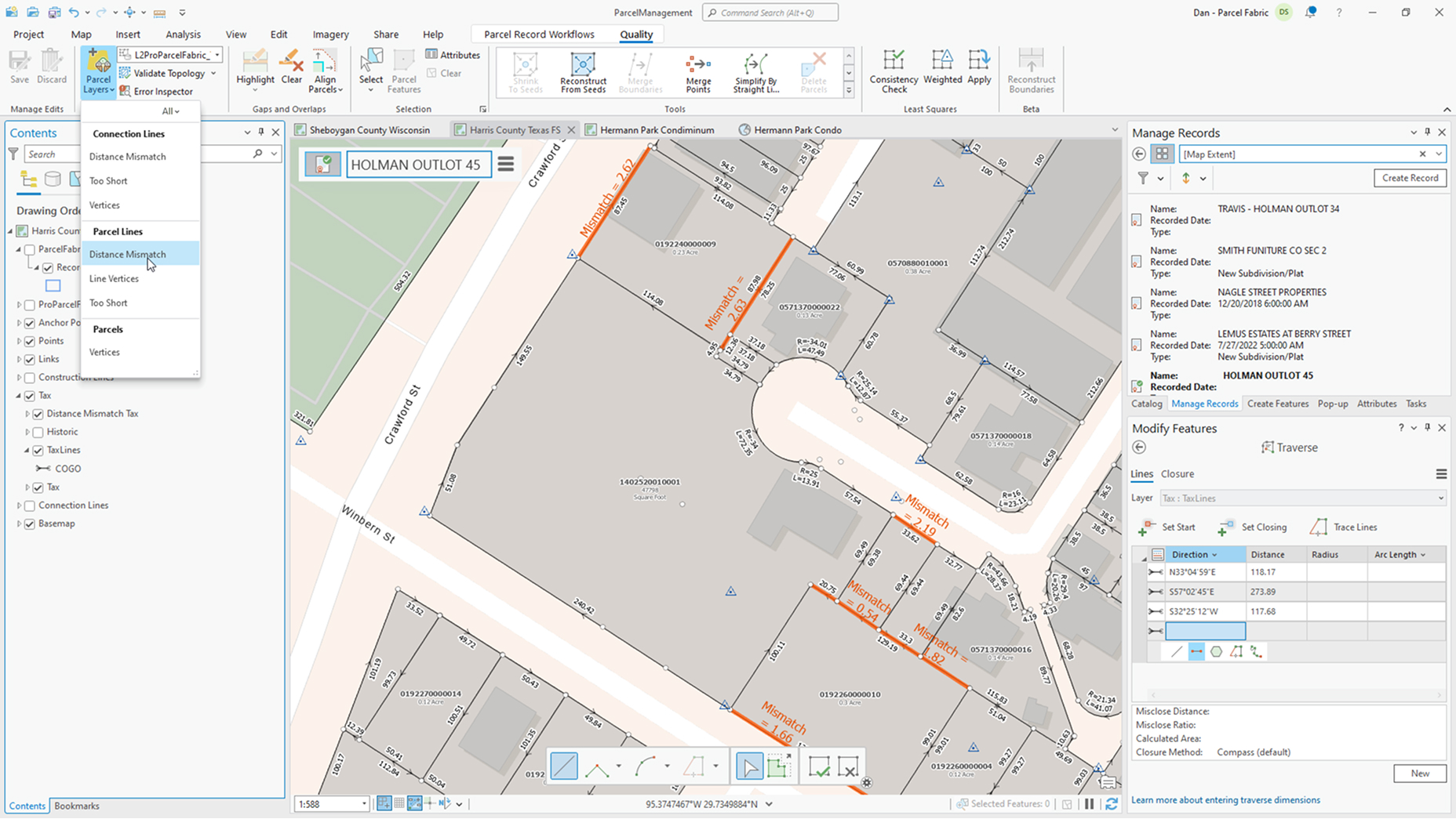
Quality-driven workflows in Parcel Fabric Discover how to use attribute and topology rules to evaluate and meet data quality requirements for your organization.
ArcGIS Parcel Fabric: Record-Driven Workflows Do you create and edit parcels? Learn about common record-driven workflows for managing the parcel fabric in ArcGIS Pro in this video.
Introduction to ArcGIS Pro Explore, visualize, and analyze data; create 2D maps and 3D scenes; and share your work to ArcGIS Online or your ArcGIS Enterprise portal.
Introduction to attribute rules Attribute rules are user-defined rules that enhance the editing experience and improve data integrity for geodatabase datasets.
Documentation Explore technical documentation, tutorials, lessons, and other resources for ArcGIS Parcel Fabric. Go to documentation
Training Learn the latest in ArcGIS Parcel Fabric through free live training seminars, self-paced courses, or classes taught by Esri experts. Go to Esri Academy
ArcGIS Blog Browse and read articles with the latest information from Esri engineers and developers on Parcel Fabric. Go to ArcGIS Blog
Esri Community Find GIS solutions, share ideas, and collaborate to solve problems with a global community of Esri users. Join the Esri Community
Land administration resources Explore resources for land administration agencies and connect with industry experts.
Record-driven editing workflows Discover predefined tasks for administering and editing a parcel fabric.