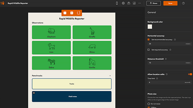
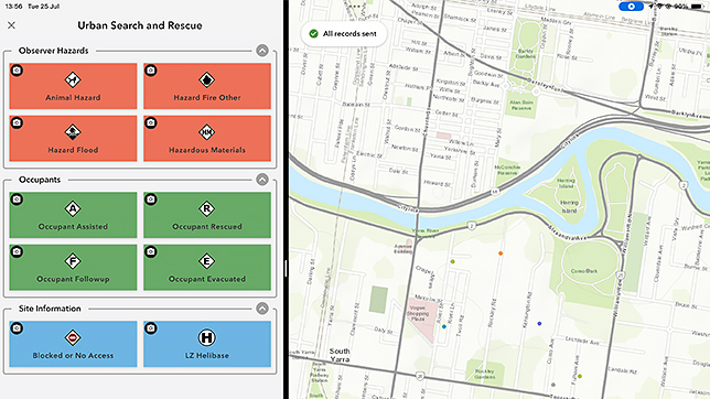
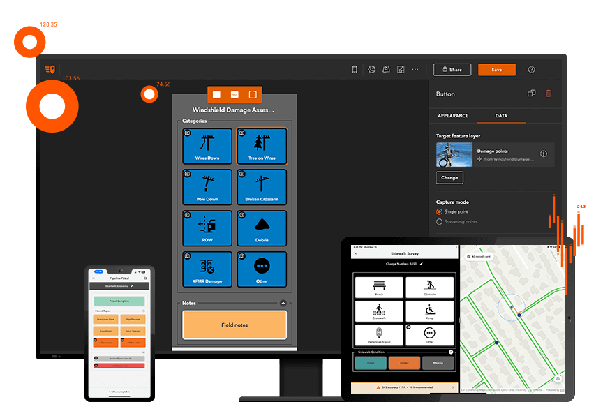
ArcGIS QuickCapture is the fastest way to collect field observations. With this simple app, you can quickly record field observations from a moving vehicle while you scout locations, conduct aerial surveys, or assess damage. Send data back to the office for analysis in real time and eliminate time spent manually processing handwritten notes. ArcGIS QuickCapture is integrated with ArcGIS, so new data from the field can be used instantly for better decision-making.
Capture data with the touch of a button
Record field observations on your mobile device from a moving vehicle
ArcGIS QuickCapture was created specifically for field teams that need to collect data from a moving truck, helicopter, or off-road vehicle.Use for aerial surveys, monitoring vegetation encroachment, asset inventories, road inspections, windshield surveys and more.
Perform fieldwork faster and more efficiently than ever
Increase productivity with a simple app that digitizes and streamlines your workflow. The minimalistic user interface in ArcGIS QuickCapture allows you toconduct inspections by capturing locations, field conditions, and even photos quickly, without interrupting the task at hand.
Get better results with accurate, real-time data from the field
Access data immediately in ArcGIS and push project updates out while teams are still in the field. Eliminate time spent manually processing field data and reduce human error from inaccurate transcription. Improve GIS analysis by obtaining data you simply couldn't get before.
Effortless to use and easy to configure
Implement immediately and start seeing results, right out of the box. Use the ArcGIS QuickCapture designer on your desktop to author your projects for field data collection. The ArcGIS QuickCapture mobile app is intuitive for field teams to use—no training needed.
Show More
How it works
Download the app
Works on Android, iOS, and Windows mobile devices. ArcGIS QuickCapture leverages the built-in GPS and camera on your smartphone or tablet.
Collect data while in a moving vehicle
Open the app and tap a button to use ArcGIS QuickCapture. No time is spent writing notes or finding GPS coordinates—the app knows where users are.
Analyze data
ArcGIS QuickCapture is integrated with your existing IT infrastructure and the ArcGIS platform, so data transmits from the field instantly.
User Story
Combating invasive species in Maryland
Our users are impressed. Now we can deliver data collection solutions quickly because it's so intuitive.
ArcGIS QuickCapture was a perfect solution for us. It's affordable, easy to use, and I can have anybody with minimal training doing quality work on it.
ArcGIS QuickCapture was an instant hit. It was the perfect data collection app for us to use in the field and gives us the ability to get the information we need in real time.
We’re helping the NZ Transport Agency improve road safety, which affects everyone. With ArcGIS QuickCapture, we can deliver projects on time because we have a detailed, technical picture of our work.
Use ArcGIS QuickCapture data for analysis in ArcGIS immediately - to better understand what's going on in the field. See why projects may be falling behind—before deadlines are missed.
Simplify your buying decisions
Build on your existing GIS system. ArcGIS QuickCapture integrates with your existing ArcGIS and IT infrastructure, so implementation is a breeze.