Generate your own 3D products in ArcGIS Pro
Generate your own true orthos, 3D meshes, point clouds, and Gaussian splats seamlessly within ArcGIS Pro, providing 3D capabilities to an environment you work in every day.

Part of the ArcGIS Reality suite of products
Reality mapping in ArcGIS Pro
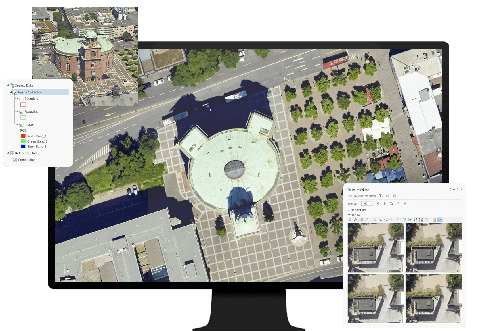
Load and manage data from multiple flights and multicamera systems.

Optimize the orientation of imagery from multiple flights and sensors. Measure control points to correctly georeference your results.

Turn large collections of aligned images and lidar data into high-quality 3D meshes, point clouds, digital surface models, true orthos, and Gaussian splats.

Iterate on the alignment and reconstruction to deal with challenging datasets.

Seamlessly share your outputs to your ArcGIS Online or ArcGIS Enterprise organization.

Explore the software applications that are a part of ArcGIS Reality. Find the reality mapping software that fits the size of your projects and the sensors you work with.
Explore this scalable, stand-alone application for citywide and countrywide reality mapping to create an important piece of 3D digital twins.
Process large volumes of drone imagery faster with cloud-based data processing and create 2D and 3D maps and models that you can quickly share across your organization.
Process drone imagery while offline or in the field. Turn recently collected drone images into 2D and 3D models, even without an internet connection.
Digital twins are representations of real-world objects and their processes and relationships. With ArcGIS Reality, users create highly accurate 3D meshes, true orthos, elevation models, point clouds, and Gaussian splats to use as an important piece when developing 3D digital twins of natural and built environments. Learn more about Esri’s 3D capabilities and how they relate to a comprehensive digital twin.
