ArcGIS Video Server
Expand ArcGIS Enterprise with web-based geospatial video

What you can do with ArcGIS Video Server
- Access video over the web
- Quickly search and find video
- Stream live video
- Pair with ArcGIS apps
- Support many data sources
Access video over the web
ArcGIS Video Server publishes video-as-a-service to allow analysts to quickly access high-quality video in a web browser instead of a computer file. This expands the current video workflow from a single local user to allow easy sharing between team members and stakeholders for enhanced collaboration anywhere in the world.


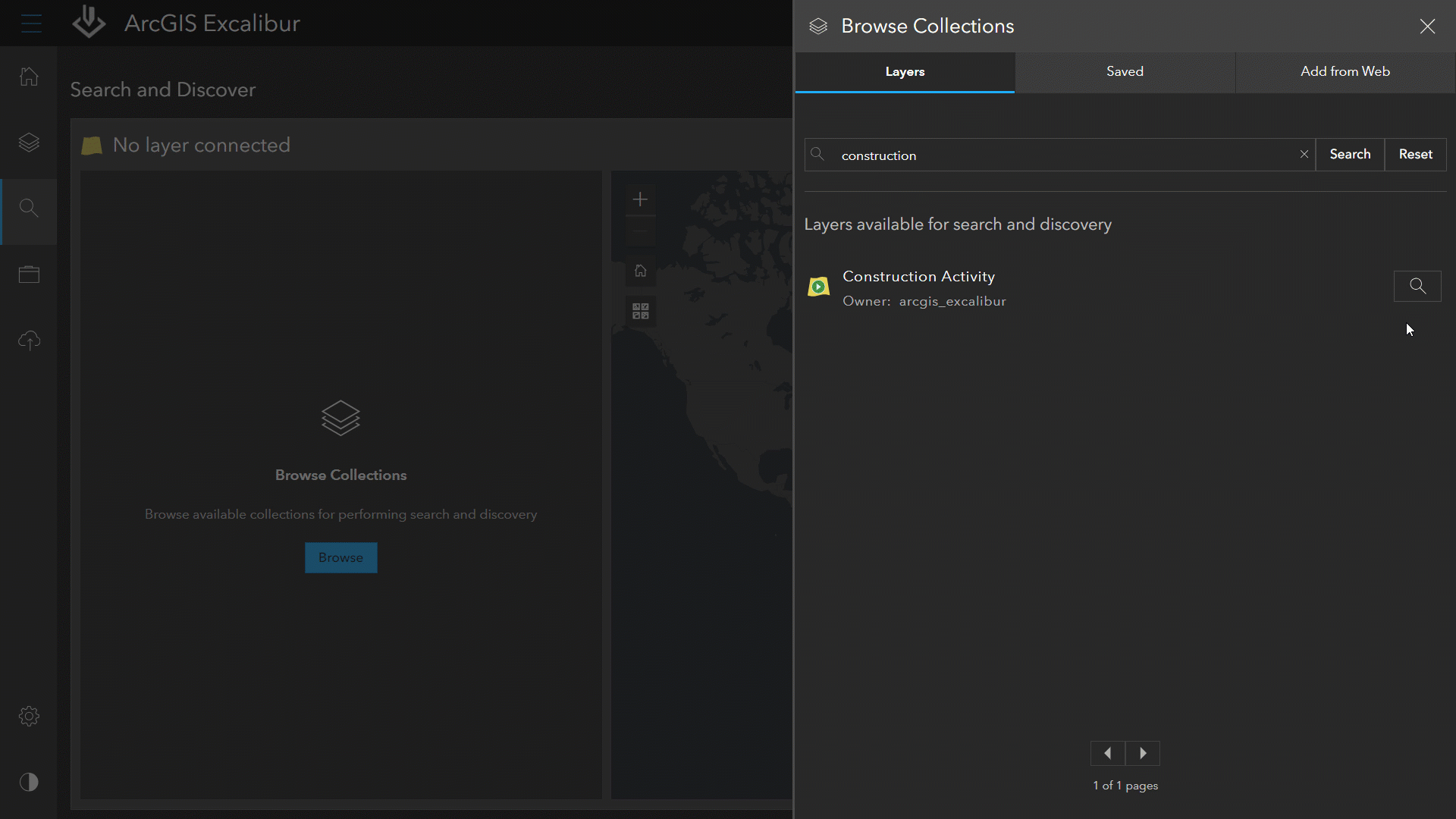
Quickly search and find video
Use ArcGIS Video Server to index video files from various data sources, manage content, and enable search and discovery by location, time, and metadata. Then deliver the video services to client applications like ArcGIS Excalibur, ArcGIS Image Analyst for ArcGIS Pro, and ArcGIS AllSource to play and analyze.


Stream live video
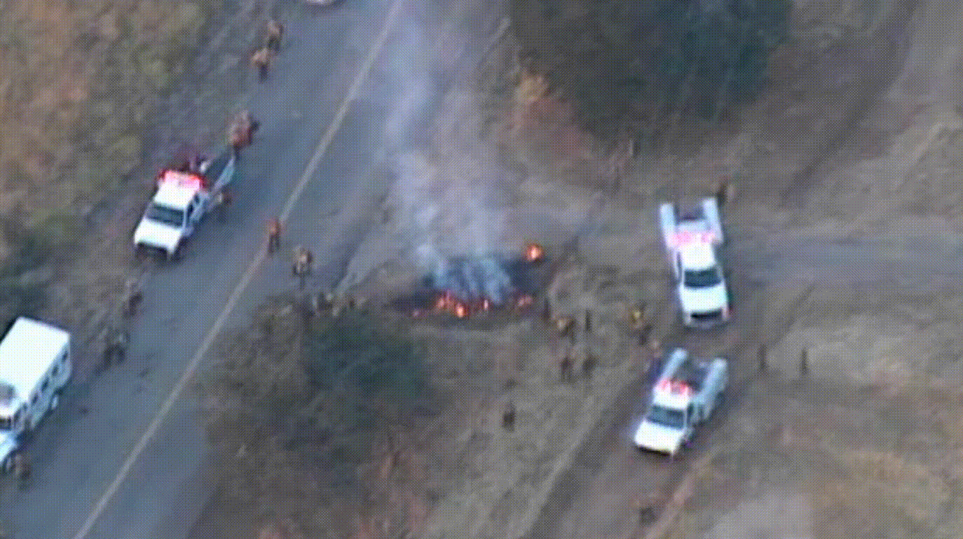
ArcGIS Video Server lets users integrate live video feeds to stream video-as–a-service to ArcGIS in near real time—providing timely context needed for supporting emergencies or live events. This feature also supports tasks such as situational awareness, remote inspections, and general security operations for faster and informed decision-making.

Pair with ArcGIS Apps for analysis
ArcGIS Video Server enables users to incorporate video as an additional data source in analysis workflows throughout ArcGIS. It delivers video to the same ArcGIS client applications that analysts use for daily imagery and geospatial workflows: ArcGIS Excalibur, ArcGIS Image Analyst for ArcGIS Pro, and ArcGIS AllSource. Using the tools in these apps, analysts can use video to examine trends and patterns and highlight change over time.

Support many data sources
ArcGIS Video Server supports government and industry video standards and formats. It introduces adaptive bitrate streaming (ABR) to ArcGIS, which provides modern and flexible delivery to support the best viewing experience in variable bandwidth environments.
How it works
Publish the video-as-a-service
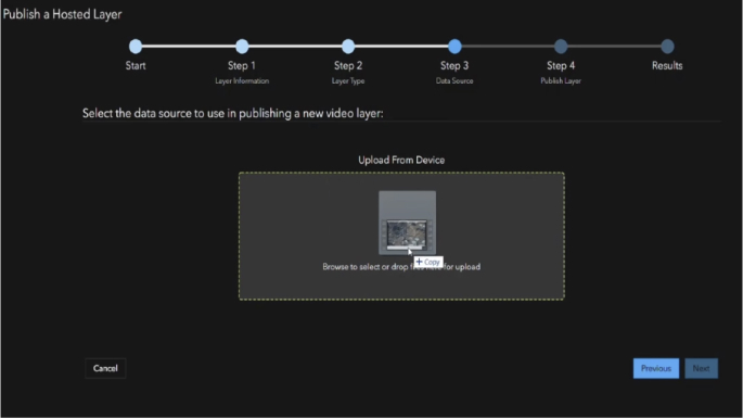
First, upload your video file to ArcGIS Video Server to publish as a web-enabled service.
Find the video in ArcGIS
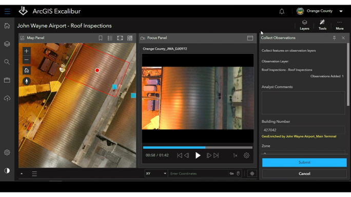
Then, leverage ArcGIS client applications such as ArcGIS Excalibur to search by time, location, or metadata to find the video you need. Or search by an area or object of interest in a video to find out how many times it appears, at what time, and for how long. You can also configure a video layer to view live video as it streams in near real time.
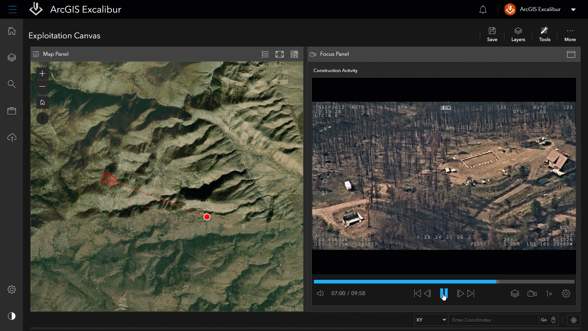
Play the video with map telemetry
Now play the video to visualize imagery in motion alongside its telemetry on a map—a feature you can toggle on and off. Choose from a range of player controls such as pause, fast forward, or rewind. A list of markers identified from your search, such as when a facility of interest appears, allows you to jump to key moments in the video.
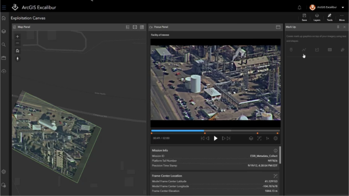
Conduct analysis with ArcGIS tools
Use the simplified tools in ArcGIS Excalibur to take a screenshot of an object in the video and apply it to the map. Use the Flash tool to click on the object in the video to verify its location on the map. Mark up and annotate the screenshot, and then export it to share with stakeholders in presentations.
How to get started
To use ArcGIS Video Server, you must have a base deployment of ArcGIS Enterprise. Then, you will need to use an ArcGIS client application, such as ArcGIS Excalibur, ArcGIS Image Analyst for ArcGIS Pro, or ArcGIS AllSource to interact with your geospatial video.
Web app
ArcGIS Excalibur
Web app
ArcGIS Excalibur
For web-based workflows, pair with ArcGIS Excalibur, an imagery analysis app. Excalibur offers ready-to-use tools for simple imagery and video analysis—no imagery or GIS experience required.
Desktop app
ArcGIS Image Analyst (coming soon)
Desktop app
ArcGIS Image Analyst (coming soon)
For desktop-based workflows, pair with ArcGIS Image Analyst, an ArcGIS Pro extension. ArcGIS Image Analyst for ArcGIS Pro provides tools for advanced video interpretation and geospatial analysis. Integration with ArcGIS Video Server is coming soon.
Intelligence software
ArcGIS AllSource (coming soon)
Intelligence software
ArcGIS AllSource (coming soon)
ArcGIS AllSource is intelligence analysis software for investigative, geospatial, and link analysis. It’s built for analysts in the military, civilian intelligence agencies, and law enforcement. Integration with ArcGIS Video Server is coming soon.
Documentation and training
Get the answers you need to get started. Learn how to set up and use ArcGIS Video Server with this documentation and training.
Previous
Next
Contact sales
Please share your information and our sales team will contact you soon. We look forward to communicating with you.