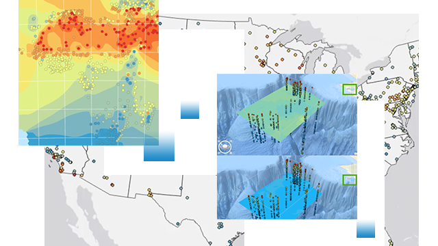
Accurate data predictions
The statistical models and tools available in ArcGIS Geostatistical Analyst derive accurate and reliable estimates for phenomena at locations where no measurements are available. The geostatistical software provides a probabilistic framework for quantifying uncertainties when user data is incomplete or subject to error.
Create surfaces from sample data using the following interpolation methods:
- Inverse distance weighted (IDW)
- Radial-based functions
- Global and local polynomials
- Kriging for exact data and for error-contaminated data
- Cokriging (a multivariate version of the above-mentioned kriging models)
- Isotropic or anisotropic models
Interactive interface
Fine-tune the parameters of your model with the Geostatistical Wizard that provides interactive, step-by-step guidance to walk you through the process of applying a geostatistical interpolation model. The interactive wizard experience begins when you choose an interpolation method and continues while viewing summary measures of the model's expected performance.
Extend to 3D interpolations
In ArcGIS Geostatistical Analyst, kriging is extended to work in three dimensions to allow you to perform interpolation of points. This enables you to predict the value at all locations between the points in 3D. Various 3D interpolation methods are available as geoprocessing tools including empirical Bayesian kriging 3D, IDW 3D, and Nearest Neighbor 3D. In addition, you can leverage ArcGIS Pro voxel layers to visualize and interactively explore the details of the 3D interpolation results.
Model evaluation and assessment
ArcGIS Geostatistical Analyst provides validation and cross validation tools that allow you to evaluate the model and predictions.
Perform the following with evaluation and assessment tools:
- Cross validation for checking the model's quality
- Validation for checking prediction quality
- Comparison of cross validation results of several models
- Predicted value shown at cursor (MapTips)
Simulate realizations
Create multiple versions of a surface to perform risk analyses. Geostatistical simulation produces multiple surfaces that mimic the real phenomenon and provide possible values. This provides a basis for risk analyses, economic decision-making, and other estimations that involve uncertainty, allowing you to make more informed decisions.
Pricing
ArcGIS Geostatistical Analyst is an extension for ArcGIS Pro and ArcGIS Enterprise. Explore pricing options and available extensions.