Technical Demo: Building Digital Twins with Reality Capture and GIS
Key takeaway
Creating digital twins starts with a reality capture workflow, including these steps:
- Data capture and integration: Drone technology helps collect information.
- Real-time information and visåualization: Explore what you've captured and make it understandable for stakeholders, using dashboards, for instance.
- Analyze and predict: Understand the current state and predict what's going to happen.
- Share and collaborate: Engage stakeholders and decision-makers.
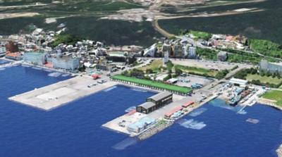
Jump-start a digital twin of your infrastructure project by using a complete drone mapping workflow. This technical demonstration details how the Taiwan Fisheries Agency used reality capture to build a digital twin of the Badouzi Fishing Port with Site Scan for ArcGIS, end-to-end drone mapping software. The software helped the agency acquire and process drone imagery, work with resultant data products, and manage assets.
View the full technical demo, or continue reading for a video summary.
Video summary
With drone workflows consolidated in a single system, getting drone data out of the field and into shareable maps and models happens faster and with fewer setbacks. This is especially important when creating a digital twin. Site Scan for ArcGIS, end-to-end drone software, simplifies the process, supporting flight planning and image capture; image processing, management, and analyses; and dissemination and collaboration.
The Taiwan Fisheries Agency used drone mapping to plan future port development and mitigate the impact of rising sea level on the Badouzi Fishing Port by creating simulations. The agency's process included four basic steps:
- Plan automated drone mapping missions.
- Generate high-accuracy photo-realistic 3D mesh models and true orthomosaics.
- Create simulations using staff content.
- Develop interactive maps and models to communicate with stakeholders.
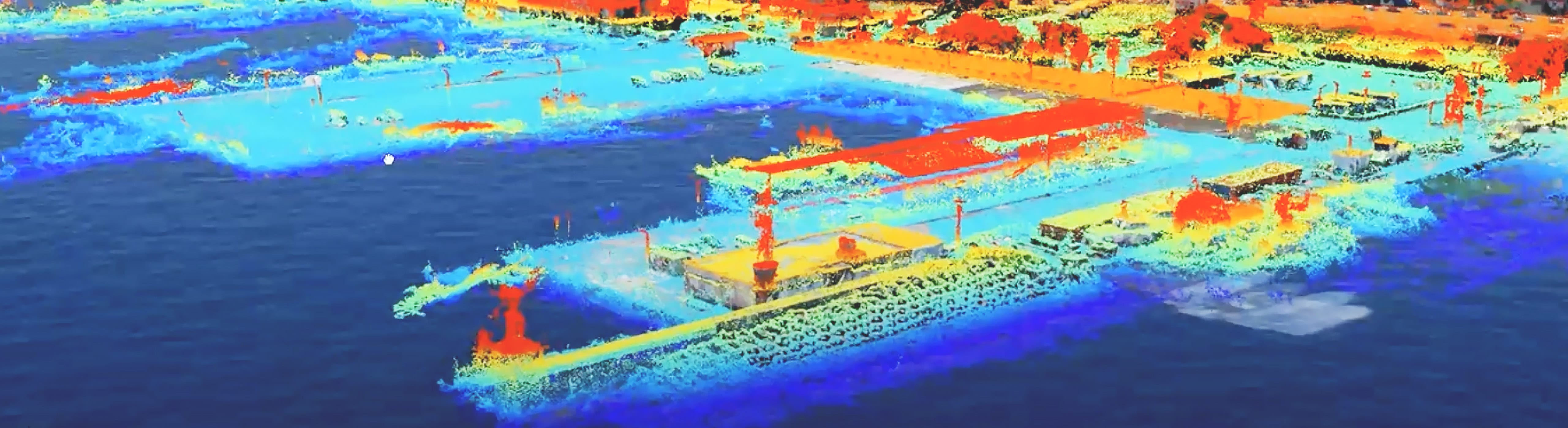
 Detailed view of the Badouzi port created using a high fidelity mesh of nadir images
For the Badouzi Fishing Port project, the reality capture process resulted in a huge amount of information. To combine the different kinds of information, the agency's team brought the data into a web scene, a representation of the built area and the natural environment around it. Using point cloud data, an ocean data layer, and a mesh, the team worked with Site Scan for ArcGIS to display features such as elevation, showing which areas are more vulnerable to sea level rise.
Further integration with BIM data and the building slicing tool reveals that some buildings have internal construction protecting them from lower amounts of sea level rise, changing the equation for decision-makers and providing a fuller picture. This valuable information can be shared with stakeholders, construction crews, and architects.
A digital twin can help provide meaningful, actionable information to end users. Esri's location-based technology, reality capture and drone software, and GIS all play important roles in creating digital twins. We hope this demo inspires you to think about ways you could use the tools in your own projects.
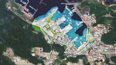
 A digital image of the Badouzi port showing a model of sea level rise
Need help finding the right solutions?
Schedule a conversation with one of our experienced sales consultants. Tell us how you're using imagery and remote sensing data now, and we'll show you where a complete geospatial system can take your work next.