Five Ways Remote Sensing Powers a Geographic Approach to Sustainability
Key takeaways
- Remote sensing is an essential, foundational part of the geographic approach—a framework for problem solving that recognizes every issue has a geographic component that must be understood to gain full context.
- Understanding our world starts with measuring it.
- There is an ever-increasing amount of data available, and we'll need it all to inform our science, make predictions, and take meaningful action toward a sustainable future.
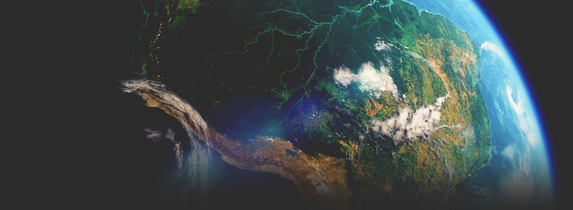
Our human footprint is creating challenges like biodiversity loss and climate change. Imagery and remote sensing professionals are uniquely positioned to address these issues with scientific and technical knowledge. If we take action, the earth can heal. Imagery and remote sensing professionals can see the changes on the earth in a way others can't—it's a superpower. The more we see, the more we understand, and the better we can collaborate and take action. Tools and data provide a deeper and richer understanding of the natural and built worlds, and remote sensing provides a foundational layer of information by measuring our world.
In this presentation, Richard Cooke, global director of business development at Esri with 30 years of experience in the remote sensing industry, discusses how a geographic approach to problem-solving can create the holistic understanding we need to respond to today's complex challenges. Remote sensing is going mainstream, in both business and government, and has the potential to help us create a sustainable future.
Play the video to experience the full presentation, or continue reading for key takeaways.

Five essential geographic approaches remote sensing professionals can use to understand the world and achieve sustainability
- Analytics: Use spatial analytics with imagery and remote sensing data to classify objects, identify relationships, and find spatial patterns. Move beyond seeing the world in terms of just x, y, and z—add time (t) and relationships (r).
- Visualizations: Communicate visually to create shared understanding. Speed understanding and buy-in by reducing the friction for those outside the remote sensing field. Create shared understanding with those who need to make decisions.
- Design: Inform more sustainable design by adding richer spatial context. The information products we create help city planners, AEC firms, and infrastructure and construction companies design more sustainably.
- Collaboration: Improve collaboration and engage stakeholders. Create collaborative environments that communicate the science behind our work and its value. A combination of imagery and dashboards can help create situational awareness at a glance.
- Accounting: Assess, monitor, and track assets and resources. Imagery and remote sensing are the best sources of data to monitor resources and assets. Creating authoritative inventories and spatial context helps people know they can trust the insights we're providing.