
Transform your operations
Identify hidden problems and evaluate trends to proactively prioritize activities. Evaluate your performance indicators with data analysis.

Gain efficiencies with powerful analytics
ArcGIS Insights is a web-based, data analytics workbench where you can explore spatial and non-spatial data.
Discover trends and patterns in your operations, evaluate assets for planning, and better understand your customers.
Transform your operations

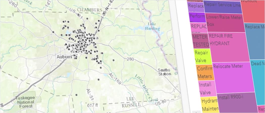
Evaluate assets for planning
Better understand your customers
With ArcGIS Insights, you can quickly discover the secrets your data holds. Visualize, analyze, and tell your story like never before.
Through the power of tying your non-spatial data to your spatial data, you can begin to answer questions based off data coming from multiple sources and business systems.
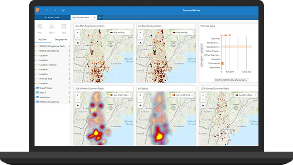
Create charts, graphs and reports that will save time and improve decision making.
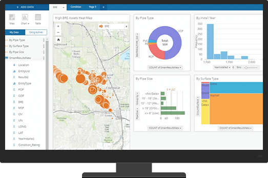
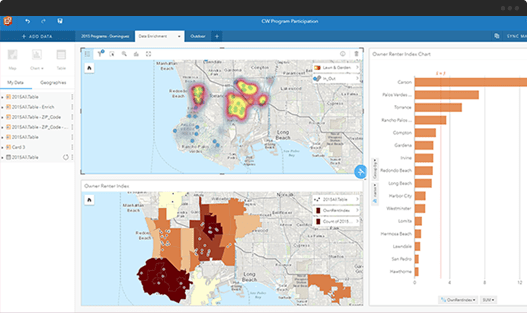
Aggregate your spatial data to quickly create new, rich datasets. Gain new discoveries about our data, through card interactivity. Linked cards allow you to click on a chart and see related data light up on another card.
Rich analysis often extends beyond variables within your data and organization. In this example, we enrich your analysis with demographic data.

Insights empowers you to integrate and analyze data from ArcGIS Enterprise including ArcGIS demographic data, geodatabases, and Living Atlas content.
Insights connects to enterprise databases such as SQL Server, SAP HANA, Teradata, Oracle, Hadoop, and GE Smallworld, as wells as excel spreadsheets.
We’re here to help. Provide your information below, and we will get in touch with you to get started.