R-ArcGIS Bridge

Integrating R and ArcGIS

Connecting GIS and spatial analysis with R for advanced data science

Get started
Collage of a scientist collecting a water sample, maps showing high temperatures in Africa, a bird, and river networks

R-ArcGIS Bridge is a suite of R packages that integrate ArcGIS and the R programming language. It consists of two R packages: {arcgis} and {arcgisbinding}. The {arcgis} meta-package brings ArcGIS Online and ArcGIS Enterprise services to R, providing access to GIS feature services, geocoding, and more. The {arcgisbinding} package powers R-based spatial analysis and geoprocessing tools in ArcGIS Pro and ArcGIS Enterprise.

How does R-ArcGIS Bridge work?

The {arcgis} package communicates directly with your organization’s web GIS by creating API requests and handling responses. The {arcgisbinding} package integrates directly into the geoprocessing framework of ArcGIS Pro.

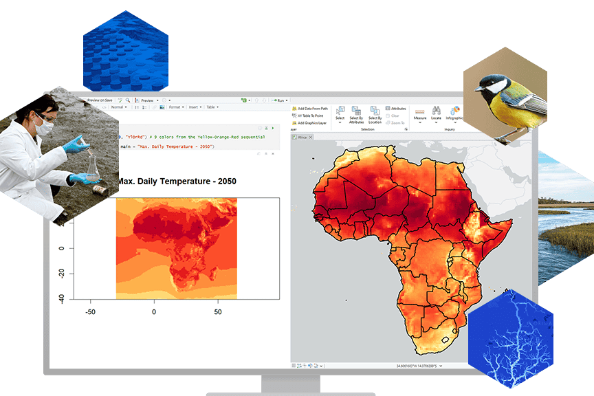
Access spatial data with R

Harness ArcGIS data from R, whether it’s stored locally or hosted in ArcGIS Online or ArcGIS Enterprise. 

Use the {arcgis} meta-package to access your organization’s feature services, hosted interactive maps, and imagery. Alternatively, you can use {arcgisbinding} to interact directly with geodatabases.

 A screenshot of an RStudio interface displays code, data, and a map of Pennsylvania counties

Use ArcGIS Location Services in R

Leverage enterprise-grade geocoding and point-of-interest (POI) search directly in the R environment to enrich your analysis and visualizations. 

With the {arcgis} package, you can access secure, authoritative ArcGIS Online and ArcGIS Enterprise services to retrieve precise location data, integrate it with your datasets, and generate spatial features as native R objects.

A computer monitor shows a colorful map of Atlanta, Georgia with each color representing a different geographic segment

Enhance spatial analysis with R in ArcGIS

Use the {arcgisbinding} package to transform your R scripts into geoprocessing tools that support repeatable, scalable spatial analysis. Seamlessly pass data between ArcGIS Pro and R using native R objects like {sf}, enabling smooth input and output handling and greater analytical flexibility.

Whether you’re building tools for internal workflows or publishing services for broader use, {arcgisbinding} helps you embed R’s statistical power directly into the ArcGIS geoprocessing framework.

A laptop screen shows a map of the US divided into color-coded regions and a geoprocessing window for a Hierarchical Clustering R Tool

Share R-driven analytics

With the {arcgisbinding} package, you can build reproducible analytics pipelines that integrate seamlessly into ArcGIS Pro. 

These R-powered tools can be shared across your organization as toolboxes or deployed as geoprocessing services in ArcGIS Enterprise—making it easy for teams to run consistent analyses, benchmark results, and track change over time.

A screenshot of an ArcGIS Pro ModelBuilder window displaying a workflow diagram for geographic data analysis

Choose the R-ArcGIS Bridge package that’s right for you

Previous
Next

How do you get started with R-ArcGIS Bridge?

Build sophisticated geospatial workflows leveraging R-ArcGIS Bridge. Whether you want to use R-ArcGIS Bridge directly within ArcGIS Pro or prefer working in an IDE, R-ArcGIS Bridge packages are available to you.

To get started, follow these steps: 

  1. Install R. 
  2. Install the R packages that suit your use case from within either ArcGIS Pro or your R IDE of choice.

Learn more about getting started
A screenshot of an RStudio interface displays code, data, and a map of Pennsylvania counties

Contact sales

Connecting You with Sales Experts

Talk to someone on our sales team

1-800-447-9778

7:00 a.m.–5:00 p.m., Monday through Friday (PT)

Chat online

Start a chat

Contact the sales team

Fill out the contact form