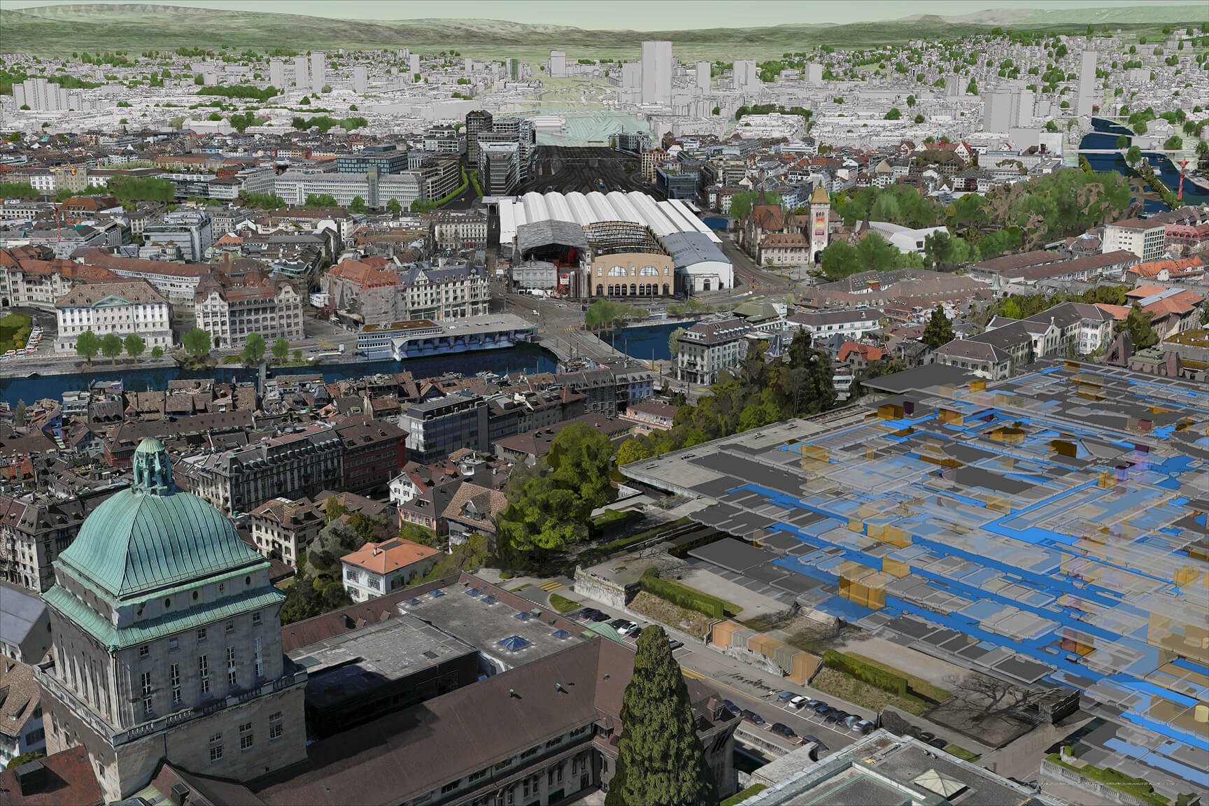
Meet Esri at Geo Week

February 16–18, 2026 | Denver, Colorado

Visit Esri experts at booth #1323 to learn how ArcGIS powers digital twins and delivers geospatial solutions across industries.

A 3D mesh rendering of Zurich, Switzerland, including a central train station and government buildings

Integrate everything: Digital twins in ArcGIS

Esri’s ArcGIS incorporates imagery and remote sensing data from a variety of sensors and platforms into a powerful enterprise asset. Bring your real-world data into a digital environment to build a living digital twin.

Previous
Next

Explore Esri's Geo Week presentations

Reality Mapping: The Foundation for Digital Twins

Arkadiusz Szadkowski, Brian Connolly, and Cody Benkelman | February 16 at 10:30 a.m. | Bluebird Ballroom 3G

Modernize Your GIS With Imagery and Remote Sensing

Stephanie Dockstader | February 17 at 2:45 p.m. | Bluebird Ballroom 3E

Geospatial Gaussian Splats: Toward Autonomous Asset Monitoring

Konrad Wenzel and Jean-Philippe Pons | February 18 at 11:30 a.m. | Bluebird Ballroom 3A

Additional Esri presentations

February 16

  • AI and Geospatial Intelligence in Modern Construction | Asaf Even Paz | 2:00 p.m.

  • Digital Twins and 3D Modeling for Infrastructure and Urban Environments | Andrew Carey | 2:00 p.m.

  • The Many Uses of 3D Above and Below Ground Mapping | Amadea Azerki | 2:00 p.m.

February 17

  • Heat Island Mapping from Thermal Aerial Imagery | Brian Connolly | 3:00 p.m.

February 18

  • Global Lessons in Urban Digital Twins | Holger Lipke | 11:00 a.m.

  • Geospatial Readiness for Climate Change Panel | Arkadiusz Szadkowski | 1:30 p.m.

Demonstration

Evolving capabilities of reality mapping

Discover the benefits—including visualization and analysis—of creating a photorealistic basemap.

Connect with an Esri expert

Share your details and an Esri sales consultant will contact you to explore how imagery and remote sensing can enhance your analysis, workflows, and decision-making.