
Solutions for Land Records
Ready-to-use maps and apps to manage property information

Specialized maps and apps for land records
- Manage and share property data
- Analyze property values
- Recover tax revenue

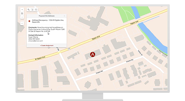
Manage and share property data
Modernize land records and parcel management by compiling authoritative data—like addresses and survey descriptions—in a single database that populates shareable digital maps. Ensure access to accurate location information for residents as well as government services like 911, permitting, billing, and taxation.

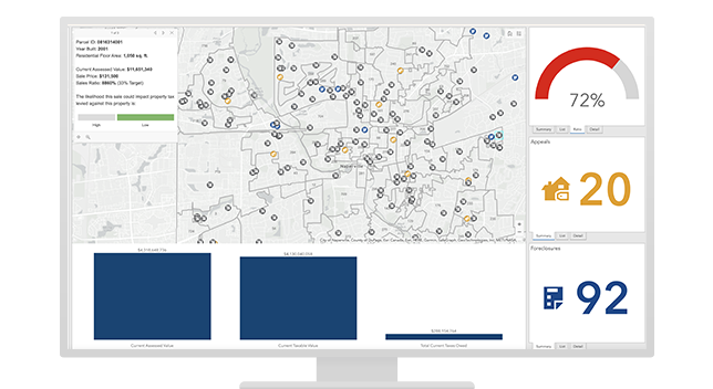
Analyze property values
Understand local land values with maps and apps that make parcel information transparent and accessible. Improve the quality of property assessments; track market trends over time; and visualize the location of sales, foreclosures, and appeals—and ultimately, ensure fair property evaluation and equitable community growth.

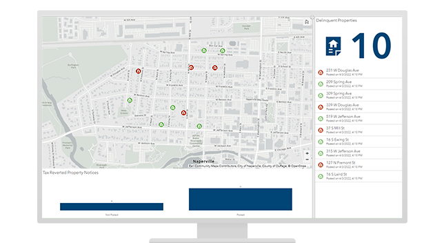
Recover tax revenue
Collect and map tax information on delinquent properties to streamline the recovery of back taxes, interest, and penalties. Maximize tax revenue by engaging real estate professionals, development companies, and the public to return delinquent properties to a productive state and bring positive change to your community.
Local government solutions for any initiative
Implement a collection of focused maps and apps to help address challenges in your organization.
Previous
Next
Contact sales
For more information about solutions for land records, please complete the form and a representative will be in touch.