Solutions for Transit
Ready-to-use maps and apps to manage public transportation
Specialized maps and apps for transit
- Analyze and manage networks
- Communicate with riders
- Manage transit safety
- Plan and map transit expansion

Analyze and manage networks
Plan smart public transportation with real-time data, smart maps, and communication tools. Visualize routes, stops, assets, and travel times to enhance your team’s work and public awareness. Analyze your network to see where service changes can have the biggest impact, and manage your transit systems with data-driven decisions.

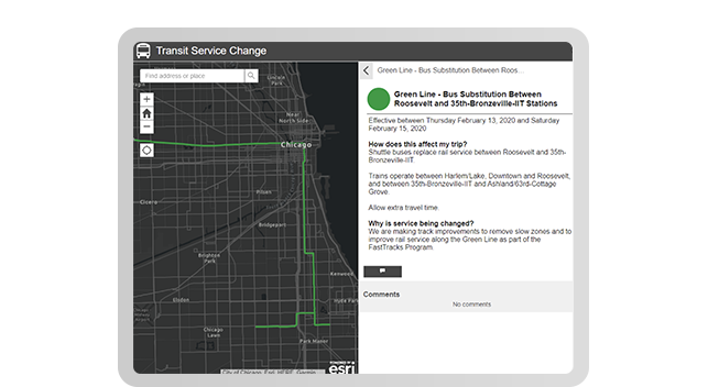
Communicate with riders
Modern, location-based public transportation software powers an engaging experience for riders. Share up-to-date—even real-time—maps with your community displaying routes, stops, service alerts, and proposed changes. Gather feedback to understand real-world needs for service updates, and report on performance for greater transparency,.

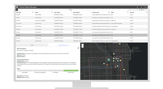
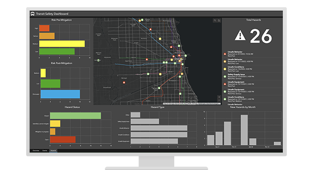
Manage transit safety
Stay ahead of Federal Transit Administration safety standards with a robust, modern safety management system (SMS). Apps for rapid data collection and maps for high-quality location-based reporting help you document safety events, report hazards, manage corrective actions, and ultimately enable safe transit journeys for your riders.

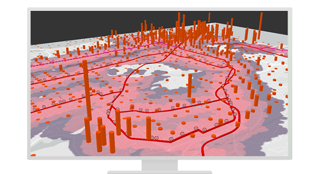
Plan and map transit expansion
Use transit data with location-based public transportation software to visualize smart, sustainable plans for network expansion. Leverage analytics tools to enable growth with minimal impact on your community's natural landscape. Share engaging maps and multimedia reports with residents to get buy-in and generate ridership.
Solutions for every initiative
Implement a collection of focused maps and apps to help address challenges in your organization.
Previous
Next
Contact sales
For more information about solutions for transit, please complete the form and a representative will be in touch.