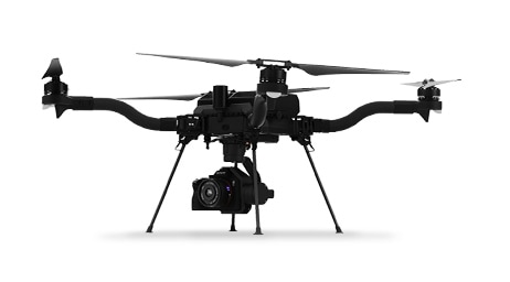
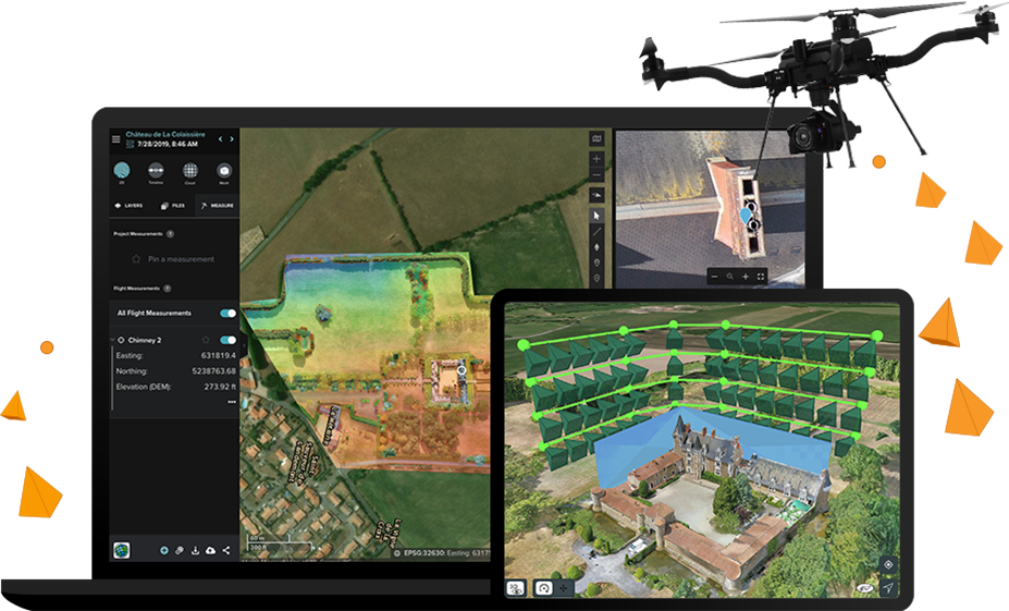
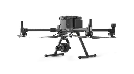
Skip to Content
End-to-End 3D Drone Mapping Software

End-to-End 3D Drone Mapping Software

Streamline your workflow from planning to analysis with Site Scan for ArcGIS

Contact sales
Laptop computer analyzing drone imagery of a castle and an iPad showing the flight pattern of a drone around a castle

Site Scan for ArcGIS is the end-to-end, cloud-based drone mapping software designed to revolutionize imagery data collection, processing, and analysis. Maintain your drone flight history while capturing up-to-date imagery when needed. Securely process imagery in a scalable cloud environment and quickly share high-quality 2D and 3D imagery products throughout your organization. Directly publish your drone data to your ArcGIS organization to perform advanced drone analytics such as object detection and deep learning workflows.

Reality Capture with ArcGIS

Man standing at a large round table in front of a large computer monitor with 2 large TV monitors showing a digital 3D image

Complete drone mapping software in the cloud

Plan autonomous drone flights in 3D

Increase efficiency by creating and sharing advanced 3D flight plans with your pilots. Overlay 2D and 3D data from ArcGIS Online and ArcGIS Enterprise for enhanced flight safety and data quality. Manage your data in the field and upload it to the cloud.

Ipad screen of a flight plan with terrain follow feature enabled showing the profile view of the flight

Process and analyze in the cloud

Unlimited amounts of drone flight data are processed into 2D and 3D outputs through a scalable cloud environment. High accuracy is ensured through automatic ground control point detection. Easily visualize and analyze results directly in a web browser.

Desktop screen with a point cloud of a bridge and side bar menus of the analysis tools

Drone analytics

Perform drone analytics by measuring distances, surface areas, and volumetrics; conducting temporal analysis; generating cut/fill maps; and measuring change over time. Maintain quality control by comparing your drone data to design overlays—including those in your Autodesk cloud environment—or compare it to drone data captured earlier in the project.

3 digital images stacked together representing types of analysis with the foreground image showing a construction site

Quickly share drone and project data

Share information with your stakeholders in formats they understand, whether in a 3D view, as a report, or as a map within ArcGIS Online or ArcGIS Enterprise; invite read-only users to analyze data in Site Scan Manager for ArcGIS; share content and report issues within Autodesk BIM 360; or export in common file formats.

Desktop screen of a construction site image project with a BIM model and options for sharing to ArcGIS Online in a sidebar

Enterprise fleet management

Fleet management keeps track of flights, drone hardware, and pilot flight history—all in one place. Drone program managers can create custom preflight checklists for their teams and store responses in the cloud.

Enterprise fleet management dashboard showing a bar graph, map, activity feed, and status icons for drone flight and pilots

Advanced data analysis in ArcGIS

With the press of a button, Site Scan aerial photogrammetry data is available throughout the ArcGIS system, on premises or in the cloud, to perform and automate advanced analytics such as object detection with ArcGIS Image Analyst. Easily integrate your drone imagery with building information modeling (BIM), lidar data, real-time Internet of Things (IoT) data, and more.

Analysis with oriented imagery of a pipeline project in ArcGIS Image Analyst with background images showing object detection

Recommended drones

Previous
Next

WHAT CUSTOMERS ARE SAYING

Streamlined workflows

Our process is more streamlined and efficient now. Mission planning and collection are faster, allowing the team to capture more imagery and important geospatial data than was previously possible.

Jason Knowles

GeoAcuity

Contact sales

Talk to us to get started with Site Scan for ArcGIS.