Skip to Content

Mapping Equity Across Industries

Advance equity and social justice in your community

Change happens when you have a location-based equity strategy

An aerial view of a city park surrounded by tall buildings and overlaid with two maps and map markers representing people of different ages and identities

Develop an equity strategic plan

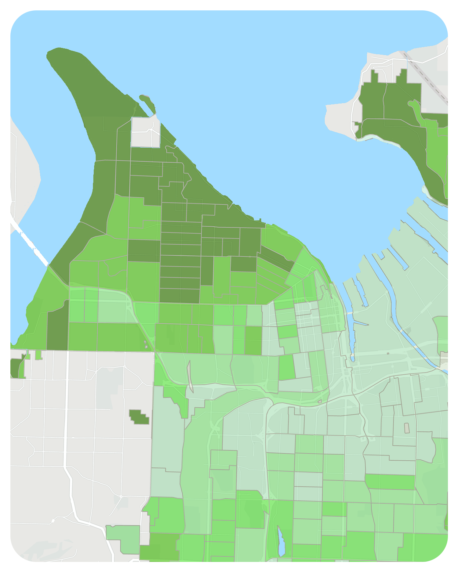
Every government, nonprofit, and business can advance equitable outcomes with an equity strategic plan. Geographic information system (GIS) technology is essential to developing a successful equity strategy. 

With a geographic approach, you can understand where to allocate resources, how you can address equity and social justice issues, and make informed decisions. 

An aerial view of a neighborhood in Washington state, with Mount Rainier in the distance and a cloudy sky
A map of a coastal area with land segmented by different shades of green

Embrace the geographic approach in four steps

GIS allows you to collaborate with community members, policymakers, and business leaders; establish benchmarks and priorities; and effectively distribute resources, staff, and services where they're most needed to advance equity.

Understand your community

An effective equity strategy begins with making data-driven decisions. GIS is a system that allows organizations to discover where inequities in transportation, affordable housing, or park access are concentrated. 

Organize, collect, and analyze demographic, socioeconomic, lifestyle, and vulnerability data sets across disciplines. With GIS, you can integrate layers of information to expose patterns of inequity. 

A freeway interchange overlaid with an illustrated, diverse group of people

Create a location-based strategy

GIS is foundational to your location-based strategy. Use it to identify where barriers to equity—including economic opportunity, transportation, climate factors, social determinants of health, and other resources—are located. 

Align departments around specific purposes to ensure equitable outcomes by adding equity-focused location technology to your workflows. With a location-based strategy in place, each stakeholder can identify and address inequities within their discipline and contribute to the equity strategic plan.

A map of New York City and the surrounding area segmented by different shades of blue overlaid with two graph icons

Operationalize your plan

Solving for inequities requires different disciplines and experts to come together. GIS empowers each department to set benchmarks and mobilize resources and tools. Location-based equity solutions allow each department to pinpoint and implement concentrated efforts. 

The geographic approach allows you to effectively apply resources such as budget, personnel, and services where they’re needed most to improve equitable outcomes.

Illustrated people in an office participating in a meeting overlaid with an image of a map

Measure your impact

Achieving equity takes time—especially when you consider demographic and socioeconomic factors. Use location-based data to measure your success and uncover opportunities to redirect efforts. 

Organizations that achieve equity monitor decisions and policies with real-time GIS, make necessary adjustments to their strategy, and apply appropriate resources where they’re needed. 

A person sitting at a desk using a desktop computer overlaid with different displays of GIS software

Applying an equity lens across industries

Explore Esri resources that identify areas of opportunity to enhance equity and social justice in your industry.

Previous
Next

Discover the value of an equity strategic plan

Access the ebook to learn how nonprofit organizations, local governments, healthcare groups, and transportation agencies are achieving equity with GIS.