ArcGIS Mission
Streamline operations while providing teams with tactical situational awareness with all-inclusive command and control software.

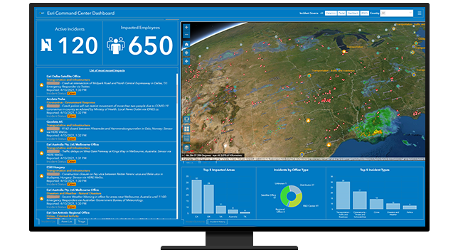
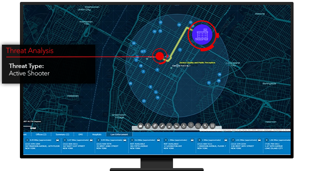
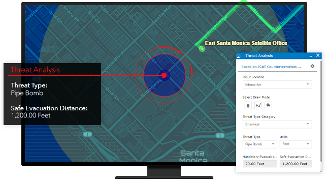
Critical infrastructure protection and incident management

Protect critical infrastructure with powerful map visualizations and incident data that evolve with your event security needs. Ensure safe and efficient mission execution with configurable security plans to support high-risk operations. Effectively organize people, processes, and threat data in real time.
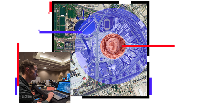
Leverage a fully integrated framework to design digital pre-plans and site surveys for any facility or event. Location-based technology helps guide the planning, preparation, and execution of security operations for critical incident management. Share plans with authorized personnel in both your organization and partnering organizations.

Securing special events requires a connected environment and a common operational view for all mission participants. Enable persistent communication to enhance incident management. GIS allows you to quickly quantify risk through a continuous connection between the field and the command center, and from peer to peer.

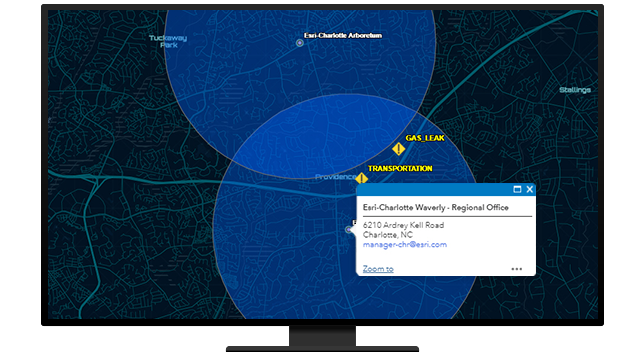
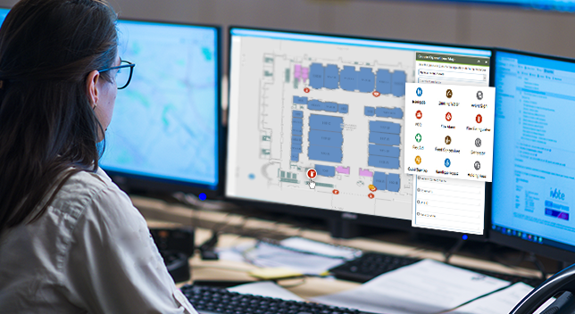
Manage planned and unplanned incidents with adaptable and configurable response plans. ArcGIS delivers connectivity between the command center and the field to provide security personnel with up-to-date information. Staff can then build and modify security plans in real time to support the shifting dynamics of an evolving tactical situation.
Integrate information from varied sources and across multiple applications. ArcGIS supports visualization in a single display to give you a live, dynamic view of any threat landscape. Align overlapping security missions by providing simple mechanisms for trusted organizations to collaborate, share, and view data for complete operational awareness.