Local Government
Collector Saves Town in Tennessee $15,000

Located near Memphis, Tennessee, the Town of Collierville has used GIS technology since 1998. After signing a Small Government Enterprise License Agreement with Esri in 2013, the town wanted to easily get more information into people’s hands.
The Challenge
Managing storm water drainage is a key responsibility for any municipality. For the town of Collierville, which receives more than 50 inches of rain annually, storm water management is critical in preventing flooding and preserving private property.
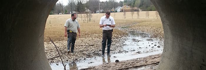
To visually inspect and record information about storm water pipes and drainage structures, Collierville Public Services staff would regularly walk ditches more than a mile long. Equipped with notepads, tape measures, paper maps, and digital cameras, staff would manually take measurements, photographs, and notes in the field and then return to the office to enter information into the GIS. After signing a Small Government Enterprise License Agreement with Esri in 2013, town staff were determined to see whether they could find a more efficient and accurate way of completing this important work.
The Solution
Public Services staff were assigned network-enabled tablet devices loaded with the Collector for ArcGIS app. At the same time, the town’s GIS staff configured ArcGIS to receive the data collected by these devices. Staff created a geodatabase structure that would record all the relevant information during inspections and published it to ArcGIS Online as an editable feature service.
After a few training sessions, Public Services staff hit the ditches with just their tablets, not the cumbersome equipment they used to carry. As staff walk a ditch, they document each structure they see with Collector. If the structure hasn’t been recorded, they can add it through a simple form-based interface. At each drainage structure or pipe, staff can now easily record measurements, take and attach photos, and document an asset’s condition in real time, all using a single device. Using Operations Dashboard for ArcGIS, captured information is fed into a customized view for management back in the office.

The Benefit
In just a single month, staff were able to inspect and inventory more than 200 structures in the field. The project has saved at least 118 hours in administrative data entry and an estimated $15,000 in time and labor costs. The workflow has also resulted in Collierville’s first-ever digital inventory of drainage assets with accompanying images. Staff have begun attaching bridge inspection documents from the Tennessee Department of Transportation to each bridge-related asset, providing an even more complete view of its history and status.
In addition to displaying the overall status of inspection efforts, Operations Dashboard for ArcGIS has also helped management get a better sense of the condition of assets in the field. At a glance, management can see how much inventory progress has been made, the various types of storm water structures in the town, and a report of their condition.
The storm water inventory workflow has gone so well that the town is now rolling out a similar project for a street sign inventory.
“The Esri software used in our ditch maintenance project has streamlined our process and has been extremely beneficial for our department,” said John Fox, Public Services operations assistant, Town of Collierville. “It has made it easier for employees to enter more accurate and detailed information directly from the field.”