Skip to Content
Smiling woman, infrastructure including skyscrapers and highways, a map with green areas and map with blue squares

Infrastructure Management

The geographic approach

Create a resilient, sustainable, and equitable future with GIS

Download the ebook

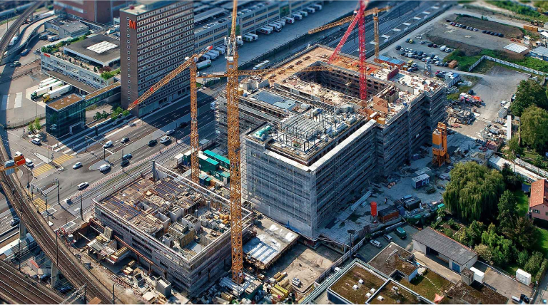
Building a better world

What is infrastructure management?

Infrastructure management is the planning, delivery, and operation of assets, networks, projects, and IT across organizations to deliver a modern, sustainable, resilient, and equitable future. Organizations use GIS for infrastructure management to model, connect, and enable relationships of the built, social, and natural worlds with advanced visualizations and analytics across the entire infrastructure life cycle.

Map of the Western United States

Understand people and places

Visualize precise location details and demographics to optimize infrastructure investments.

The geography of infrastructure investments

GIS powers infrastructure management

Modern infrastructure management requires holistic thinking on both micro and macro scales. A geographic approach to planning and operations helps leaders understand how infrastructure projects relate to surrounding environments. GIS is the nervous system for modern infrastructure management, connecting systems, workforces, organizations, and communities. ArcGIS is the cornerstone by which organizations modernize their networks and improve resiliency in a sustainable and equitable way.

Map with green and blue areas

Determine areas of greatest need

Map infrastructure and status, such as broadband speeds, to make investments in locations that will have the greatest impact.

A foundation for modern infrastructure

Building resilient, sustainable, and equitable infrastructure requires a deep understanding of each asset's location-based relationship to environmental and human-made systems. GIS shows where infrastructure investments will provide the greatest benefit.

What is sustainable infrastructure?

Sustainable infrastructure ensures that the needs of modern society and its infrastructure are met while factoring in economic, social, and environmental needs. GIS is essential in managing the infrastructure life cycle in a sustainable manner—including planned, designed, constructed, operated, and decommissioned states. Location intelligence supports the social, economic, and environmental processes required to maintain human equity, resilience, and the health of natural systems.

Map of a river and surrounding land

What is resilient infrastructure?

Resilient infrastructure helps communities resist and recover from stresses and supports positive economic, social, and environmental outcomes. GIS allows organizations to plan for the unknown with maps and analysis that help leaders effectively anticipate, absorb, and rapidly recover from a disruptive event. Creating resilient infrastructure dramatically reduces costs in terms of physical, social, and economic loss.

Map of a developed area with blue shading

What is equitable infrastructure?

Equitable infrastructure investments support social, economic, and environmental well-being. Once organizations have acknowledged the diverse historical, social, and cultural needs of a community, leaders can use GIS-based maps and analysis to factor them into decision-making. GIS provides data and insights on communities to help decision-makers ensure that the services and resources of modern infrastructure are delivered equitably.

Map with 3D vertical bars

GIS-based infrastructure management supports smart investments

Taking a geographic approach to infrastructure management is important for decision-makers working to modernize operations and asset management. Location-based insights improve resiliency, sustainability, and equity for architecture, engineering, and construction (AEC); water utility; energy utility; telecommunications; and transportation organizations.

Location intelligence for AEC

Architects, engineers, builders, and owners use Esri solutions to improve workflows, bring context to projects, and increase collaboration throughout project life cycles. GIS is helping architecture, engineering, and construction firms build smart sustainable communities and assets for the future.

More on AEC
Large building under construction

Managing water utilities with GIS

Water utilities and resource managers use GIS to improve location data quality and accessibility, empowering users across organizations to make informed decisions and improve workflows. Esri solutions help utilities manage capital improvement projects, meet and exceed regulatory requirements, and retain institutional knowledge to last generations. 

More on water utilities
Water treatment plant

Digitally transforming utilities with GIS

GIS supports the utility asset life cycle—planning, engineering, design, construction, and operations. As a result, GIS is the enabling technology that helps organizations meet sustainability and resiliency goals and prioritize infrastructure investments. In addition, GIS uncovers and supports unforeseen events that continually challenge utilities.

More on energy utilities
Man in a hardhat with windmills behind him

Driving success with location intelligence

Every aspect of building a broadband network involves location and geography. GIS is uniquely suited to help an organization bid, plan, design, construct, and operate networks while meeting reporting obligations associated with funding applications and awards.

More on telecommunications
Man standing outside and talking on cell phone

Understanding transportation data with GIS

Managing modern airports, ports, and rail organizations has become increasingly complex. Esri's GIS technology transforms transportation organizations into performance-driven agencies guided by spatial data. GIS helps decision-makers better plan, manage, and maintain infrastructure and understand activity in real time.

More on airports
More on ports
A shipping hard with blue storage crates stacked high as an airplane flies low overhead through a cloud-swept blue sky

UPCOMING EVENT

Esri International IMGIS Conference

The Esri International Infrastructure Management & GIS Conference, to be held April 8–10, 2024, brings users from interconnected industries together in Frankfurt, Germany, to uncover new insights and learn from peers around the world. This event creates a rich and valuable learning environment for organizations to move their location intelligence forward with GIS.

Explore the event page

Explore similar initiatives

Previous
Next

Download the infrastructure management ebook

The Making Infrastructure Smart and Sustainable—Now and for the Next Generation ebook explores how a geographic approach supports modernization, climate risk mitigation, and day-to-day operations.

Download now