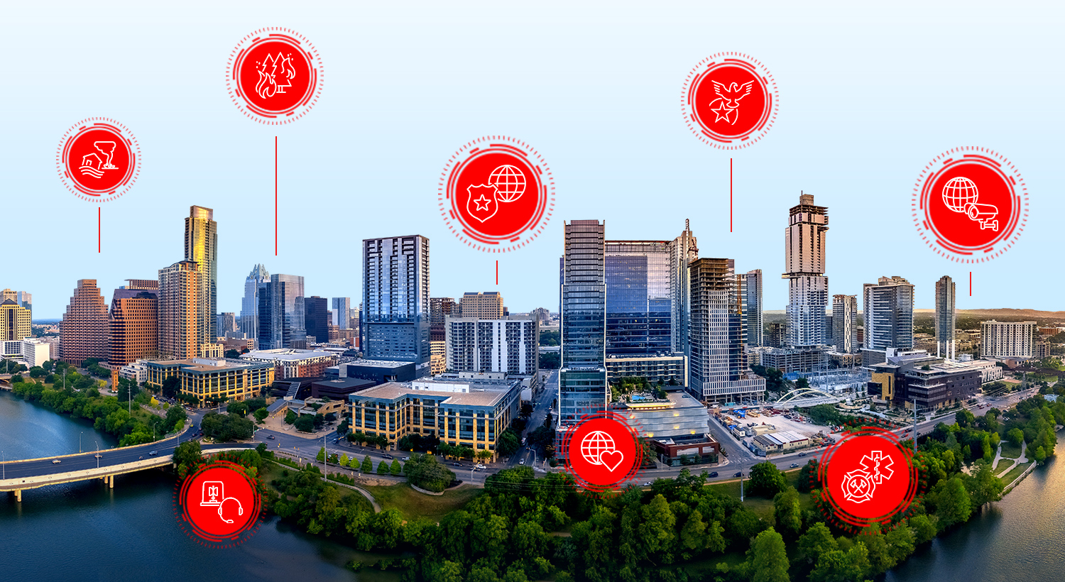
Leveraging GIS for Multiagency Incident Response
Webinar 1 of 3
Explore how GIS can bolster collaboration among agencies during major incidents, with real-world examples from public safety organizations.

Support missions, workflows, and operations
Stay on top of trends, technical advancements, and best practices related to GIS in public safety
NEW WEBINAR SERIES
Date: March – May 2024
Time: Multiple times offered
Location: Virtual
In this webinar series, join our team of experts as we discuss advanced geospatial analysis techniques to help you get more from your GIS investment. We will show you the latest advancements in spatial analytics that can help you identify hidden patterns, make predictions, and gain new insights into your data.
FIRE, RESCUE, AND EMS
Date: May 9, 2024
Time: 9:00 a.m. (Pacific Time)
Location: Virtual
Cost: No Cost
Language: English
In this webinar, learn how to leverage GIS for firefighter accountability with our partner 3AM Innovations. Integrate your existing GIS data with the FLORIAN platform to enhance decision-making, communication, and coordination. Discover how GIS improves situational awareness, incident management, and post-incident review.
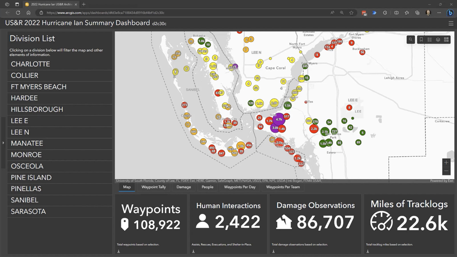
This three-part webinar series explores how GIS products can enhance operations through collaboration and engagement, providing inspiring real-world stories and live demonstrations to understand how leveraging these tools can help meet many organizational challenges.
Webinar 1 of 3
Explore how GIS can bolster collaboration among agencies during major incidents, with real-world examples from public safety organizations.
Webinar 2 of 3
Discover how GIS platforms offer a robust framework for organizing and analyzing geospatial data crucial for emergency management.
Webinar 3 of 3
Explore how spatial data integration can enhance cross-jurisdictional data sharing and collaboration in disaster management scenarios.
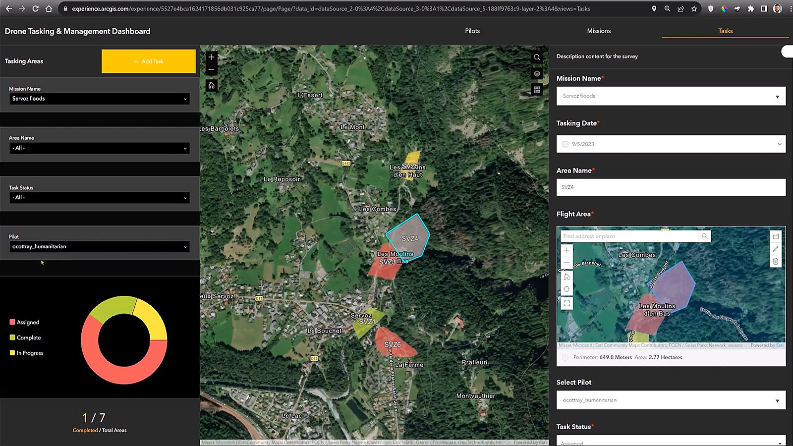
This four-part webinar series demonstrates how agencies can collect data from the field, communicate with responders, and share appropriate data for decision support and situational awareness.
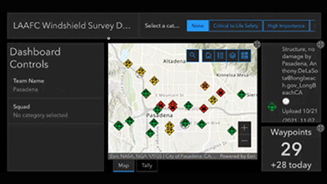
Webinar 1 of 4
See how to quickly capture, edit, and share data from the field to support real-time decision-making.
Webinar 2 of 4
See how digital mobile workflows improve safety and accountability, providing information to on-scene resources and decision-makers in real time.
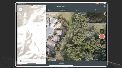
Webinar 3 of 4
Revolutionize operations with 2D and 3D unmanned aircraft systems imagery. Collect and process GIS data efficiently in a disconnected environment.
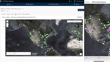
Webinar 4 of 4
Cobb County, Georgia , deploys ArcGIS Mission to support its tactical operations during the World Series.
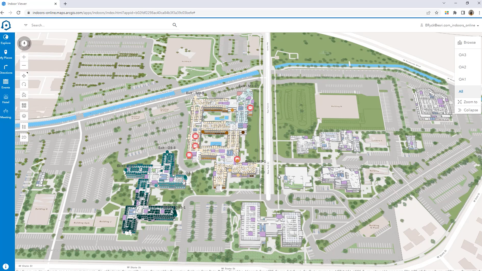
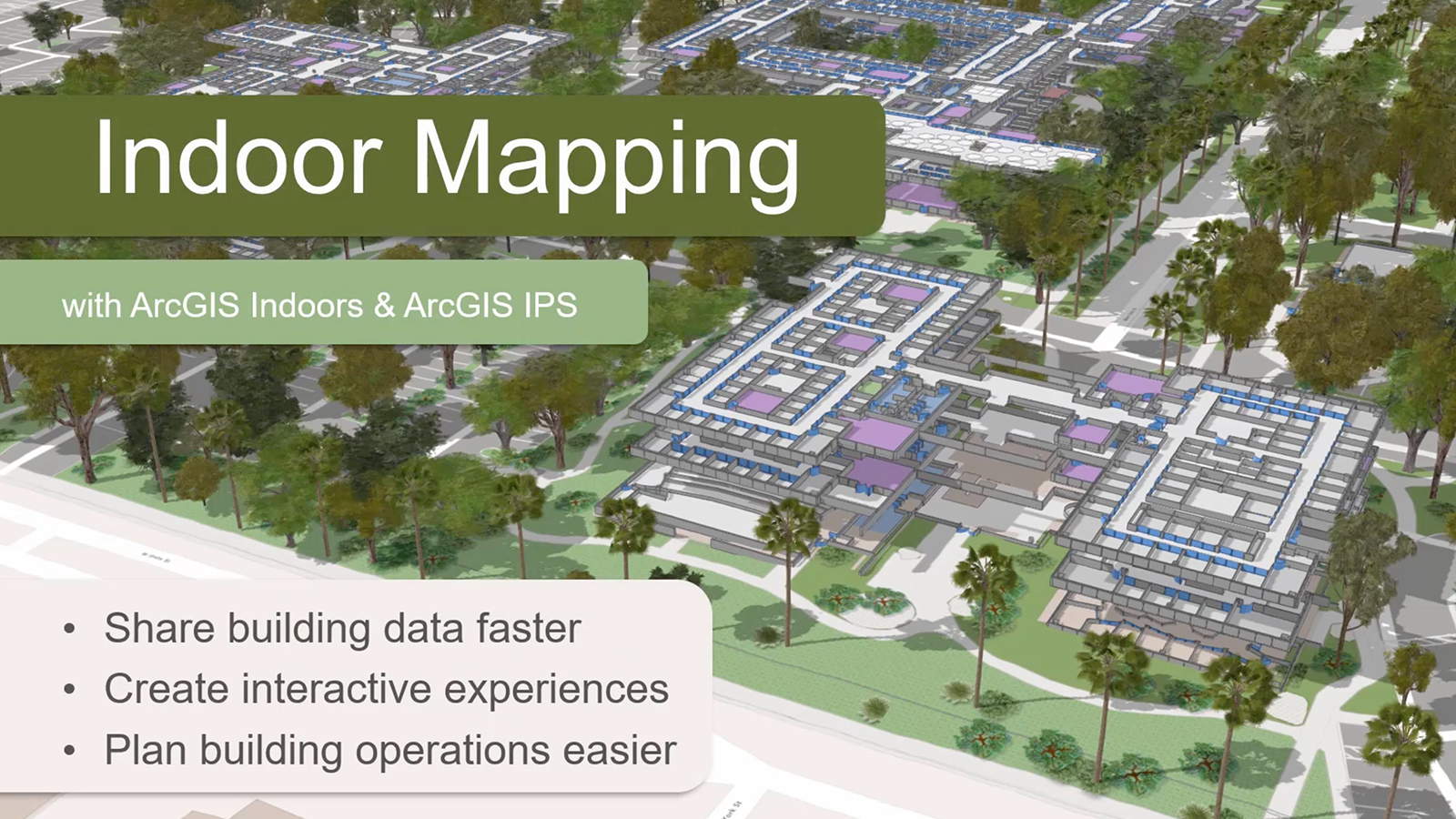
This two-part webinar series demonstrates the value of indoor maps as a vital component of the next evolution of public safety GIS and a requirement toward achieving complete domain awareness.
Webinar 1 of 2
See how to exploit low-cost, high-yield 2D indoor mapping strategies.
Webinar 2 of 2
Learn how ArcGIS Indoors leverages indoor mapping and tracking strategies that help improve workplace safety and site security.
In this three-part webinar series, our experts discuss how Esri's ArcGIS technology is used to plan, mitigate, and respond to critical events using location-based intelligence, integrating real-time data feeds, and supporting effective collaboration during the response.
Webinar 1 of 3
Learn how web mapping, desktop applications, data, and analysis come together to help modernize public safety operations centers.

Webinar 2 of 3
Learn how to integrate all these various data sources, using maps and apps to help your public safety operations center focus on what's important.
Webinar 3 of 3
Our panelists discuss how to stand up an information management hub for creating, managing, and sharing operational plans.
The following webinars and webinar series are available now and can be accessed at your convenience.
Sharing information with the public and managing situational awareness are critical workflows for public safety, emergency management, and disaster response. Recent updates to ArcGIS Experience Builder and the ArcGIS Maps SDK for JavaScript have been designed to address these common workflows in new and modern ways.

Improve public safety through GIS
Geographic Information Systems (GIS) can drive better outcomes for public safety agencies. Join Esri and Microsoft in this three-part webinar series to learn how.
Four part webinar series
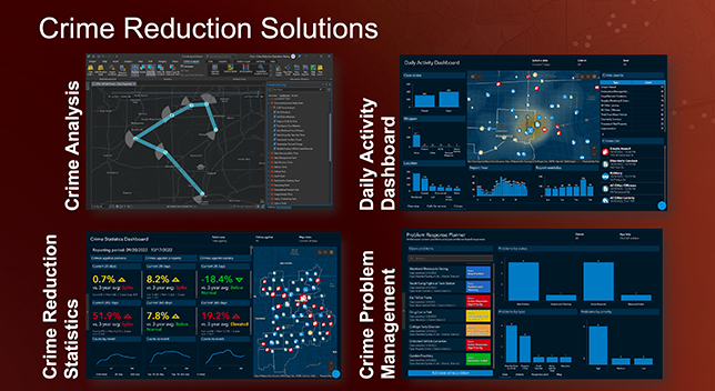
Explore past webinars focused on our three new crime reduction solutions: the daily activity dashboard, crime reduction statistics, and crime problem management. This series is taking place from April to July 2023.
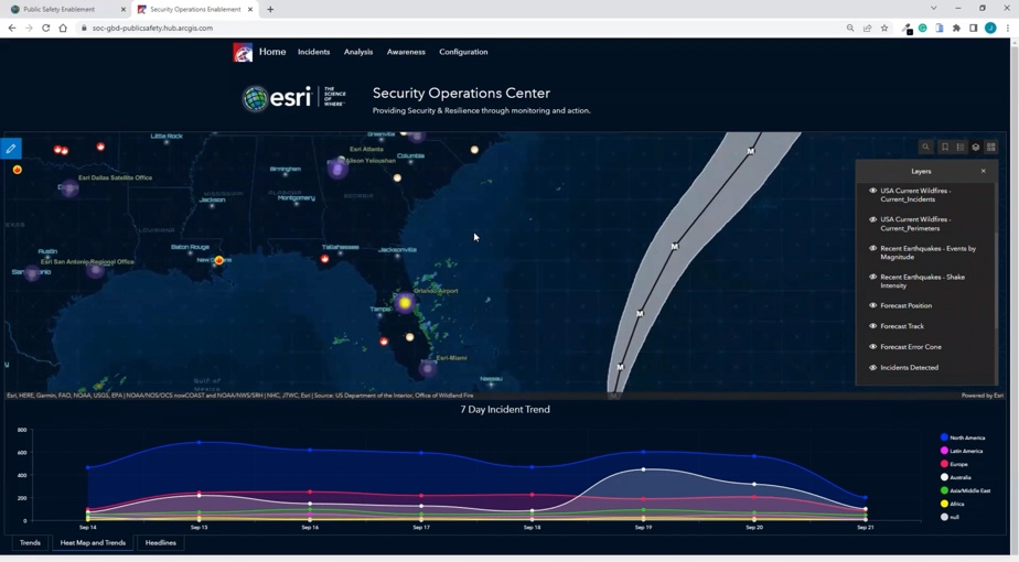
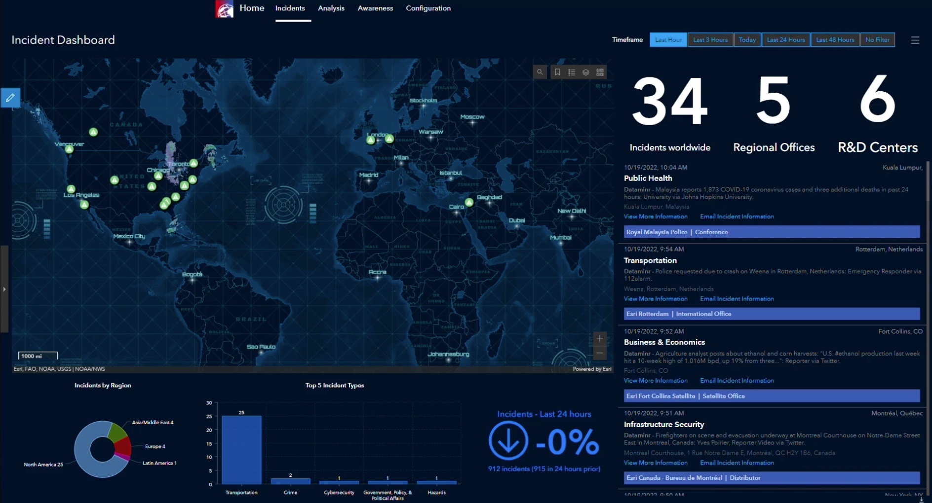
Real-time situational awareness for response
Discover how fully integrating your system with the Emergency Management Operations solution allows you, your team, and unlimited partner agencies to have shared situational awareness at any point during a response.
Use cases for GIS during emergencies
This four-part educational webinar series highlights how incident management team (IMT) personnel can use GIS to understand, plan, and respond to incidents and includes access to additional resources.
GIS applications for public safety and crisis response
Explore past webinars and videos to support public safety missions, workflows, and operations.
Sign up for upcoming Public Safety webinars and be the first to see technology demonstrations and hear from your peers on how they are leveraging GIS.
Explore events specific to a public safety discipline. Discover trade shows and conferences, upcoming and past webinars, and more.