Water Utility Network Editing
Streamline the creation and editing of water, sanitary sewer, and storm water infrastructure.
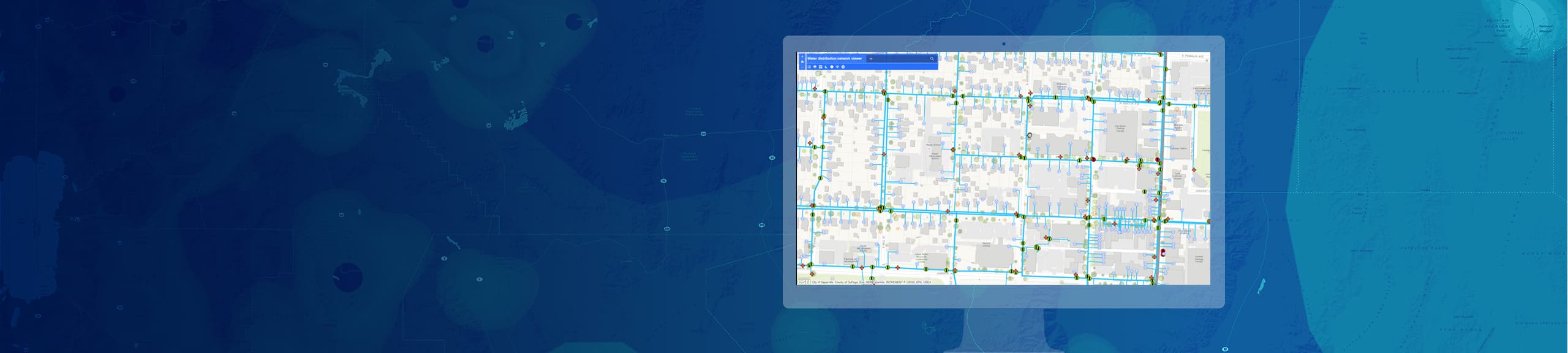
Develop and maintain the digital representation of your system
Empower your water utility to be more effective with better informed decisions about asset management as well as overcoming your main challenges. Efficiently maintain your data with easy-to-use editing tools and ensure your data meets your established standards with configurable quality assurance and quality control tools. Provide your staff with access to your authoritative data through desktop, web, and mobile clients. Get feedback from staff on the completeness and accuracy of your data.
By leveraging off-the-shelf configurable solutions, we were able to increase productivity by 60 percent, allowing us to meet our consent decree mandates related to as-built incorporation and avoid penalties.
We’d like to help you get started. Fill out the form to discuss what you need to get started with the Smart Infrastructure solution.