Smart water meters
Reduce water waste, recover revenue, and analyze your consumption data.
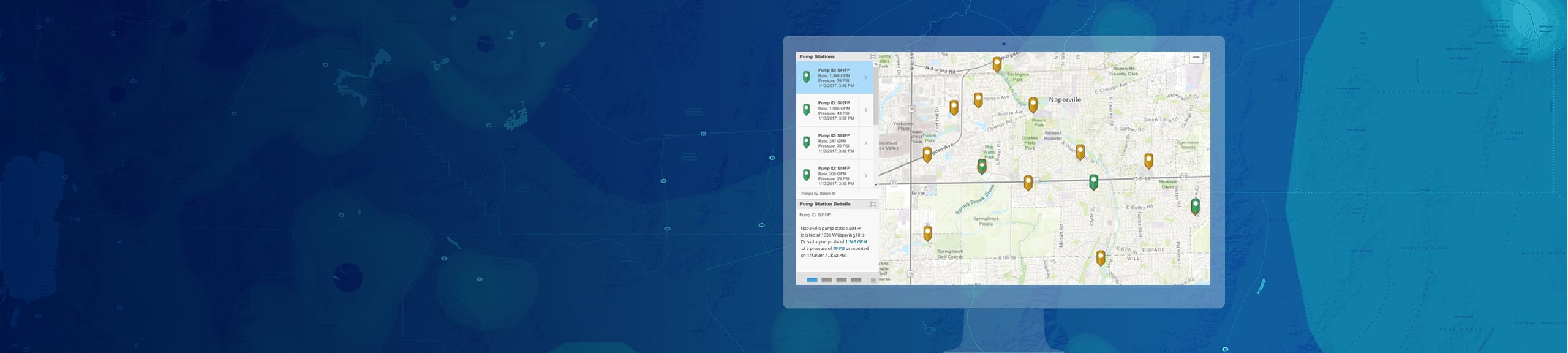
Monitoring
Operate your water utility in real-time
Real-Time GIS gives you the ability to tap into, analyze, and display streaming data from many sensors, devices, vehicles, and social media feeds. Real-time monitoring for water utilities will allow you to automatically and simultaneously send alerts to key personnel, detect and focus on the most important events, monitor thresholds for your operations, improve safety across your organization, and respond faster to emergencies.
Connect your real-time information from virtually any source to ArcGIS to create a real-time digital twin of your water utility. Don’t waste your data, use it to monitor, respond, and analyze for informed actionable decisions.
Create location intelligence with different apps to see a real-time view of you utility.
We’d like to help you get started. Fill out the form to talk to an expert and discuss what you need to get started with the Real-Time Monitoring solutions.