public safety
Become a GIS Hero: Support Emergency Operations
With projects in the queue and no storm clouds on the horizon, it's tempting to put off preparing for the worst. The reality is that putting together an emergency management GIS strategy takes careful planning, time, and effort. And before GIS professionals can address the technology needed to respond to a single crisis, they have to first understand what’s needed to provide real-time situational awareness, manage the flow of public information, and coordinate an effective response.
Your understanding of these key workflows, and your ability to communicate the value of location in emergency management, can transform the way your organization responds to crises in the future.
A power for good
If you are a GIS professional, you are well positioned to become a hero for your emergency management agency. Your experience enables you to see how GIS can help during a response and how, with the right tools, your organization can be more resilient. You have the necessary background and geographic thinking to be a leader for your organization.
Emergency managers need to understand the potential impacts when an emergency is forecasted or has just occurred. GIS helps managers quickly understand the scope and scale of any emergency and allows them to geographically target the deployment of resources to affected areas more directly. GIS also serves as a platform where partners can collaborate and share information during a response, and where public information officials can dispatch timely information using maps that provide context during chaos. GIS apps support damage assessment teams working to collect information in the field and helps them expedite the recovery process. Communities with a modernized GIS for emergency management can better anticipate where action is needed and coordinate all the moving parts required to respond efficiently.
What can you do to help drive this digital transformation with your emergency manager?
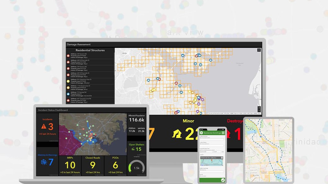
 Esri's solution for emergency management includes a full suite of web and mobile applications designed to help authorities prepare, respond, and recover in the event of a natural disaster.
Guidelines for creating change
To begin, you will need to communicate with your emergency management leadership—the Emergency Management Director or the Operations Chief. Engage a team of change champions and technical leadership to meet with these executive sponsors. Go to these meetings prepared to lay out how GIS can enable key emergency management workflows that help maintain situational awareness, conduct damage assessments, and manage public information. Discuss how the ArcGIS platform in which your agency has already invested can be configured to support these workflows and more. You can leverage Esri’s demonstration apps to showcase some of the key emergency management capabilities that will help them see the value of your work.
You’ll need to be ready to listen to their needs during these meetings. Discuss how your GIS skills can support these needs, but avoid using technical language and remain focused on the workflow that they are describing. Finally, clarify their expectations and agree on timelines for development and implementation phases—start small with the most urgent need they expressed. Convey the idea that you are partnering with them on this project and that their involvement is essential to ensure the solutions meet their needs. Leaving this first meeting, you’ll want to set up a cadence to touch base, iterate on the solution, and prioritize the next steps as a team.
Extending your GIS team
For GIS professionals that already have a full slate of projects or limited resources, modernizing your emergency management organization’s GIS technology is a big task. These are mission-critical applications that need to be stable and supported, and that takes time and resources to do well. Unfortunately, emergencies will continue to happen no matter how busy your workload. But don’t worry—Esri can help you meet this challenge by becoming part of your GIS team.
Our Esri subject matter experts can help you identify tools and launch the solutions that are right for your agency. They will train your team and help you configure your ArcGIS Online organization for your emergency management needs. If you are unsure where to begin, we have a five-day implementation package to accelerate the rollout of emergency management solutions. In just one business week, we’ll work with you to deploy the most common applications for emergency management operations based on more than 25 years of experience responding to disasters of all types via the Esri Disaster Response Program (DRP). With Esri on your team, you’ll continue to drive the digital transformation you need while building a capable GIS staff and a powerful emergency management toolkit.
Stepping up when needed
As a GIS professional, you have an opportunity to guide your emergency management agency forward. By applying your geographic thinking and embracing digital transformation, you can become a true GIS hero for your organization. They need your skills and expertise more than ever. Now is the time to get started on building the resilience required for the next crisis response.
To learn more about getting Esri on your GIS team and leveraging the five-day emergency management jumpstart program, please complete the form below.
Contact sales
To be contacted by an Esri team member about the Emergency Management solution, please complete the form below.