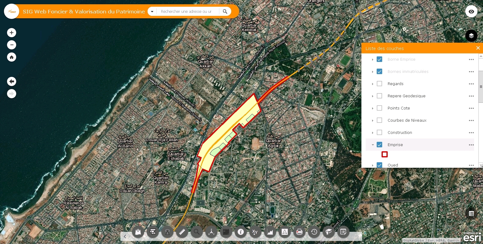
At ONCF, a restructuring project was set out to unify data of all assets, technical infrastructure, land and property of the company. The result is a powerful platform for pooling and sharing strategic data between the various business departments of our Office.
user story
Morocco’s National Railway Company Restructures Database for Optimal Asset Management
Morocco, constitutional monarchy and member of the Arab League, is situated in the North West of Africa. Its national railways office ONCF (Office National des Chemins de Fer) is a company with nearly 8,000 employees, working under the aegis of the Ministry of Equipment, Transport and Logistics. Aside from being responsible for the passenger and freight transport on a railway network of nearly 3,600 km (2,237 miles), ONCF also manages and maintains the state-owned company’s various assets.
Following a classic organization structure, the technical and legal management of realty, railway, buildings, utility facilities, and telecommunication systems are divided into domains, directorates, departments, and sections.
In a collaboration time of under a year, Esri’s Casablanca based distributor Géomatic and ONCF managed to achieve the urgently needed centralization of a vast amount of geospatial data, making them accessible for teams with overlapping tasks.
Challenge
The National Railway Company of Morocco holds an extensive organizational chart, needing precise location information and clear communication on every level. Before introducing Esri’s GIS technology, several hundred administrators – working for classic and high-speed railway, but also for business lines like real estate or telecom network – dealt with separate data bases in an array of formats and extensions.
For directorates like Railway Tracks, Landholding and Optical Fiber Network, for example, exact information of ownership, boundaries, and line courses are the common groundwork. Sharing overlapping interests, their teams exchange geospatial data, legal information, as well as finance parameters, all conveyed in a mix of formats like PDF, DOCX, JPEG, MP4, CSV for tables, DWG for CAD, any many other.
The challenge was not only to enhance synergy for all domains and the hundreds of users in their dedicated task forces through optimized data management, but also to provide real time monitoring of all operations for the top management.
Solution
Following the specific needs of each task, tailor made GIS applications were developed with Web AppBuilder, allowing domains to share data for certain business features via interfaces. All apps access a centralized database, continuously updated through Portal for ArcGIS.
An admin team consisting of designated members from each department is tending the Portal. Predefined action profiles allow fast access for entering or editing the geo-processed data needed by end users on all levels.
The Portal administrator for the department of Real Estate, for example, updates mapping data concerning locations, distances and areas related to property of land and construction. He imports and exports geospatial data via Widgets or edits them via Feature Servers. This information not only enables his department to schedule surveys of property lines or execute expropriation and registration through the Foncier (French for Realty) App, it also makes those departments responsible for the lease of optical fiber cable or the planning of high-speed tracks co-beneficiaries.

Results
The implementation of centralized GIS data lead to a significant increase in efficiency at ONCF. Today, all domains use their own GIS application, designed for their specific needs. By continuously contributing updated information to the database, hundreds of users benefit from improved synergy throughout the large organization.
Through GIS technology, ONCF opened up to new ways of data processing such as the implementation of geo-localized HD photography. A digital GPS-linked camera, placed in a train wagon, now produces images of any area within ONCF’s rail networks, and after several post-processing steps, these images form a virtual 3D-environment that provides exact measurements and coordinates of all the visible objects on both sides of the given track. These data, updated every 6 months, lead to a striking improvement in ONCF’s rail asset management.
Additionally, a superordinate GIS Web Application bundles the functions of all apps and supports ONCF’s top management in surveying all of the company’s operations.