editorial
Taking the Power of GIS Indoors to Enable Smart Buildings
GIS has become a crucial part of almost every business these days. It helps us understand patterns, trends, and relationships by putting demographic, socioeconomic, and other kinds of data in the context of location. Adding the perspective of where allows conclusions to be made about the impact of specific actions as well as predictions about future developments and best practices. Location data has become essential for management to make the best possible informed decisions.
While GIS has long been limited to the outdoor world, new technology has now also paved the way for indoor GIS. Activating the power of location inside buildings provides occupants with unprecedented levels of visibility and actionable data. Indoor GIS helps increase workflow efficiencies and productivity and enables smart buildings.
Optimizing Space Utilization
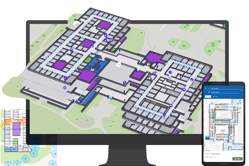
As GIS professionals are constantly seeking to collect and analyze spatial data to derive meaningful insights, and extending the range of their work to the indoor space opens entirely new opportunities. They can monitor movement patterns inside the building, compile room utilization statistics, and then visualize them on a map and dashboard.
By analyzing this data, management is empowered to draw conclusions on current space utilization and how it can be optimized. For instance, in a corporate office setting, if conference room 1.12 is hardly ever used, it could be repurposed to create space for individual offices or a hot-desking area.
While GIS managers are working with geospatial data daily to help others make better-informed decisions for their core business, applying it to the workplace is new ground. By bringing GIS indoors, everyone at the workplace can rely on maps and location data to enhance their working experience and optimize their operations.
Understanding Workplace Operations with Location Data
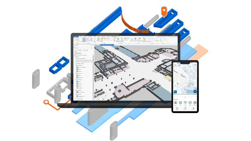
ArcGIS Indoors allows all stakeholders to collect, manage, and analyze data to optimize processes and enhance efficiencies at the workplace. Data interoperability ensures that all data is unified and seamlessly integrated into one holistic system. This way, all stakeholders get their information from a single source of truth and are provided with a clear, common operating picture.
The system helps employees understand workplace operations and leverage location information to be more productive. Dashboards provide information on resource capacities and location, the workforce, and the facility's condition. This way, tasks can easily be assigned, and resources can be optimally allocated and managed. Moreover, it allows employees to be more efficient in their daily routine and collaboration.
In light of the coronavirus disease 2019 (COVID-19) pandemic, ArcGIS Indoors can be leveraged to support business continuity and reduce the risk of infections at the workplace as employers are gradually reopening their facilities. Location data provides employers with the information they need to create a safe indoor environment in preparation for the return of their employees.
Analyzing how employees move inside the facility and identifying potential risks (e.g., narrow corridors) help management take proactive measures. By visualizing this data on the workplace map, it is easy to determine danger zones and learn how to avoid or mitigate potentially hazardous situations.
Due to the highly infectious nature of the virus, workplaces will also have to adjust their seating arrangements to ensure compliance with safe distancing regulations. In addition, setting up sanitization stations inside the facility will be a necessity. Similarly, especially in public buildings, areas for picking up masks and taking visitors' temperatures are obligatory now. ArcGIS Indoors can help identify the best locations for these stations to ensure the highest safety standards are considered.
In case an employee tests positive, indoor location data can be used to analyze that person's movement across the workplace. This can help identify who they have been in contact with recently and take action by testing these people for COVID-19 as well.
Indoor GIS in Response to COVID-19
As previously mentioned, since the outbreak of the pandemic, governments, enterprises, and individuals all have found themselves confronted with massive challenges. Hospitals, in particular, have been strongly affected and suffered from the sudden influx of patients. Due to federal safety regulations, hospital staff, who are constantly exposed to COVID-19 cases, must be relocated away from their families to prevent further spread of the disease. In these newly found housing units, which are often hotels, universities, or convention centers, GIS can make a big difference.
Esri provides three levels of facility mapping to address different scenarios arising from this situation. The ascending levels are congruent with an increase in capabilities and complexity as well as implementation time.
Level 1: Quick Campus Mapping
The first level provides users with basic spatial awareness. A digital map of the campus down to the building footprint provides insights into housing arrangements of patients and staff and their movement patterns on-site. The map shows where resources are located and thus allows for easier allocation. In addition, utilization status and purpose of the individual facilities can be identified, and occupants can be tracked outside these facilities.
This is the most basic level and takes only up to five days to implement. It is based on ArcGIS Online and uses Survey123 for ArcGIS to create accounts. Tracker for ArcGIS enables tracking that can be viewed via ArcGIS Online, ArcGIS Pro, and the Track Viewer web app.
Level 2: Indoors Facility Mapping
The second level builds on this basis and unlocks more capabilities that reach into indoor environments. The map visualizes the indoor spaces on a floor plan level and provides more detailed data. In this level, users can see who is assigned to which room and get information on their health status. While outdoor routing is enabled via GPS, ArcGIS Indoors empowers users to route themselves inside the building.
Due to the indoor-scale data processing on this level, the implementation can take around 10–15 days. In this level, the existing BIM/CAD floor plans are migrated to GIS. This level is based on ArcGIS Enterprise and uses Survey123 for account creation.
Level 3: Indoors Facility GIS
Building on Level 2 capabilities, Indoors Facility GIS includes an indoor positioning system (IPS), indoor routing in real time, geofencing, work order visualization, and additional data processing. Geofencing can be used to create zones on the map (e.g., rooms where only COVID-19 patients are supposed to enter). If an unauthorized person was to enter that zone, an alarm could be triggered in the system, and medical staff could respond accordingly.
Visualizing work orders provides higher transparency for staff concerning where and when issues have occurred and what needs to be done to address them.
Level 3 is the most sophisticated and complex implementation. Unless there is a foundation to build on (e.g., Level 1 or 2), the timeline for implementation will go beyond 15 days. Therefore, an installation is not recommended while the crisis is ongoing. The Indoor Facility GIS is best implemented for future use with disease containment, response, management, and other scenarios.
Buildings are often very complex and organized in concatenations of nontransparent and noninteroperable systems, structures, and technology. ArcGIS Indoors takes GIS inside these buildings and adds the power of location. It allows businesses to extract valuable data that can help them operate more efficiently and make better-informed decisions. In the context of a pandemic, indoor GIS can help support the response efforts and keep processes running smoothly while ensuring safety and business continuity.