The beauty of a digital twin is that once you’ve got one, the world’s your oyster. Anything you can do at one particular location, you can do at any and all locations.
Russel Vine
Cross River Rail
INFRASTRUCTURE
When planners need to build or modernize infrastructure, GIS models a shared, real-time view of project designs, challenges, and progress.
Two tunnels pierce the bedrock under Australia’s Brisbane River. These passageways, designed to carry trains to and from Brisbane’s central business district, form the backbone of Cross River Rail—the first subway built in Queensland’s capital city.
Each six-kilometer tunnel is lined with interlocking concrete rings. Workers assembled these rings by joining six curved segments per ring—a total of 24,000 segments throughout the project.
Each segment lives within an immersive 3D model, a digital twin of Cross River Rail created using geographic information system (GIS) technology. This virtual replica has proven crucial for planning, design, decision-making, and communication throughout the six-year construction process.
With two years left before the subway opens to the public, the Cross River Rail team can see the light at the end of the Brisbane River tunnels. As major construction nears completion, they continue to find new uses for the digital twin.
“We’re a really interesting test case for what digital models can do, and we now find ourselves in a very interesting period for the project,” said Russell Vine, Cross River Rail’s lead innovation officer. “In these last two years, we can really start thinking about what the role of our digital twin is, beyond just design and construction.”
It was a vision for the future that originally drove the Queensland government to commit to the rail project. By 2036, the South East Queensland metro area will grow by 1.5 million residents, reaching a population of over 5 million. While most new arrivals will live outside Brisbane, many will commute to jobs in the central business district.
The region’s current rail infrastructure needs an upgrade to handle the increase in traffic. In addition to the river tunnels, the Cross River Rail project includes four new underground stations and upgrades to eight existing aboveground stations.
 Before the first train rolls, a digital twin helped shape the design and optimization of the new subway system, ensuring a smooth ride for passengers.
From the start, the project was fraught with infrastructural peril. Tunneling several stories under Brisbane’s teeming metropolis and creating expansive subterranean stations—what could go wrong?
To navigate the risks, Cross River Rail’s planners consulted with the team behind London’s Crossrail project—now operating as the Elizabeth line—ultimately adopting a three-pronged strategy. First, they agreed that all plans would reside in a common data environment, one built using GIS. From that environment, a digital twin would arise.
The traditional construction industry planning method uses building information modeling (BIM) to depict inert objects floating in space. What GIS provided, when matched with BIM, was context. It showed the subway in relation to everything around, above, and below it, including existing underground infrastructure, streets and buildings, and, of course, the river.
Building the twin would require every architect, planner, contractor, and subcontractor to submit their BIM files using the same formats, standards, and protocols. That was the second directive. Every object would be clickable, and observable as a technically accurate object within the twin. A single handle on the extensive pipework system, for example, can display over 200 separate fields of information within the digital twin.
 The BIM model of the Cross River Rail station
As the stations are nearing the end of their construction cycle, “you can start to see the real handles appearing as part of real pipe networks,” Vine said. The third directive was, as Vine put it, “the party piece, the one everybody loves.”
The team repurposed the digital twin by pushing the same GIS and BIM datasets through a gaming engine, creating an immersive experience. The result is 17 kilometers of future railway infrastructure that users can navigate like a first-person video game—either by manipulating a web scene on-screen or via a virtual reality (VR) headset.
As construction forges on, the immersive environment has served several purposes.
It provides a way for nontechnical stakeholders—people not directly involved in the design and construction of Cross River Rail—to better understand the future built environment. It also gives those who have designed the infrastructure the kind of visual assessments that even the most detailed static 3D models cannot provide.
For example, each underground station contains a large-scale art installation by an Indigenous artist. The immersive experience has allowed teams to better understand how the artwork will look within the wider architecture.
It’s in the final stages of project delivery that the digital twin has truly shown a return on investment, saving both money and time. “We talk about ROI, but we also use the phrase ROE, or ‘return on effort,’” Vine said.
The Cross River team recently hosted a team of train drivers and signal sighting experts at the project’s mixed-reality theater. As a group, they were able to assess, from an operator’s perspective, the visibility of train signals and marker boards.
 A digital twin can show the driver’s-eye view of train operators.
Although most were deemed sufficient, a few required changes. By performing this analysis virtually, rather than waiting for test trains traveling through the real tunnels, Vine estimates the project will have averted up to four months of potential delay—on a project where overall construction can cost millions of dollars per day.
The beauty of a digital twin is that once you’ve got one, the world’s your oyster. Anything you can do at one particular location, you can do at any and all locations.
In the years since the Cross River Rail project got the immersive treatment, the resolution possible with the software has dramatically improved. The imagery is now at a very high level of photorealism. Exploring one of the new stations virtually feels close to exploring it in real life.
An observer can see that the cladding and the color of the terrazzo floors in each station are slightly different, an indirect way for passengers to know which station they are in. (“It’s a subtle form of wayfinding,” Vine said.)
The photorealistic aspect is proving especially useful for seeking acceptance and approval of the infrastructure’s emergency features. Fire and emergency officials take virtual tours of the routes they will need to follow when accessing the stations.
“Projects like ours often run into trouble with fire and emergency accreditation very late in the process,” Vine said.
The team has made a special effort to push the bounds of realism for these virtual journeys. They’ve experimented with modeling actual fires, with orange flames and accurate smoke density. As part of the VR experience, the team is also testing gloves with haptic capabilities. This will allow emergency officials to feel how much pressure they need to apply when turning a valve.
The beauty of the digital twin is that it can exist in perpetuity, evolving along with the subway it models. As the years go by, people will find new uses for it, with few if any extra costs on top of the original investment.
“Our job is to build the project,” Vine said. “Other people will maintain the railway. And we hope they’ll be thinking about how they can use the digital twin for asset management.”
Take those 24,000 concrete segments. Maintenance crews will need to inspect the tunnel periodically for structural damage that necessitates repairs. Just as the digital twin helped when the segments were installed, tunnel inspectors can use it to call up data specific to each segment. Back at the office, managers can track and examine survey results, transporting themselves into virtual tunnels.
Brisbane will host the Olympics in 2032. By then, it’s possible that the digital twin of Cross River Rail, which now includes the land and buildings above the subway, could be a tool for building a new stadium.
Explore more examples of how leaders in business and government are using GIS to enhance analysis, operations, and decision-making.

URBAN PLANNING
When cities plan for the future, GIS models changes in population, risks, and land use to help leaders analyze the best ways to serve communities.
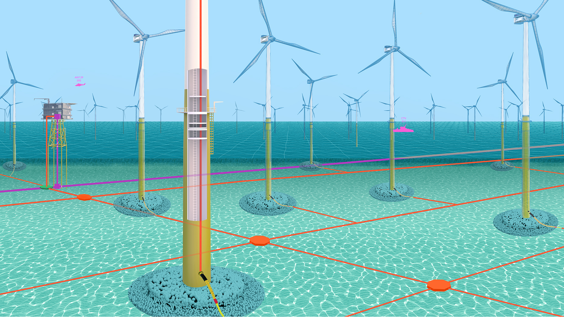
ENERGY GROWTH
When organizations in Europe need new energy sources, GIS models the potential of new sites.
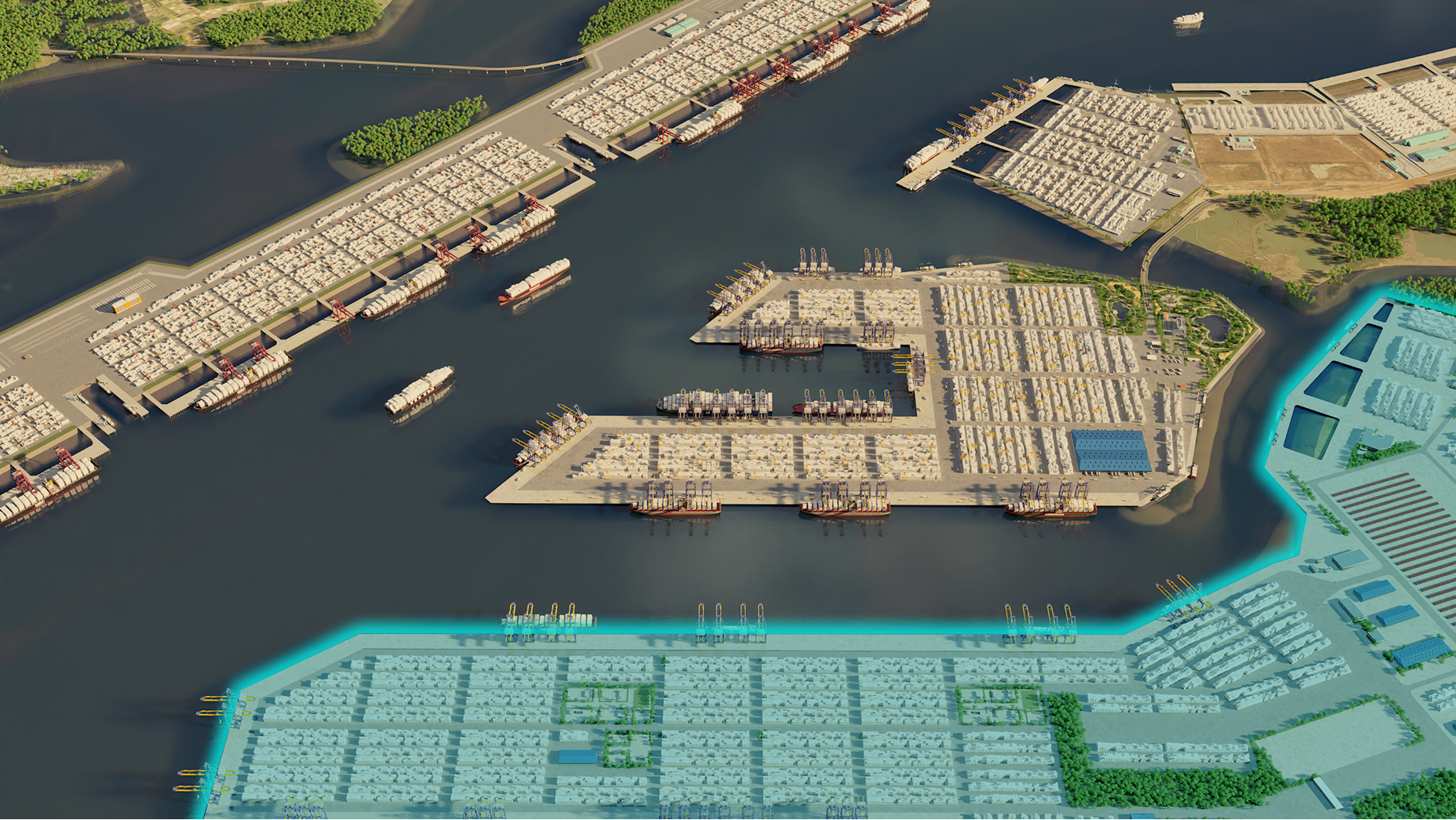
LOGISTICS
GIS-powered digital twins guide port expansions to meet growing economic demand and keep global supply chains moving.
Learn more about the products used in this story
Discover geographic information system (GIS) technology, the mapping and data analysis software that’s powering business decisions, supporting government operations, and quietly changing the world.