Real-Time Intelligence Now
How NYC executives can improve efficiency and operations
This event has ended. Access the recording to get up to speed on the innovative strategies cities are using for real-time data sharing and faster action.
Exclusive Executive Event
The live event from Crain's New York Business Content Studio and Esri has ended, but you can still sign up to access the recording. Watch the event on demand to:
- Explore progressive data practices in leading cities that collect, combine, analyze, and share data so that they can take smarter action more quickly
- Hear two expert panels and deep-dive discussions on how technology can help achieve real-time awareness, support confident decision-making in daily operations, and help you prepare for disruptions
- Gain clear actionable takeaways
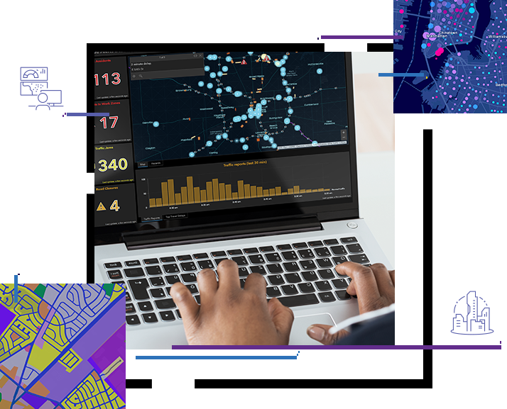
Real-time maps drive efficiency in NYC
Want to learn more about how location technology supports urban operational excellence? View our collection of related content and explore best practices tailored for NYC government executives.
What to expect
Hear how complex organizations are using geospatial technology to collect data from the field; combine it with existing information; analyze it; and share it with everyone who needs it, when they need it.
Around the world decision-makers need to see their city not just as it is now, but also how it is likely to shift in an hour, a day, or a week.
Whether it's London or Europe's largest port you'll get an inside look at emerging real-world practices for operational excellence.
Keynote
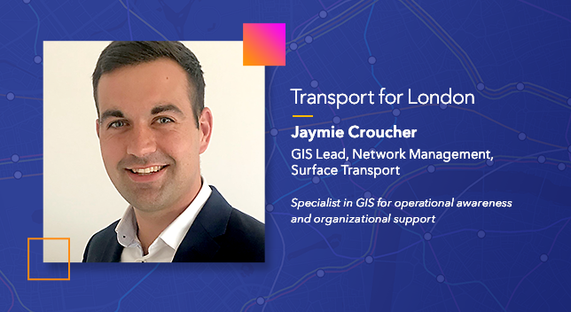
Transport for London (TfL) has pioneered the use of real-time maps and data for seamless citywide transit operations. TfL’s centralized platform powers smart, coordinated decisions about traffic flow and planning. Join Jaymie Croucher, GIS Lead, Network Management, Surface Transport for London for a special presentation about the organization’s innovative work.
Part One
9:00 a.m.—10:30 a.m. (EDT)
Listen in as experts discuss the Esri technologies that support current priorities in urban operations. Hear about the GIS tools your peers are using to solve real-world problems in leading global cities. Join the conversation during a closing Q&A.

Keynote
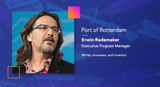
Europe’s largest port is utilizing a digital twin to provide a real-time visualization of all operations. Join Erwin Rademaker, award-winning executive program manager for the Port of Rotterdam, the Netherlands, to hear more about the impact of faster, fully digital workflows that can help cities improve efficiency and operations.
Part Two
10:30 a.m.—12:00 p.m. (EDT)
Hear about Esri’s plans to bring real-time data and advanced 3D mapping together—the digital twin vision. Get an inside look at what’s next in GIS technology for city leaders in New York and beyond. Join the conversation during a closing Q&A.

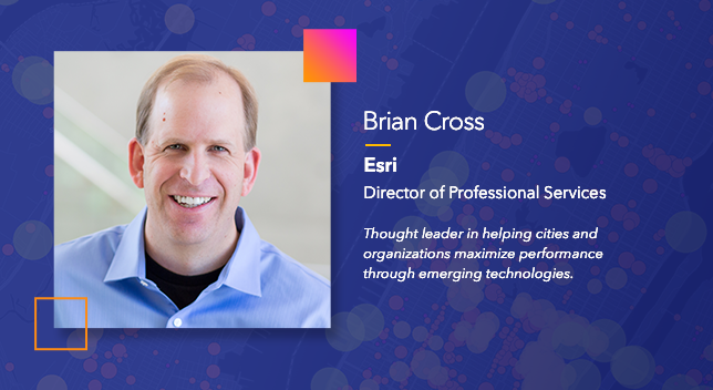
Keynote
Put the day's themes and topics in context with a high-level look at how geospatial technology is at the core of operational intelligence. Hear key takeaways from Esri's Director of Professional Services, Brian Cross, during this special concluding presentation.