This project is consistent with our history of research, analysis, and learning to gain insight into GIS technology. In 2006, SEMCO was presented an Esri Special Achievement in GIS Award for this due-diligence approach to projects. We're pleased with the outcome of our readiness assessment with POWER's team. The staff we worked with demonstrated POWER's shared desire for high customer satisfaction, and we are moving forward with our current full Utility Network migration with POWER.
user story
UPDM and ArcGIS Utility Network Prepare SEMCO ENERGY for the Future
SEMCO ENERGY Gas Company, headquartered in Port Huron, Michigan, is a regulated public utility that delivers natural gas to approximately 300,000 residential, commercial, and industrial customers. As a long-standing Esri customer with a highly experienced and knowledgeable geographic information system (GIS) team, SEMCO saw an opportunity to take advantage as an early adopter of Esri's Utility and Pipeline Data Model (UPDM) and ArcGIS Utility Network.
Challenge
SEMCO initially was unsure of the level of effort and cost necessary to convert its ArcGIS system to UPDM across all five of the utility's service regions. With customer satisfaction in mind, SEMCO was looking for a low-risk and cost-effective way to assess its existing data while gaining valuable insight into ArcGIS Pro, UPDM, and Utility Network. Other considerations included ensuring that SEMCO increased the level of Utility Network expertise for both managers and technical staff, facilitated internal knowledge transfer, and supported budgetary planning with confident estimates for the effort required to convert SEMCO's gas networks to UPDM and Utility Network. It was important that SEMCO build and implement a data model that would support the utility's GIS growth for the next decade.
Industry - Electric and Gas
SEMCO delivers natural gas to approximately 300,000 customers in Michigan.
Challenge
The utility wanted a better data model and network modeling capability to meet present and future business and regulatory requirements.
Solution
SEMCO, with the assistance of POWER Engineers, is implementing UPDM and ArcGIS Utility Network.
Results
SEMCO's GIS is modernized and prepared to better support workflows across the utility.
Solution
Recognizing the benefits of Utility Network, SEMCO engaged POWER Engineers, Inc., to assess the level of effort and cost of migrating the utility's current ArcGIS data to UPDM and implementing Utility Network. Working together, POWER and SEMCO performed a Utility Network Readiness Assessment (UNRA). The UNRA effort included deploying and establishing an ArcGIS Enterprise 10.7/ArcGIS Utility Network sandbox environment on SEMCO's servers. This would help SEMCO gain insight into how requirements for existing (and future) GIS interfaces, third-party tools, and customizations might be met using core Esri Utility Network functionality. The UNRA effort also included converting a pilot dataset and providing a hands-on experience with the new technology to SEMCO's staff.
Partner
SEMCO selected POWER for its Utility Network experience; ability to provide advanced data migration tools; and knowledgeable team, which would work with the utility's GIS team to complete a collaborative and comprehensive Utility Network assessment. POWER provides geospatial and asset management solutions to federal, state, and local government agencies as well as utilities, facilities, and power plants.
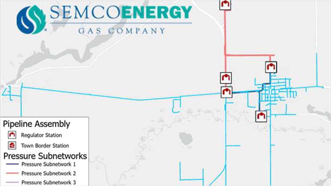
 SEMCO Energy's Stations and Pressure Subnetworks
Results
After performing the data assessment with POWER, SEMCO had a comprehensive report that included a detailed gap analysis between the five existing SEMCO data models and the core gas geometric network schema. The report documented gaps and recommendations on extending the model to support Utility Network. SEMCO also received a customized and comprehensive plan that detailed scheduling and the level of effort to prepare for full conversion of the utility's data to Utility Network.
As a result of the UNRA, SEMCO engaged POWER for the full Utility Network data conversion and implementation, which is currently in progress. SEMCO now has the advanced ability to trace the pressure subnetworks, allowing staff to make faster decisions that will increase the quality of service to the utility's customers.
ArcGIS is a registered trademark of Esri, Inc.