user story
GIS Initiatives Showcase UAE's Key Statistical Data
The Federal Competitiveness and Statistics Centre (FCSC) for the United Arab Emirates (UAE) is the government's official source of statistics and monitors competitive performance in international reports. It is responsible for the development of a unified, comprehensive, accurate, consistent, and up-to-date national statistical system across different sectors including, but not limited to, health, education, tourism, and the environment.
The FCSC is now embracing ArcGIS through its 1Map Platform to help improve the understanding of data related to the UAE while making it easily accessible for all people.
Challenge
The FCSC is responsible for collecting and managing vast quantities of statistical data, with more than one million records and around 100 maps. To present this data in a manageable format, the FCSC envisioned a one-stop page from which users and authorities can access all related maps, coupled with statistical indicators.
Khatib & Alami (K&A), an Esri Platinum partner, was appointed by FCSA to support the development of a solution that maximizes the potential of FCSC's statistical information and provides an engaging experience for users.
 Economic statistics Dashboards
Industry—Government
User
The UAE Federal Competitiveness and Statistics Centre (FCSC)
Challenge
FCSC needed to present the UAE's statistical data in a manageable way via a one-stop page from which users and authorities can access all related maps, coupled with statistical indicators.
Solution
The solution captured, cleansed, unified, and migrated more than one million records and around 100 maps using ArcGIS to achieve high-quality, user-friendly visualizations of FCSC's statistical information through a single platform known as 1Map Platform.
Results
FCSC's 1Map Platform integrates GIS technology with national statistics and survey databases to geo-enable the data, making it easier to understand and analyze
Solution
A two-phase development process was established that took eight months to complete. This involved data cleansing, unifying, and migration of all FCSC information. This is, in addition to restructuring the enterprise spatial database engine (SDE) to accommodate FCSC's requirements.
Best practice methods were used to access Esri apps within the ArcGIS Enterprise suite, thereby maximizing the benefits and achieving better visualizations of FCSC's statistical information through a single platform, known as 1Map Platform.
The solution draws on the full suite of Esri ArcGIS Enterprise 10.7.1 tools, including the following:
- ArcGIS Enterprise Sites
- ArcGIS Dashboards
- ArcGIS Web AppBuilder
- ArcGIS StoryMaps
- ArcGIS Insights
- ArcGIS for Excel
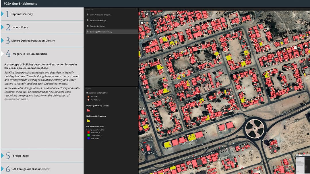
 After AI methods extracted the buildings, it was overlaid with meters data to identify each building land use
Results
FCSC's 1Map Platform comprises a centralized geospatial database and a UAE Sustainable Development Goals (SDGs) data hub. It also includes the ArcGIS Enterprise portal that enables internal users and external governmental entities to have access to detailed statistics and survey outputs on geospatial dashboards, story maps, and web applications. GIS systems are integrated with national statistics and survey databases to geo-enable the data, making it easier to understand and analyze.
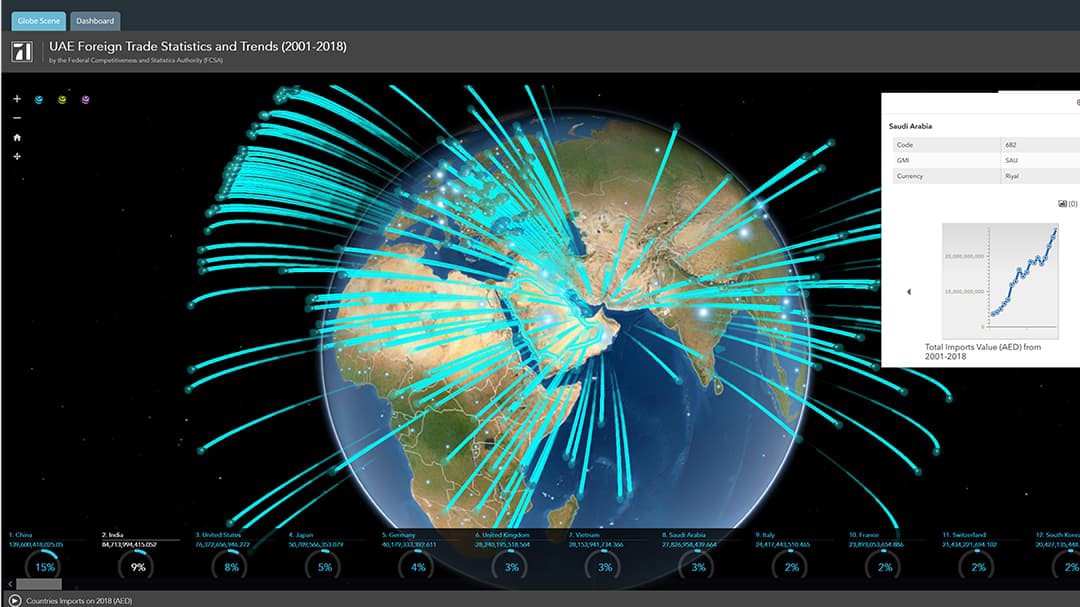
Via the platform, users can access many valuable services, such as locating health and educational facilities, understanding foreign trade statistics, and viewing administrative boundaries and a demographics dashboard.
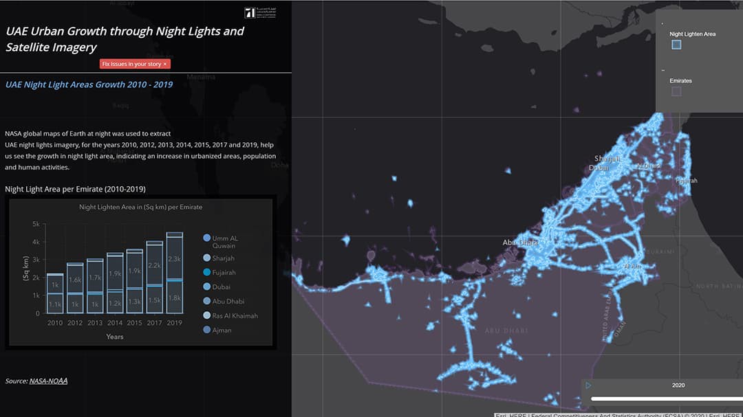
The 1Map Platform also features data stories that show the UAE's urban growth through satellite images of the earth at night —capturing urban lighting, in particular, major roads and infrastructure— to tell the story of the country's remarkable growth over the years.
H.E. Mohamed Hassan, FCSC Executive Director of the National Statistics and Data Sector, said: "At the core of 1Map is the concept of collaborations between government entities. It is simply a joint activity of many federal and local agencies, focusing on geographic information that feeds an easy to use platform which provide great benefits to decision-makers, researchers and students through a smart display of information and interactive maps that can be consumed easily and effectively. This is just the start, as FCSC has an extended future roadmap for the 1MAP Platform to cover further diversified areas that serve our society."
FCSC's 1MAP Platform can be accessed via the following link: https://geostat.fcsa.gov.ae/gisportal/home/
 Night Light Story Map - This data story seeks to capture patterns of growth and development in urban life in the UAE at the national and emirate-levels using different types of satellite imagery including night lights imagery and then comparing growth in selected national statistical indicators with growth in night light areas.