case study
Johnstown, Colorado, Proves GIS Is for Governments of All Sizes, Even Those without Massive IT Infrastructure
Residents have come to expect accessible maps and apps for learning about things—where development is occurring in their neighborhood, where road closures are, where to vote, and much more. It is safe to say that a geographic information system (GIS) has become one of the most prevalent technologies in government, supporting operations that include public works, planning, law enforcement, and health and human services. So shouldn't small governments apply the same modern approaches that their peers at larger jurisdictions are incorporating?
Barriers such as limited technical skills; lack of access to training, data, software, and hardware; and budget constraints have sometimes hindered small organizations from adopting GIS technology. But with Esri's local government solutions that no longer needs to be the case.
The Town of Johnstown, Colorado, is a leading example of how a small jurisdiction is modernizing its operations by adopting GIS technology as a mission-critical tool. For years, Johnstown—a community of about 17,000 residents—experienced stagnant development, and the town did not see a reason to map out the locations of utilities, town limits, or oil and gas lines, as it would waste valuable time and resources that could be dedicated elsewhere. In the past, the town counted on staff members' memory or informal documentation for things like utility locations. But then, the town started to witness unprecedented population growth, and staff knew they needed to take action to continue operations while also accommodating the growing population. GIS is serving as Johnstown's mission-critical tool, allowing staff to quickly generate required datasets, collect accurate field data, and map out the town's utilities.
Cloud-Based GIS Improves Town's Efficiency in Record Time
Steve Holmes, Town of Johnstown, GIS Specialist
"A cloud-based GIS through ArcGIS Online required very little uplift for me; as a one-person shop, I did not have the time, resources, or IT department to set up a GIS. So this was a major selling point for us, as it didn't require any further infrastructure from us and allows us to easily share the data to all departments and users,"
The Town of Johnstown is located in two counties: Weld County, where most residents reside, and Larimer County, where most businesses are located. Each of these counties leverages GIS to empower its workflows, but this didn't necessarily give the Town of Johnstown a comprehensive view into its own data and plans.
Johnstown staff knew that to keep up with the new population growth, they would need their own system to manage land use, development, and growth. Having some GIS background, the town manager, Matt LeCerf, asked the utilities director, Ellen Hilbig, to hire a GIS specialist to streamline the town's workflows into one system. Upon arrival, Steve Holmes, GIS specialist for the Town of Johnstown, was a team of one. As the town had not used GIS before his arrival, he was tasked with creating, combining, and modernizing Johnstown's datasets from scratch.
"A cloud-based GIS through ArcGIS Online required very little uplift for me; as a one-person shop, I did not have the time, resources, or IT department to set up a GIS. So this was a major selling point for us, as it didn't require any further infrastructure from us and allows us to easily share the data to all departments and users," said Holmes.
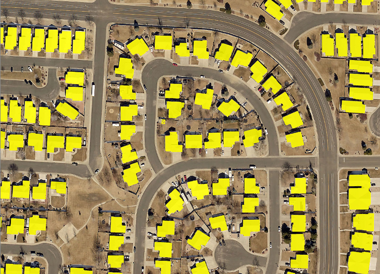
With the desktop tools provided in Esri's local government solutions and, especially, the cloud-based enterprise agreement (EA), Johnstown now has an accurate picture of the municipal boundary and the development projects that are under way. In addition, Johnstown leveraged new tools like deep learning—a subset of machine learning that uses several layers of algorithms in the form of neural networks—in ArcGIS Pro to capture building roofline data for over 8,500 buildings. The data was captured in just two workdays.
 Roofline data for more than 8,500 buildings was generated by deep learning algorithms.
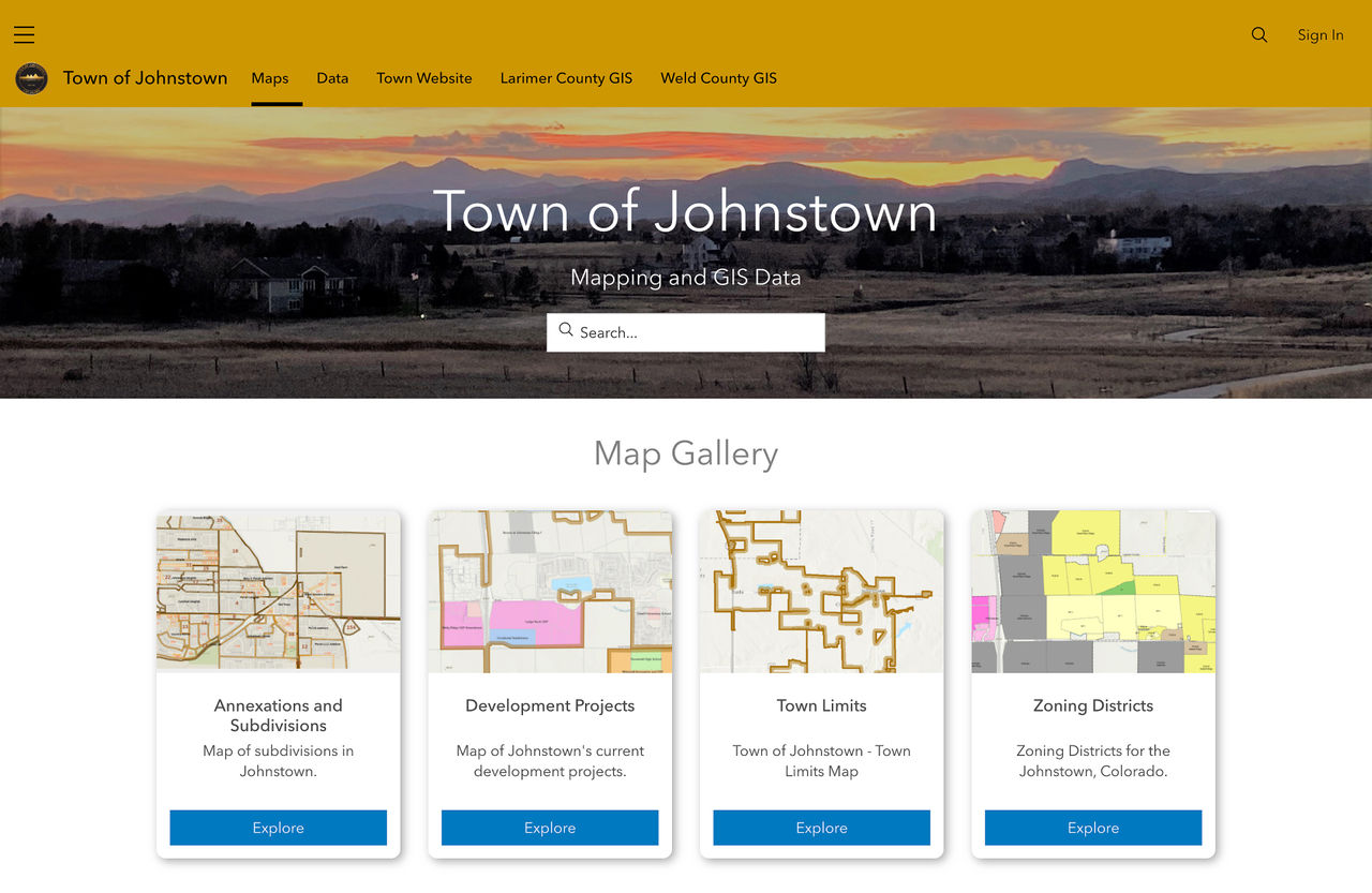
The cloud-based GIS provided the scalability that the Town of Johnstown needed in record time. There was no need to create any further IT infrastructure, as the could-based GIS runs on any device with an internet connection. Also, Holmes is now able to keep his organization informed on projects by uploading his work onto the town's hub site, created using ArcGIS Hub, an easy-to-configure cloud platform that organizes demographics, data, and tools to accomplish initiatives and goals.
 Town of Johnstown Hub Site
Accelerating Johnstown's Community Development with GIS
Although Holmes is a one-person team, his job requires him to work with multiple departments. As Johnstown grows, new real estate development, construction, and capital projects need to be approved. However, before GIS technology, Johnstown had no record of where oil and gas pipelines were, what parcels or buildings the town owned, or where the town limits are. Staff relied on old drawings and personal memory for utility location information, which lengthened the amount of time it took town leaders to review and approve development activities.
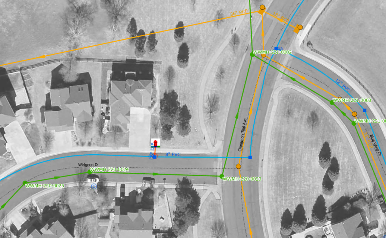
"As developments moved forward, we didn't have record of where our utilities were or reliable annexation data. So it was crucial for the town staff to go into the field to collect this data with GIS technology, which we then easily added into our central systems of record," said Holmes.
 Town of Johnstown Utilities
Having this data is key when working with developers, and GIS allowed the Town of Johnstown to efficiently do this across the organization. Staff no longer needed to go into the field with clipboards and pens. Instead, they used ArcGIS Field Maps, the all-in-one app that helps mobile workers perform data collection and editing, find assets and information, and report their real-time locations.
GIS Prepares Johnstown for the Future
GIS technology is allowing the Town of Johnstown to openly embrace and prepare for the new growth that is taking place. Despite having limited staff, the town was able to update key datasets, map out essential infrastructure and utility systems, and move forward with modernizing the entire town's workflows—all using one location-based system.
"Thanks to GIS, we're in a position to more efficiently move our town forward. Without web-based GIS, the Town of Johnstown would not have been able to keep up with the unprecedented growth we've experienced," said Holmes.
The Town of Johnstown benefited from Esri's local government solutions bundle. It assesses your jurisdiction's requirements, population size, and infrastructure to generate a pricing module unique to your needs.